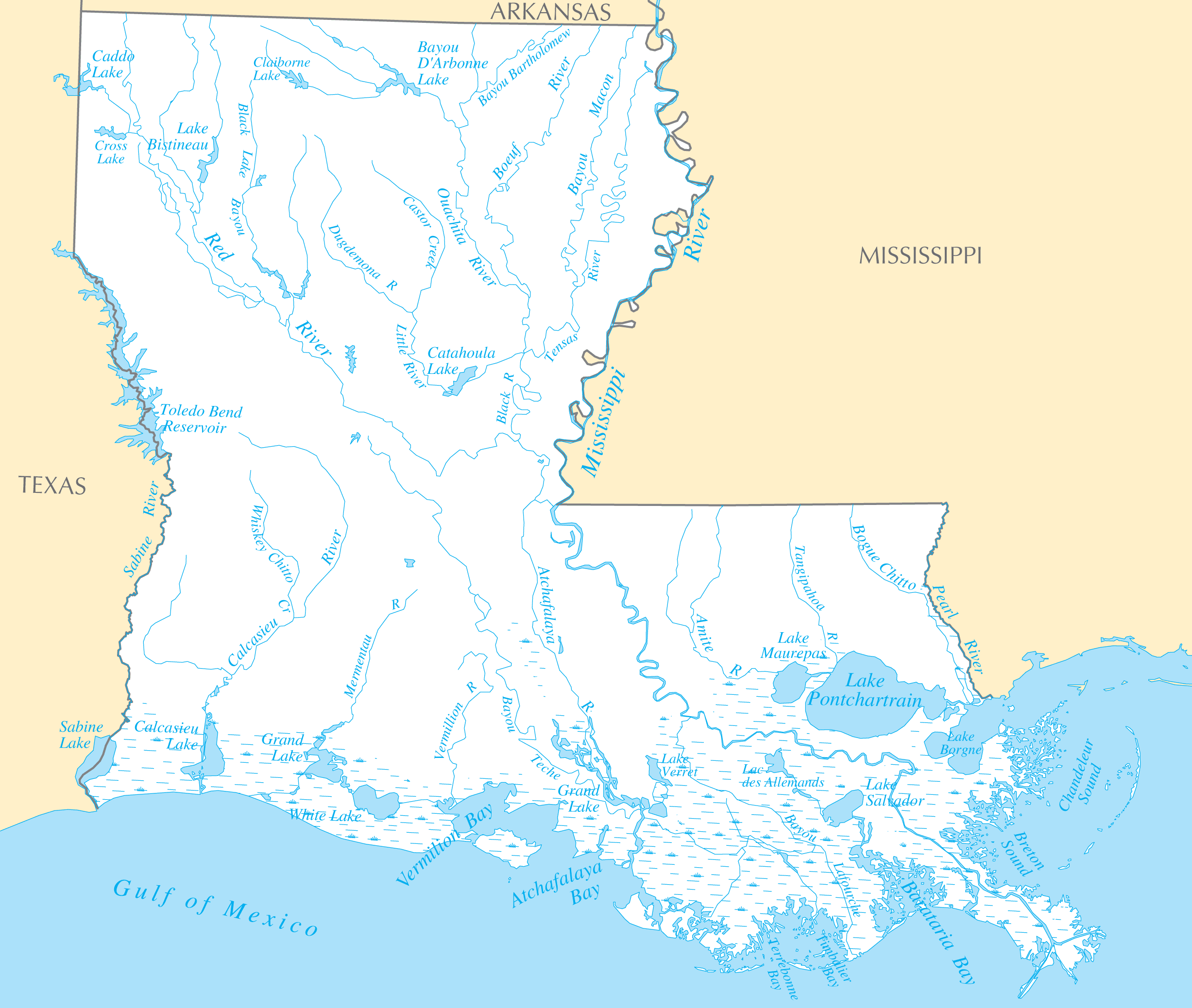
Louisiana Rivers And Lakes
Louisiana is defined and shaped by several iconic river systems.
Mississippi River
The Mississippi River forms much of Louisiana's eastern border. Facts about the Mississippi River in Louisiana:
- It flows over 2,300 miles from Minnesota to the Gulf of Mexico.
- The river passes through major Louisiana cities like Baton Rouge and New Orleans.
- Its delta provides vast wetland ecosystems critical for fishing and migratory birds.
- The Port of New Orleans along the river is one of the nation's busiest ports.
Red River
The Red River forms part of Louisiana's northwestern border with Texas and Arkansas. Details about the Red River:
- It flows southeast over 1,000 miles from the Texas Panhandle.
- In Louisiana, the river passes through Coushatta, Natchitoches, and Alexandria.
- The river served as a political boundary between French and Spanish colonial territories.
Atchafalaya River
The Atchafalaya River branches off from the Mississippi in central Louisiana. Facts about the Atchafalaya River:
- It flows 140 miles through the Atchafalaya Basin to the Gulf of Mexico.
- The Atchafalaya is an important overflow channel for the Mississippi.
- It supports extensive swamplands, wildlife habitats and fishing activity.
Notable Lakes in Louisiana
Some of Louisiana's biggest lakes include:
- Lake Pontchartrain - A large estuary lake north of New Orleans.
- Toledo Bend Reservoir - The largest manmade lake in the South on the Sabine River.
- Lake Charles - Located in Louisiana's southwest corner near the city of Lake Charles.
- Caddo Lake - A wetland lake on the Texas border.
Louisiana's iconic rivers, wetlands and lakes are intertwined with its culture, ecosystems and economy.