Antarctica,
Antarctica: polar continent
About
Quick Facts about Antarctica
| Population | 1,300 |
| Area | 14000000 km2 |
| Northernmost point | Point(-57.302194444 -63.213305555) |
| Latitude & Longitude | -83.3595,16.5234 |
| Named for | Arctic, anti- |
| Time Zone | UTC+12:00, UTC+10:00, UTC+06:00, UTC−03:00, UTC+07:00, UTC+11:00, UTC+08:00, UTC+05:00, UTC−04:00, UTC+03:00, UTC±00:00 |
| Local time | 05:43:11 (9th June 2026) |
Geography
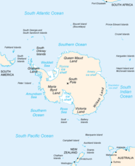
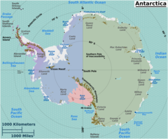
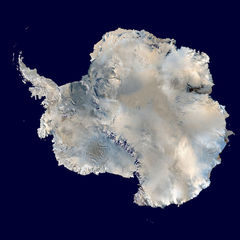
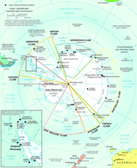
Antarctica is located at 83°21'34"S 16°31'24"E (-83.3595113303545, 16.5234375).
Antarctica map
Click "full screen"  icon to open full mode. View satellite images
- Bouvet Island
- South Georgia and the South Sandwich Islands
- Heard Island and McDonald Islands
- French Southern and Antarctic Lands
Demographics
| Year | Population | % Change | Method |
|---|---|---|---|
| 2009 | 1,100 | - | winter |
| 2026 | 1,300 | 15.38% |
Antarctique, Antarktida, Antarktik, Antarktika, Antarktis, Antarktisz, Antarkto, Antarktyda, Antarktyka, Antarktída, Antarktíka, Antarktīda, Antartica, Antartida, Antartide, Antartika, Antàrtida, Antárktis, Antártica, Antártida, Chau Nam Cực, Etelaemanner, Etelämanner, Nam Cực, Sudurheimskautslandid, Sudurskautslandid, Suðurheimskautslandið, Suðurskautslandið, an Antartaice, ʻAnetatika, ʻAnetātika, Ανταρκτική, Антарктида, Антарктик, Антарктика, Антарктыка, אנטארקטיקה, אנטרקטיקה, أنتاركتيكا, القطب الجنوبي, انتارکتیکا, انٹار ٹکا, قطب جنوب, अंटार्कटिका, আন্টার্কটিকা, അന്റാര്ട്ടിക്ക, แอนตาร์กติกา, ལྷོ་རྩེའི་མཐའ་གླིང་།, ཨེན་ཊཱག་ཊི་ཀ, ანტარქტიკა, አንታርክቲካ, 南极洲, 南極, 南極大陸, 안타티카
Map & Images (more maps)
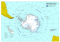
Antarctica
2311 x 1625
- 388,089k -
gif
Antarctica 1
1182 x 944
- 55,972k -
png
Antarctica Large Map
944 x 944
- 102,645k -
jpg
Antarctica Map
1200 x 1480
- 169,171k -
jpg
Antarctica Map 1
502 x 617
- 16,903k -
png
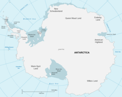
Antarctica Regions Map
2000 x 1646
- 245,331k -
png
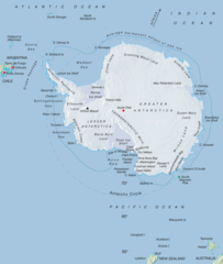
Antarctica Satellite Image Map
600 x 600
- 55,080k -
jpg
Antarctic Map
600 x 738
- 186,798k -
png
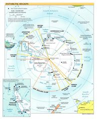
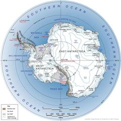
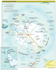
Antarctic Region
990 x 1220
- 210,964k -
jpg
Map of Antarctic
2339 x 2761
- 613,431k -
png
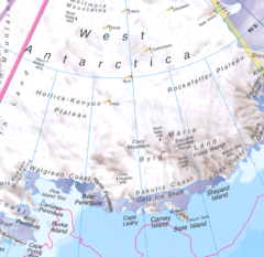
West Antarctica
788 x 766
- 287,865k -
png
Antarctica Political Map
816 x 907
- 134,812k -
jpg
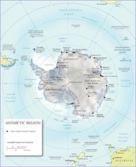
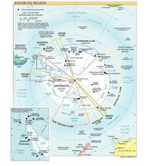
Antarctic Region Map
1034 x 1302
- 216,301k -
png

Antarctica Political Map 1
816 x 907
- 134,812k -
jpg