Street View
Street View in Google Maps lets you explore places through 360-degree street-level imagery, whether you’re looking at locations in your town or across the globe.
Using Street View
Street View in Google Maps lets you explore places through 360-degree street-level imagery, whether you’re looking at locations in your town or across the globe. With Street View, you can check out a restaurant before going there, find beautiful places around the world to visit on your next vacation, or check out neighborhoods when you’re looking to move.
Getting Started
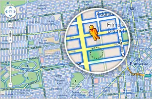
- To view street-level imagery in Google Maps, click and
drag Pegman
 to the place you want to see. Roads with Street View imagery
will appear with a blue border.
to the place you want to see. Roads with Street View imagery
will appear with a blue border.
- You can also enter Street View by zooming in all the way, for areas where Street View imagery is available.
To get started with Street View, visit Google Maps.
For more information, please check out the Google Maps User Guide.
Navigating in Street View

Rotate
To rotate your view in Street View, use the wheel
in the control panel in the top left corner
use the wheel
in the control panel in the top left corner
 or
use the left and right arrows on your keyboard
or
use the left and right arrows on your keyboard
 or
click and drag with your mouse.
or
click and drag with your mouse.
Walk
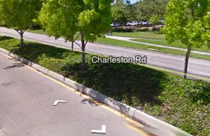
To walk down a street, click on
one of the white arrows overlaid on the street
click on
one of the white arrows overlaid on the street
 or
use the up and down arrows on your keyboard.
or
use the up and down arrows on your keyboard.
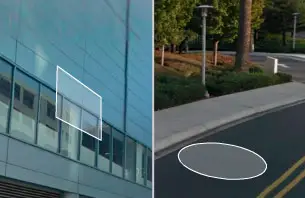
Jump
To jump and view a place, click on the
rectangular ‘waffle’ or circular
‘pancake’ shape lying flat where
your mouse is pointing.
click on the
rectangular ‘waffle’ or circular
‘pancake’ shape lying flat where
your mouse is pointing.
 When there
is a magnifying glass within the pancake, clicking it will zoom
in on the current image.
When there
is a magnifying glass within the pancake, clicking it will zoom
in on the current image.

Exit
To exit Street View,- click
 on the
top right corner
on the
top right corner
 or
zoom out to view the map.
or
zoom out to view the map.