Zimbabwe (Republic of Zimbabwe), ZW
Zimbabwe: Located in Southern Africa, this landlocked country is known for its dramatic landscape and diverse wildlife.
About

Country Snapshot
Republic of Zimbabwe at a glance
Republic of Zimbabwe currently has 45 quality-checked populated place pages and 10 state or regional pages linked on MapSof.
Mapped cities & towns
45
These counts use a stricter populated-place filter so the main lists stay focused on real city and town pages.
States & regions
10
Open related pagesLargest city
HararePopulation 1,542,813
Top linked places
Quick Facts about Republic of Zimbabwe
| Population | 17,073,087 |
| Country | Zimbabwe |
| Plate code | ZW |
| Area | 390757 km2 |
| Official name | la République du Zimbabwe, Zimbabwe, Zimbabwe |
| Water as percent of area | 1% |
| Land as percent of area | 99% |
| Continent | Africa |
| Northernmost point | Point(29.82 -15.6) |
| Latitude & Longitude | -19.0000,29.7500 |
| Legislative body | Parliament of Zimbabwe |
| Named for | Great Zimbabwe |
| Official language | Venda, Tsonga, Zimbabwe Sign Language, Kalanga, Tswana, Chewa, Sesotho, Northern Ndebele, Shona, English, Tonga, Ndau, Barwe, Xhosa, Tshwa |
| Capital | Harare |
| Establishment | April 18, 1980 (46 years ago) |
| Time Zone | UTC+02:00 |
| Local time | 19:28:38 (10th June 2026) |

Geography
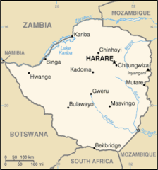
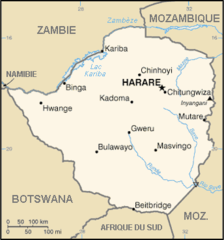
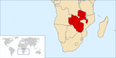
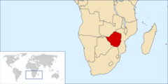
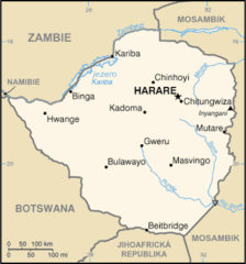
Republic of Zimbabwe is located at 19°0'0"S 29°45'0"E (-19.0000000, 29.7500000). It has 4 neighbors: Zambia, Botswana, South Africa and Mozambique.
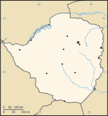
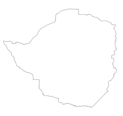
Zimbabwe map
The largest city of Republic of Zimbabwe is Harare with a population of 1,542,813. Other cities include, Bulawayo population 699,385, Mutare population 184,205, Gweru population 146,073 and Kwekwe population 99,149. See all Republic of Zimbabwe cities & populated places.
Official website of Republic of Zimbabwe
Official WebsiteCompare Republic of Zimbabwe with
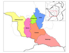
- Harare
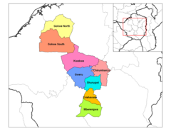
- Mashonaland East Province
- Manicaland
- Bulawayo
- Matabeleland South Province
- Midlands Province
- Mashonaland West Province
- Matabeleland North Province
- Masvingo
- Mashonaland Central Province
Demographics
| Year | Population | % Change | Method |
|---|---|---|---|
| 1960 | 3,752,390 | - | census |
| 1961 | 3,876,638 | 3.21% | census |
| 1962 | 4,006,261 | 3.24% | census |
| 1963 | 4,140,802 | 3.25% | census |
| 1964 | 4,279,559 | 3.24% | census |
| 1965 | 4,422,129 | 3.22% | census |
| 1966 | 4,568,317 | 3.2% | census |
| 1967 | 4,718,609 | 3.19% | census |
| 1968 | 4,874,109 | 3.19% | census |
| 1969 | 5,036,316 | 3.22% | census |
| 1970 | 5,206,305 | 3.27% | census |
| 1971 | 5,385,328 | 3.32% | census |
| 1972 | 5,573,282 | 3.37% | census |
| 1973 | 5,768,337 | 3.38% | census |
| 1974 | 5,967,819 | 3.34% | census |
| 1975 | 6,170,266 | 3.28% | census |
| 1976 | 6,373,946 | 3.2% | census |
| 1977 | 6,580,696 | 3.14% | census |
| 1978 | 6,796,863 | 3.18% | census |
| 1979 | 7,031,084 | 3.33% | census |
| 1980 | 7,289,069 | 3.54% | census |
| 1981 | 7,572,129 | 3.74% | census |
| 1982 | 7,876,786 | 3.87% | census |
| 1983 | 8,197,858 | 3.92% | census |
| 1984 | 8,527,836 | 3.87% | census |
| 1985 | 8,860,331 | 3.75% | census |
| 1986 | 9,193,889 | 3.63% | census |
| 1987 | 9,527,192 | 3.5% | census |
| 1988 | 9,854,098 | 3.32% | census |
| 1989 | 10,167,392 | 3.08% | census |
| 1990 | 10,461,782 | 2.81% | census |
| 1991 | 10,733,048 | 2.53% | census |
| 1992 | 10,981,267 | 2.26% | census |
| 1993 | 11,210,802 | 2.05% | census |
| 1994 | 11,428,655 | 1.91% | census |
| 1995 | 11,639,364 | 1.81% | census |
| 1996 | 11,846,110 | 1.75% | census |
| 1997 | 12,045,813 | 1.66% | census |
| 1998 | 12,229,500 | 1.5% | census |
| 1999 | 12,384,727 | 1.25% | census |
| 2000 | 12,503,652 | 0.95% | census |
| 2001 | 12,586,763 | 0.66% | census |
| 2002 | 12,640,922 | 0.43% | census |
| 2003 | 12,673,103 | 0.25% | census |
| 2004 | 12,693,047 | 0.16% | census |
| 2005 | 12,710,589 | 0.14% | census |
| 2006 | 12,724,308 | 0.11% | census |
| 2007 | 12,740,160 | 0.12% | census |
| 2008 | 12,784,041 | 0.34% | census |
| 2009 | 12,888,918 | 0.81% | census |
| 2010 | 13,076,978 | 1.44% | census |
| 2011 | 13,358,738 | 2.11% | census |
| 2012 | 13,724,317 | 2.66% | census |
| 2013 | 14,149,648 | 3.01% | census |
| 2014 | 13,586,681 | -4.14% | (Worldbank) |
| 2015 | 13,814,629 | 1.65% | (Worldbank) |
| 2016 | 14,030,390 | 1.54% | (Worldbank) |
| 2017 | 16,529,904 | 15.12% | census |
| 2018 | 14,439,018 | -14.48% | (Worldbank) |
| 2019 | 14,645,468 | 1.41% | (Worldbank) |
| 2026 | 17,073,087 | 14.22% |
Map & Images (more maps)
000 Zimbabveja Harta
Carte Du Zimbabwe Fr
Location Federation Rhodesia And Nyasaland
Locationzimbabwe
Mapa Zimbabwe
Mashonaland
Matabeleland South Districts
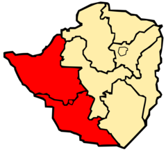
Matabeleland
Midlands Districts
Province of Bulawayo
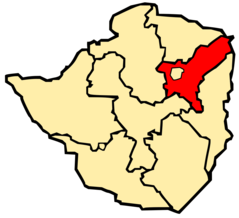
Province of Harare
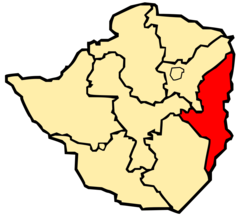
Province of Manicaland
Province of Mashonaland Central
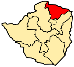
Province of Mashonaland East
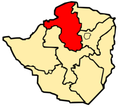
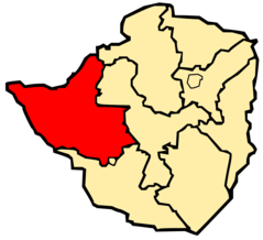
Province of Mashonaland West
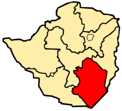
Province of Masvingo
Province of Matabeleland North
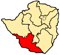
Province of Matabeleland South
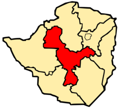
Province of Midlands
Svg Koort Simbabwe