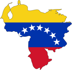
Venezuela (Bolivarian Republic of Venezuela), VE
Venezuela: Located on the northern coast of South America, this nation is known for its diverse landscapes, including the Andes Mountains, Amazon basin rainforests, and Caribbean coast.
About

Country Snapshot
Bolivarian Republic of Venezuela at a glance
Bolivarian Republic of Venezuela currently has 76 quality-checked populated place pages and 25 state or regional pages linked on MapSof.
Mapped cities & towns
76
These counts use a stricter populated-place filter so the main lists stay focused on real city and town pages.
States & regions
25
Open related pagesLargest city
CaracasPopulation 3,000,000
Top linked places
Quick Facts about Bolivarian Republic of Venezuela
| Population | 28,517,000 |
| Country | Venezuela |
| Plate code | YV |
| Area | 916445 km2 |
| Official name | Venezuela, República Bolivariana de Venezuela, la République bolivarienne du Vénézuéla, Bolivarian Republic of Venezuela |
| Continent | South America |
| Northernmost point | Point(-63.619416666 15.670972222) |
| Latitude & Longitude | 8.0000,-66.0000 |
| Legislative body | National Assembly of Venezuela, 2017 Constituent Assembly of Venezuela |
| Named for | Simón Bolívar, Venice |
| Official language | Spanish, Venezuelan Sign Language |
| Capital | Caracas |
| Establishment | January 01, 1811 (215 years ago) |
| Time Zone | UTC−04:00 |
| Local time | 01:47:09 (10th June 2026) |

Geography
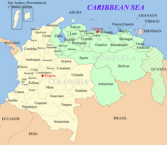
Bolivarian Republic of Venezuela is located at 8°0'0"N 66°0'0"W (8.0, -66.0). It has 14 neighbors: United Kingdom, Netherlands, France, Guyana, Brazil, Dominican Republic, Trinidad and Tobago, Saint Kitts and Nevis, Dominica, Saint Lucia, Saint Vincent and the Grenadines, Grenada, Colombia and United States.
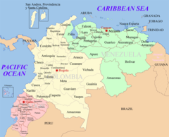
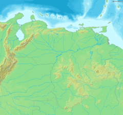
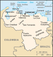
Venezuela map
The largest city of Bolivarian Republic of Venezuela is Caracas with a population of 3,000,000. Other cities include, Maracaibo population 2,225,000, Valencia population 794,288, Ciudad Guayana population 746,535 and Maturín population 514,046. See all Bolivarian Republic of Venezuela cities & populated places.
Official website of Bolivarian Republic of Venezuela
Official WebsiteCompare Bolivarian Republic of Venezuela with
- Aragua
- Vargas state
- Nueva Esparta
- Amazonas
- Merida
- Monagas
- Carabobo
- Sucre
- Portuguesa
- Apure
- Miranda
- Falcón
- Cojedes
- Guárico
- Trujillo
- Bolívar
- Yaracuy
- Tachira
- Federal Dependencies
- Anzoátegui
- Capital District
- Delta Amacuro
- Barinas
- Lara
- Zulia
Demographics
| Year | Population | % Change | Method |
|---|---|---|---|
| 1960 | 7,580,281 | - | 11676830 |
| 1961 | 7,872,644 | 3.71% | 11676830 |
| 1962 | 8,172,322 | 3.67% | 11676830 |
| 1963 | 8,477,485 | 3.6% | 11676830 |
| 1964 | 8,785,731 | 3.51% | 11676830 |
| 1965 | 9,095,742 | 3.41% | 11676830 |
| 1966 | 9,406,598 | 3.3% | 11676830 |
| 1967 | 9,719,951 | 3.22% | 11676830 |
| 1968 | 10,040,248 | 3.19% | 11676830 |
| 1969 | 10,373,554 | 3.21% | 11676830 |
| 1970 | 10,724,328 | 3.27% | 11676830 |
| 1971 | 11,093,065 | 3.32% | 11676830 |
| 1972 | 11,478,612 | 3.36% | 11676830 |
| 1973 | 11,881,567 | 3.39% | 11676830 |
| 1974 | 12,302,193 | 3.42% | 11676830 |
| 1975 | 12,739,894 | 3.44% | 11676830 |
| 1976 | 13,196,169 | 3.46% | 11676830 |
| 1977 | 13,669,054 | 3.46% | 11676830 |
| 1978 | 14,150,223 | 3.4% | 11676830 |
| 1979 | 14,628,595 | 3.27% | 11676830 |
| 1980 | 15,096,432 | 3.1% | 11676830 |
| 1981 | 15,549,525 | 2.91% | 11676830 |
| 1982 | 15,990,376 | 2.76% | 11676830 |
| 1983 | 16,426,198 | 2.65% | 11676830 |
| 1984 | 16,867,806 | 2.62% | 11676830 |
| 1985 | 17,322,754 | 2.63% | 11676830 |
| 1986 | 17,793,283 | 2.64% | 11676830 |
| 1987 | 18,275,997 | 2.64% | 11676830 |
| 1988 | 18,766,017 | 2.61% | 11676830 |
| 1989 | 19,256,060 | 2.54% | 11676830 |
| 1990 | 19,740,786 | 2.46% | 11676830 |
| 1991 | 20,218,813 | 2.36% | 11676830 |
| 1992 | 20,691,641 | 2.29% | 11676830 |
| 1993 | 21,160,262 | 2.21% | 11676830 |
| 1994 | 21,626,607 | 2.16% | 11676830 |
| 1995 | 22,092,144 | 2.11% | 11676830 |
| 1996 | 22,556,838 | 2.06% | 11676830 |
| 1997 | 23,020,184 | 2.01% | 11676830 |
| 1998 | 23,482,700 | 1.97% | 11676830 |
| 1999 | 23,945,002 | 1.93% | 11676830 |
| 2000 | 24,407,553 | 1.9% | 11676830 |
| 2001 | 24,870,441 | 1.86% | 11676830 |
| 2002 | 25,333,622 | 1.83% | 11676830 |
| 2003 | 25,797,219 | 1.8% | 11676830 |
| 2004 | 26,261,326 | 1.77% | 11676830 |
| 2005 | 26,725,897 | 1.74% | 11676830 |
| 2006 | 27,190,882 | 1.71% | 11676830 |
| 2007 | 27,655,937 | 1.68% | 11676830 |
| 2008 | 28,120,312 | 1.65% | 11676830 |
| 2009 | 28,583,040 | 1.62% | 11676830 |
| 2010 | 29,043,283 | 1.58% | 11676830 |
| 2011 | 29,500,625 | 1.55% | 11676830 |
| 2012 | 29,954,782 | 1.52% | 11676830 |
| 2013 | 30,405,207 | 1.48% | 11676830 |
| 2014 | 28,868,486 | -5.32% | 11676830 |
| 2015 | 30,081,829 | 4.03% | (Worldbank) |
| 2016 | 29,846,179 | -0.79% | (Worldbank) |
| 2017 | 31,977,065 | 6.66% | 11676830 |
| 2018 | 28,870,195 | -10.76% | (Worldbank) |
| 2019 | 28,515,829 | -1.24% | 11676830 |
| 2026 | 28,517,000 | 0% |
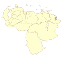
Map & Images (more maps)
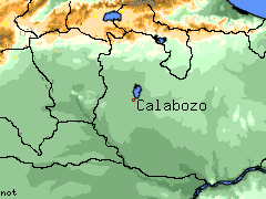
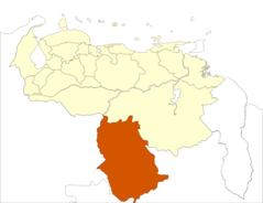
Calabozo Venezuela
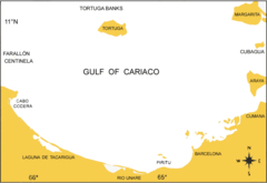
Cariacobasin
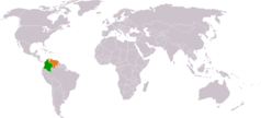
Colombia Venezuela Locator
Colombia Venezuela Map
Ecuador Colombia Venezuela Map
Estado Trujillo Venezuela
Flag Map of Venezuela
Italiansinvenezuela
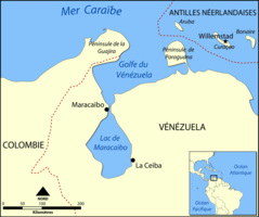
Lake Maracaibo Map Fr
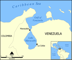
Lake Maracaibo Map
Map of Venezuela Demis
Mapa Politico Venezuela
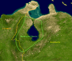
Maracaibo Basin
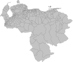
Municipios Venezuela 2007
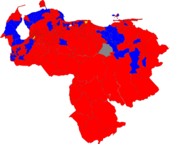
Referendum Municipio Venezuela 2007
Regioncentral
Resultados Venezuela Referendo 2007
Southerncaribbeanislands
Tdv Vargas
Ve Map