United Kingdom (United Kingdom of Great Britain and Northern Ireland), GB
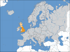
United Kingdom: This island nation, situated off the northwestern coast of mainland Europe, comprises Great Britain, Northern Ireland, and numerous smaller islands.
About

Country Snapshot
United Kingdom of Great Britain and Northern Ireland at a glance
United Kingdom of Great Britain and Northern Ireland currently has 2,790 quality-checked populated place pages and 4 state or regional pages linked on MapSof.
Mapped cities & towns
2,790
These counts use a stricter populated-place filter so the main lists stay focused on real city and town pages.
States & regions
4
Open related pagesLargest city
WashingtonPopulation 7,693,612
Top linked places
Quick Facts about United Kingdom of Great Britain and Northern Ireland
| Population | 69,281,437 |
| Country | United Kingdom |
| Different from | Great Britain, United Kingdom of Great Britain and Ireland, Category:United Kingdom |
| Plate code | GB |
| Area | 242495.41 km2 |
| Official name | Ir-Renju Unit tal-Gran Brittanja u l-Irlanda ta' Fuq, Spojené kráľovstvo Veľkej Británie a Severného Írska, Regatul Unit al Marii Britanii și al Irlandei de Nord, Regno Unito di Gran Bretagna e Irlanda del Nord, Об'єднане Королівство Великої Британії та Північної Ірландії, Teyrnas Unedig Prydain Fawr a Gogledd Iwerddon, Spojené království Velké Británie a Severního Irska, Förenade konungariket Storbritannien och Nordirland, Unitit Kinrick o Great Breetain an Northren Irland, Zjednoćene kralestwo Wulkeje Britaniskeje a Sewjerneje Irskeje, Royaume-Uni de Grande-Bretagne et d'Irlande du Nord, le Royaume-Uni de Grande-Bretagne et d’Irlande du Nord, Ηνωμένο Βασίλειο της Μεγάλης Βρετανίας και της Βόρειας Ιρλανδίας, Соединённое королевство Великобритании и Северной Ирландии, Vereinigtes Königreich Großbritannien und Nordirland, Nagy-Britannia és Észak-Írország Egyesült Királysága, Regne Unit, United Kingdom of Great Britain and Northern Ireland |
| Continent | Europe |
| Easternmost point | Point(1.76297307 52.48106832) |
| Northernmost point | Point(-0.87 60.87) |
| Latitude & Longitude | 54.0000,-4.0000 |
| Legislative body | Parliament of the United Kingdom |
| Official language | English, Welsh |
| Capital | London |
| Establishment | April 12, 1927 (99 years ago) |
| Time Zone | Greenwich Mean Time, Western European Time, UTC±00:00, UTC−04:00, UTC+06:00, UTC−08:00, UTC+02:00, UTC−05:00, UTC+01:00, UTC−04:00, UTC−02:00, UTC±00:00, UTC+02:00, UTC−03:00, UTC+01:00 |
| Local time | 22:37:52 (11th July 2026) |

Geography
United Kingdom of Great Britain and Northern Ireland is located at 54°0'0"N 4°0'0"W (54.0, -4.0). It has 17 neighbors: Cyprus, Maldives, Spain, Denmark, Belgium, Germany, Ireland, France, Norway, Jamaica, Cuba, Bahamas, Saint Kitts and Nevis, Antigua and Barbuda, Venezuela, Argentina and Union.
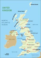
United Kingdom map
The largest city of United Kingdom of Great Britain and Northern Ireland is Birmingham with a population of 1,137,100. Other cities include, Sheffield population 685,368, Glasgow population 626,410, Liverpool population 513,441 and Leeds population 455,123. See all United Kingdom of Great Britain and Northern Ireland cities & populated places.
Compare United Kingdom of Great Britain and Northern Ireland with
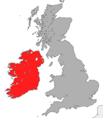
- Southern Ireland
- Scotland
- England
- Wales
- Northern Ireland
Demographics
| Year | Population | % Change | Method |
|---|---|---|---|
| 1960 | 52,400,000 | - | |
| 1961 | 52,800,000 | 0.76% | estimation process |
| 1962 | 53,250,000 | 0.85% | estimation process |
| 1963 | 53,650,000 | 0.75% | estimation process |
| 1964 | 54,000,000 | 0.65% | |
| 1965 | 54,348,050 | 0.64% | census |
| 1966 | 54,648,500 | 0.55% | |
| 1967 | 54,943,600 | 0.54% | census |
| 1968 | 55,211,700 | 0.49% | census |
| 1969 | 55,441,750 | 0.41% | estimation process |
| 1970 | 55,663,250 | 0.4% | census |
| 1971 | 55,896,223 | 0.42% | census |
| 1972 | 56,086,065 | 0.34% | census |
| 1973 | 56,194,527 | 0.19% | estimation process |
| 1974 | 56,229,974 | 0.06% | estimation process |
| 1975 | 56,225,800 | -0.01% | estimation process |
| 1976 | 56,211,968 | -0.02% | census |
| 1977 | 56,193,492 | -0.03% | |
| 1978 | 56,196,504 | 0.01% | census |
| 1979 | 56,246,951 | 0.09% | census |
| 1980 | 56,314,216 | 0.12% | census |
| 1981 | 56,333,829 | 0.03% | census |
| 1982 | 56,313,641 | -0.04% | census |
| 1983 | 56,332,848 | 0.03% | |
| 1984 | 56,422,072 | 0.16% | census |
| 1985 | 56,550,268 | 0.23% | |
| 1986 | 56,681,396 | 0.23% | estimation process |
| 1987 | 56,802,050 | 0.21% | |
| 1988 | 56,928,327 | 0.22% | |
| 1989 | 57,076,711 | 0.26% | estimation process |
| 1990 | 57,247,586 | 0.3% | census |
| 1991 | 57,424,897 | 0.31% | census |
| 1992 | 57,580,402 | 0.27% | census |
| 1993 | 57,718,614 | 0.24% | estimation process |
| 1994 | 57,865,745 | 0.25% | census |
| 1995 | 58,019,030 | 0.26% | estimation process |
| 1996 | 58,166,950 | 0.25% | estimation process |
| 1997 | 58,316,954 | 0.26% | |
| 1998 | 58,487,141 | 0.29% | estimation process |
| 1999 | 58,682,466 | 0.33% | estimation process |
| 2000 | 58,892,514 | 0.36% | census |
| 2001 | 59,119,673 | 0.38% | estimation process |
| 2002 | 59,370,479 | 0.42% | census |
| 2003 | 59,647,577 | 0.46% | estimation process |
| 2004 | 59,987,905 | 0.57% | census |
| 2005 | 60,401,206 | 0.68% | census |
| 2006 | 60,846,820 | 0.73% | census |
| 2007 | 61,322,463 | 0.78% | estimation process |
| 2008 | 61,806,995 | 0.78% | estimation process |
| 2009 | 62,276,270 | 0.75% | estimation process |
| 2010 | 62,766,365 | 0.78% | census |
| 2011 | 63,258,918 | 0.78% | |
| 2012 | 63,700,300 | 0.69% | census |
| 2013 | 64,106,779 | 0.63% | |
| 2014 | 64,602,298 | 0.77% | (Worldbank) |
| 2015 | 65,116,219 | 0.79% | (Worldbank) |
| 2016 | 65,102,385 | -0.02% | estimation process |
| 2017 | 66,022,273 | 1.39% | estimation process |
| 2018 | 66,460,344 | 0.66% | (Worldbank) |
| 2019 | 66,834,405 | 0.56% | (Worldbank) |
| 2026 | 69,281,437 | 3.53% |
Map & Images (more maps)
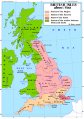
Britain 802
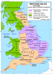
Britain 886
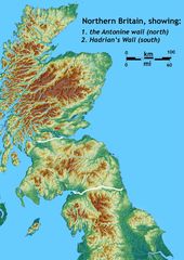
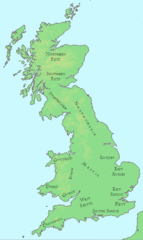
Britain Northern Walls
Britania 10dc
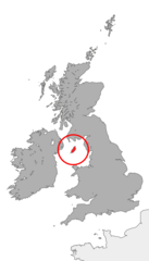
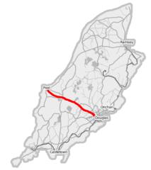
British Isles Isle of Man Svg
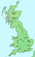
British Kingdoms C 800
British Seventh Century Kingdoms
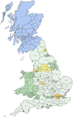
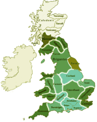
Counties In Uk
England
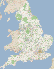
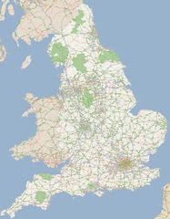
England Large Map
England Map
England Map 2
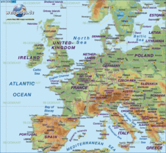
Europe Location England
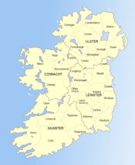
Ireland
Ireland 1
Ireland 2
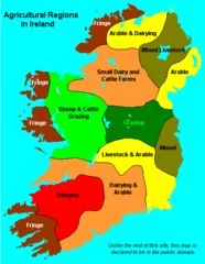
Ireland Maps Island Agriculture
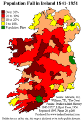
Ireland Population Change 1841 1851
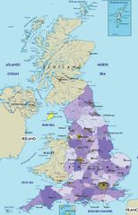
Ireland Uk
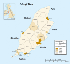
Isle of Man