Uganda (Republic of Uganda), UG
Uganda: Located in East Africa, Uganda is a landlocked country known for its diverse landscapes, including the Rwenzori Mountains and Lake Victoria.
About

Country Snapshot
Republic of Uganda at a glance
Republic of Uganda currently has 44 quality-checked populated place pages and 3 state or regional pages linked on MapSof.
Mapped cities & towns
44
These counts use a stricter populated-place filter so the main lists stay focused on real city and town pages.
States & regions
3
Open related pagesLargest city
KampalaPopulation 1,353,189
Top linked places
Quick Facts about Republic of Uganda
| Population | 45,905,417 |
| Country | Uganda |
| Plate code | EAU |
| Area | 241038 km2 |
| Official name | Ouganda, Uganda, Uganda |
| Water as percent of area | 18.2% |
| Land as percent of area | 81.8% |
| Continent | Africa |
| Northernmost point | Point(34.0 4.22) |
| Latitude & Longitude | 1.2500,32.5000 |
| Legislative body | Parliament of Uganda |
| Official language | English, Swahili |
| Capital | Kampala |
| Establishment | January 01, 1962 (64 years ago) |
| Time Zone | UTC+03:00 |
| Local time | 21:25:21 (9th June 2026) |

Geography
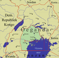
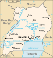
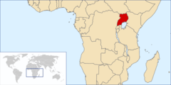
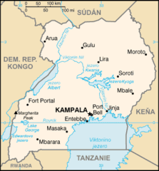
Republic of Uganda is located at 1°15'0"N 32°30'0"E (1.2500000, 32.5000000). It has 6 neighbors: Rwanda, Tanzania, Kenya, Congo Kinshasa, Sudan and South Sudan.
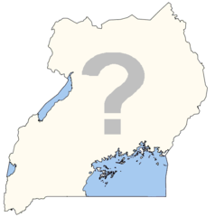
Uganda map
The largest city of Republic of Uganda is Kampala with a population of 1,353,189. Other cities include, Gulu population 146,858, Bwizibwera population 79,157, Mbale population 76,493 and Entebbe population 62,969. See all Republic of Uganda cities & populated places.
Official website of Republic of Uganda
Official WebsiteCompare Republic of Uganda with
- Kitagwenda District
- Rwampara district
- Kazo District
- Kalaki District
- Obongi District
- Madi-Okollo District
- Karenga District
- Nabilatuk District
- Kwania District
- Pakwach District
- Omoro District
- Kapelebyong District
- Bugweri District
- Namisindwa District
- Butebo District
- Kasanda District
- Kyotera District
- Kibuube District
- Rukiga District
- Bunyangabu District
- Rubanda District
- Kakumiro District
- Kagadi District
- Dokolo District
- Lwengo District
- Gomba District
- Nakaseke District
- Bulambuli District
- Katakwi District
- Serere District
- Moyo District
- Kiruhura District
- Mpigi District
- Amuria District
- Jinja District
- Kalangala District
- Sironko District
- Bukomansimbi District
- Isingiro District
- Koboko District
- Lamwo District
- Luwero District
- Soroti District
- Busia District
- Luuka District
- Kabarole District
- Mayuge District
- Nakasongola District
- Zombo District
- Kaabong District
- Kyankwanzi District
- Kumi District
- Namayingo District
- Iganga District
- Kayunga District
- Sheema District
- Mityana District
- Pader District
- Kaliro District
- Apac District
- Kole District
- Kisoro District
- Bundibugyo District
- Gulu District
- Arua District
- Buliisa District
- Ntungamo District
- Buvuma District
- Kamwenge District
- Kapchorwa District
- Bukwo District
- Alebtong District
- Mitooma District
- Moroto District
- Buikwe District
- Masaka District
- Kibuku District
- Mbale District
- Kasese District
- Kalungu District
- Maracha District
- Manafwa District
- Nwoya District
- Namutumba District
- Agago District
- Kiboga District
- Sembabule District
- Ibanda District
- Lira District
- Kanungu District
- Rukungiri District
- Amudat District
- Kibaale District
- Buhweju District
- Napak District
- Ngora District
- Kitgum District
- Nebbi District
- Kiryandongo District
- Kamuli District
- Kotido District
- Masindi District
- Buyende District
- Kabale District
- Mbarara District
- Amuru District
- Tororo District
- Yumbe District
- Hoima District
- Budaka District
- Kyenjojo District
- Kaberamaido District
- Pallisa District
- Amolatar District
- Bukedea District
- Wakiso District
- Butambala District
- Kyegegwa District
- Rubirizi District
- Ntoroko District
- Abim District
- Mubende District
- Otuke District
- Lyantonde District
- Bududa District
- Kween District
- Butaleja District
- Kampala District
- Bushenyi District
- Mukono District
- Rakai District
- Nakapiripirit District
- Oyam District
- Adjumani District
- Bugiri District
Demographics
| Year | Population | % Change | Method |
|---|---|---|---|
| 1960 | 6,788,211 | - | 2017-01-01T00:00:00Z |
| 1961 | 7,006,629 | 3.12% | 2017-01-01T00:00:00Z |
| 1962 | 7,240,155 | 3.23% | 2017-01-01T00:00:00Z |
| 1963 | 7,487,412 | 3.3% | 2017-01-01T00:00:00Z |
| 1964 | 7,746,181 | 3.34% | 2017-01-01T00:00:00Z |
| 1965 | 8,014,376 | 3.35% | 2017-01-01T00:00:00Z |
| 1966 | 8,292,751 | 3.36% | 2017-01-01T00:00:00Z |
| 1967 | 8,580,647 | 3.36% | 2017-01-01T00:00:00Z |
| 1968 | 8,872,890 | 3.29% | 2017-01-01T00:00:00Z |
| 1969 | 9,162,794 | 3.16% | 2017-01-01T00:00:00Z |
| 1970 | 9,446,024 | 3% | 2017-01-01T00:00:00Z |
| 1971 | 9,720,388 | 2.82% | 2017-01-01T00:00:00Z |
| 1972 | 9,988,441 | 2.68% | 2017-01-01T00:00:00Z |
| 1973 | 10,256,553 | 2.61% | 2017-01-01T00:00:00Z |
| 1974 | 10,533,820 | 2.63% | 2017-01-01T00:00:00Z |
| 1975 | 10,827,097 | 2.71% | 2017-01-01T00:00:00Z |
| 1976 | 11,139,632 | 2.81% | 2017-01-01T00:00:00Z |
| 1977 | 11,470,628 | 2.89% | 2017-01-01T00:00:00Z |
| 1978 | 11,818,135 | 2.94% | 2017-01-01T00:00:00Z |
| 1979 | 12,178,512 | 2.96% | 2017-01-01T00:00:00Z |
| 1980 | 12,549,779 | 2.96% | 2017-01-01T00:00:00Z |
| 1981 | 12,930,714 | 2.95% | 2017-01-01T00:00:00Z |
| 1982 | 13,324,390 | 2.95% | 2017-01-01T00:00:00Z |
| 1983 | 13,738,114 | 3.01% | 2017-01-01T00:00:00Z |
| 1984 | 14,181,630 | 3.13% | 2017-01-01T00:00:00Z |
| 1985 | 14,661,481 | 3.27% | 2017-01-01T00:00:00Z |
| 1986 | 15,180,721 | 3.42% | 2017-01-01T00:00:00Z |
| 1987 | 15,736,176 | 3.53% | 2017-01-01T00:00:00Z |
| 1988 | 16,320,417 | 3.58% | 2017-01-01T00:00:00Z |
| 1989 | 16,922,648 | 3.56% | 2017-01-01T00:00:00Z |
| 1990 | 17,534,839 | 3.49% | 2017-01-01T00:00:00Z |
| 1991 | 18,156,095 | 3.42% | 2017-01-01T00:00:00Z |
| 1992 | 18,788,440 | 3.37% | 2017-01-01T00:00:00Z |
| 1993 | 19,430,461 | 3.3% | 2017-01-01T00:00:00Z |
| 1994 | 20,081,152 | 3.24% | 2017-01-01T00:00:00Z |
| 1995 | 20,740,726 | 3.18% | 2017-01-01T00:00:00Z |
| 1996 | 21,407,693 | 3.12% | 2017-01-01T00:00:00Z |
| 1997 | 22,084,527 | 3.06% | 2017-01-01T00:00:00Z |
| 1998 | 22,780,451 | 3.05% | 2017-01-01T00:00:00Z |
| 1999 | 23,507,800 | 3.09% | 2017-01-01T00:00:00Z |
| 2000 | 24,275,641 | 3.16% | 2017-01-01T00:00:00Z |
| 2001 | 25,088,033 | 3.24% | 2017-01-01T00:00:00Z |
| 2002 | 25,943,441 | 3.3% | 2017-01-01T00:00:00Z |
| 2003 | 26,838,428 | 3.33% | 2017-01-01T00:00:00Z |
| 2004 | 27,766,986 | 3.34% | 2017-01-01T00:00:00Z |
| 2005 | 28,724,869 | 3.33% | 2017-01-01T00:00:00Z |
| 2006 | 29,711,397 | 3.32% | 2017-01-01T00:00:00Z |
| 2007 | 30,728,747 | 3.31% | 2017-01-01T00:00:00Z |
| 2008 | 31,778,799 | 3.3% | 2017-01-01T00:00:00Z |
| 2009 | 32,864,328 | 3.3% | 2017-01-01T00:00:00Z |
| 2010 | 33,987,213 | 3.3% | 2017-01-01T00:00:00Z |
| 2011 | 35,148,064 | 3.3% | 2017-01-01T00:00:00Z |
| 2012 | 36,345,860 | 3.3% | 2017-01-01T00:00:00Z |
| 2013 | 37,578,876 | 3.28% | 2017-01-01T00:00:00Z |
| 2014 | 34,634,650 | -8.5% | 2017-01-01T00:00:00Z |
| 2015 | 38,225,453 | 9.39% | (Worldbank) |
| 2016 | 39,647,506 | 3.59% | (Worldbank) |
| 2017 | 42,862,958 | 7.5% | 2017-01-01T00:00:00Z |
| 2018 | 42,723,139 | -0.33% | (Worldbank) |
| 2019 | 44,269,594 | 3.49% | (Worldbank) |
| 2026 | 45,905,417 | 3.56% |
Map & Images (more maps)
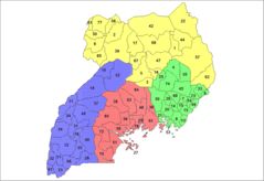
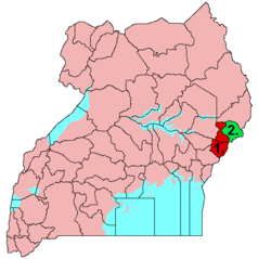
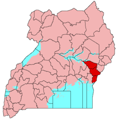
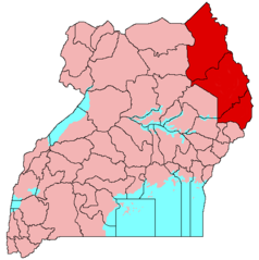
Uganda Districts
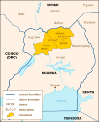
Acholiland, Uganda
Blankmap Uganda
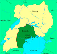
Boeganda
Bugisu
Bukedi
Flag Map of Uganda

Kaart Oeganda Nl
Kaart Oeganda
Karamoja
Karte Buganda
Kigezi
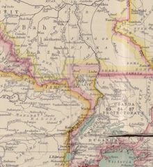
Lado Enclave Map
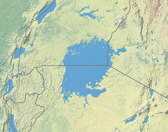
Lake Victoria Vegetation Map Blank
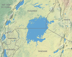
Lake Victoria Vegetation Map Fr
Lango Subregion
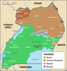
Languages of Uganda
Locationuganda
Madi
Mapa Ugandy