Thailand (Kingdom of Thailand), TH
Thailand: Located in Southeast Asia, this constitutional monarchy is known for its tropical beaches, opulent royal palaces, ancient ruins, and ornate temples depicting figures of Buddha.
About

Country Snapshot
Kingdom of Thailand at a glance
Kingdom of Thailand currently has 205 quality-checked populated place pages and 79 state or regional pages linked on MapSof.
Mapped cities & towns
205
These counts use a stricter populated-place filter so the main lists stay focused on real city and town pages.
States & regions
79
Open related pagesLargest city
BangkokPopulation 5,676,648
Top linked places
Quick Facts about Kingdom of Thailand
| Population | 65,859,640 |
| Country | Thailand |
| Plate code | T |
| Area | 513119.5 km2 |
| Official name | le Royaume de Thaïlande, ราชอาณาจักรไทย, ประเทศไทย |
| Continent | Asia |
| Northernmost point | Point(99.955311111 20.465019444) |
| Latitude & Longitude | 15.5000,101.0000 |
| Legislative body | National Assembly of Thailand, National Legislative Assembly of Thailand |
| Official language | Thai |
| Capital | Bangkok |
| Time Zone | UTC+07:00 |
| Local time | 04:16:51 (10th June 2026) |

Geography
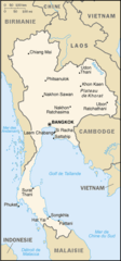
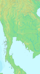
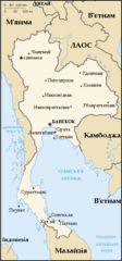
Kingdom of Thailand is located at 15°30'0"N 101°0'0"E (15.5000000, 101.0000000). It has 4 neighbors: Myanmar, Laos, Malaysia and Cambodia.
Thailand map
The largest city of Kingdom of Thailand is Bangkok with a population of 5,676,648. Other cities include and Hat Yai population 191,696. See all Kingdom of Thailand cities & populated places.
Official website of Kingdom of Thailand
Official WebsiteCompare Kingdom of Thailand with
- Phitsanulok
- Udon Thani
- Nong Khai
- Kalasin
- Songkhla
- Amnat Charoen
- Kamphaeng Phet
- Phang Nga
- Lopburi
- Nakhon Phanom
- Phetchabun
- Yasothon
- Phra Nakhon Si Ayutthaya
- Ubon Ratchathani
- Tak
- Chaiyaphum
- Uthai Thani
- Nan
- Nakhon Pathom
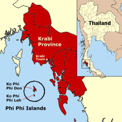
- Krabi
- Mukdahan
- Lampang
- Yala
- Phuket
- Khon Kaen
- Sing Buri
- Lamphun
- Chai Nat
- Satun
- Uttaradit
- Saraburi
- Maha Sarakham
- Prachin Buri
- Chumphon
- Nakhon Ratchasima
- Samut Songkhram
- Buri Ram
- Kanchanaburi
- Nong Bua Lam Phu
- Mae Hong Son
- Phatthalung
- Chon Buri
- Nakhon Si Thammarat
- Samut Sakhon
- Loei
- Prachuap Khiri Khan
- Phrae
- Bueng Kan
- Roi Et
- Phichit
- Ratchaburi
- Rayong
- Chiang Rai
- Sukhothai
- Chiang Mai
- Narathiwat
- Surin
- Suphan Buri
- Nakhon Sawan
- Nakhon Nayok
- Pathum Thani
- Sa Kaeo
- Si Sa Ket
- Phayao
- Trang
- Samut Prakan
- Phetchaburi
- Nonthaburi
- Ang Thong
- Bangkok
- Pattani
- Chanthaburi
- Trat
- Surat Thani
- Sakon Nakhon
- Ranong
- Chachoengsao
Demographics
| Year | Population | % Change | Method |
|---|---|---|---|
| 1919 | 9,207,355 | - | census |
| 1929 | 11,606,207 | 20.67% | census |
| 1937 | 14,464,106 | 19.76% | census |
| 1947 | 17,442,689 | 17.08% | census |
| 1960 | 26,257,916 | 33.57% | census |
| 1961 | 28,195,264 | 6.87% | census |
| 1962 | 29,058,659 | 2.97% | resident registration |
| 1963 | 29,951,191 | 2.98% | census |
| 1964 | 30,870,998 | 2.98% | census |
| 1965 | 31,816,307 | 2.97% | census |
| 1966 | 32,784,476 | 2.95% | census |
| 1967 | 33,774,079 | 2.93% | census |
| 1968 | 34,785,711 | 2.91% | census |
| 1969 | 35,820,705 | 2.89% | census |
| 1970 | 36,878,580 | 2.87% | census |
| 1971 | 37,959,301 | 2.85% | census |
| 1972 | 39,057,780 | 2.81% | resident registration |
| 1973 | 40,162,277 | 2.75% | census |
| 1974 | 41,257,648 | 2.65% | census |
| 1975 | 42,332,566 | 2.54% | census |
| 1976 | 43,382,444 | 2.42% | census |
| 1977 | 44,408,422 | 2.31% | census |
| 1978 | 45,412,214 | 2.21% | census |
| 1979 | 46,397,977 | 2.12% | census |
| 1980 | 44,824,540 | -3.51% | census |
| 1981 | 48,319,564 | 7.23% | census |
| 1982 | 49,247,430 | 1.88% | census |
| 1983 | 50,165,305 | 1.83% | census |
| 1984 | 51,090,390 | 1.81% | census |
| 1985 | 52,031,925 | 1.81% | census |
| 1986 | 53,003,237 | 1.83% | census |
| 1987 | 53,993,052 | 1.83% | census |
| 1988 | 54,956,736 | 1.75% | census |
| 1989 | 55,833,321 | 1.57% | census |
| 1990 | 56,582,726 | 1.32% | census |
| 1991 | 57,184,324 | 1.05% | census |
| 1992 | 57,661,001 | 0.83% | census |
| 1993 | 58,069,612 | 0.7% | census |
| 1994 | 58,491,145 | 0.72% | census |
| 1995 | 58,983,954 | 0.84% | census |
| 1996 | 59,562,136 | 0.97% | census |
| 1997 | 60,206,941 | 1.07% | resident registration |
| 1998 | 60,903,042 | 1.14% | census |
| 1999 | 61,623,143 | 1.17% | census |
| 2000 | 60,916,441 | -1.16% | census |
| 2001 | 63,069,070 | 3.41% | resident registration |
| 2002 | 63,797,841 | 1.14% | census |
| 2003 | 64,488,338 | 1.07% | census |
| 2004 | 65,087,400 | 0.92% | census |
| 2005 | 65,559,487 | 0.72% | census |
| 2006 | 65,883,961 | 0.49% | resident registration |
| 2007 | 66,076,927 | 0.29% | resident registration |
| 2008 | 66,185,340 | 0.16% | census |
| 2009 | 66,277,335 | 0.14% | census |
| 2010 | 66,402,316 | 0.19% | census |
| 2011 | 66,576,332 | 0.26% | census |
| 2012 | 66,785,001 | 0.31% | census |
| 2013 | 67,010,502 | 0.34% | census |
| 2014 | 68,438,730 | 2.09% | (Worldbank) |
| 2015 | 68,714,511 | 0.4% | (Worldbank) |
| 2016 | 65,931,550 | -4.22% | resident registration |
| 2017 | 66,188,503 | 0.39% | resident registration |
| 2018 | 69,428,524 | 4.67% | (Worldbank) |
| 2019 | 69,625,582 | 0.28% | (Worldbank) |
| 2026 | 65,859,640 | -5.72% |
Map & Images (more maps)
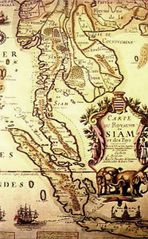
1686frenchmapofsiam

1820 1829 Siam And Cochin China John Crawfurd Journal of An Embassy O
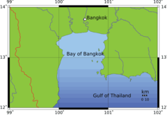
Bay of Bangkok
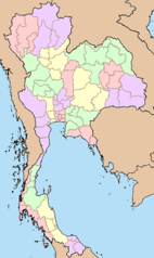
Blankmap Thailand
Carte Thailande
Dvaravatimapthailand
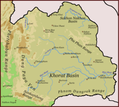
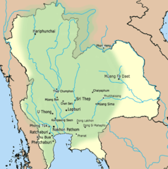
Isaanmountains
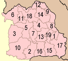
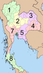
Isan Provinces
Map of Thailand Demis
Map of Thailand Uk
P Thailand
Phi Phi Islands
Referendum Tailandia 2007
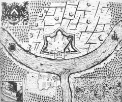
Siege of Bangkok
Souththailandmap
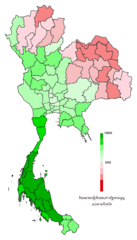
Thailand Electoral Areas 2007
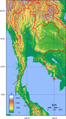
Thailand Topography
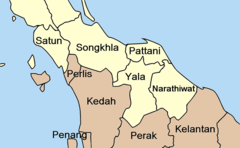
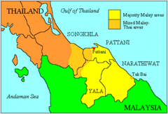
Thailand Deep South Named
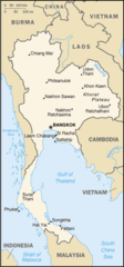
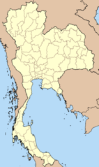
Thailand Map Cia
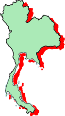
Thailand Map Green