Taipei, Taiwan
Taipei: Located in northern Taiwan, the city is a global hub of finance, technology, and culture.
About

Quick Facts about Taipei
| Population | 2,692,118 |
| Country | Taiwan, Empire of Japan |
| State | Taiwan (Taiwan) |
| County | Taipei City |
| Postal code | 100 |
| Phone Area Codes | 02 |
| Area | 271799700 km2 |
| Official name | Тайбэй, Тайхоку, Тайбэй, 臺北 |
| Latitude & Longitude | 25.0478,121.5319 |
| Legislative body | Taipei City Council |
| Official language | Chinese |
| Altitude | 33 feet / 10 meters |
| Capital city | Taipei is capital of Taiwan Province, Republic of Formosa, Taiwan, Taiwan, Taiwan under Japanese rule |
| Establishment | January 01, 1709 (317 years ago) |
| Time Zone | UTC+08:00 |
| Local time | 05:09:32 (10th June 2026) |

Emblem of Taipei City seal image
Geography
Taipei is located at 25°2'52"N 121°31'55"E (25.0477600, 121.5318500).
Taipei map
Click "full screen"  icon to open full mode. View satellite images
Official website of Taipei
Official Website- Asunción (1987 )
- Atlanta (1979 )
- Bangkok (2010 )
- Banjul (1997 )
- Bissau (1997 )
- Boston (1997 )
- Castries
- Cincinnati
- Cleveland (1975 )
- Cotonou (1967 )
- Daegu
- Dakar (1997 )
- Dallas (1997 )
- George Town
- Gold Coast (1982 )
- Guam (1973 )
- Guatemala City (1998 )
- Ho Chi Minh City (1968 )
- Houston (1961 )
- Hyderabad (2000 )
- Indianapolis (1978 )
- Jeddah (1978 )
- Johannesburg (1982 )
- La Paz (1997 )
- Lagos
- Lilongwe (1984 )
- Lomé (1966 )
- Los Angeles (1979 )
- Majuro (1998 )
- Managua (1992 )
- Manila (1966 )
- Marshall (1978 )
- Mbabane (1997 )
- Monrovia (1998 )
- Newark (1984 )
- Oklahoma City (1981 )
- Ouagadougou (2008 )
- Panama City (1989 )
- Phoenix (1979 )
- Prague
- Pretoria (1983 )
- Quezon City (1968 )
- Riga (2001 )
- San Francisco (1970 )
- San José (1984 )
- San Nicolás
- San Nicolás de los Garza (1997 )
- San Salvador (1993 )
- Santo Domingo (1970 )
- Seoul (1968 )
- Suva
- Tegucigalpa (1975 )
- Ulaanbaatar (1997 )
- Ulan-Ude (1996 )
- Versailles (1986 )
- Vilnius (1998 )
- Warsaw (1995 )
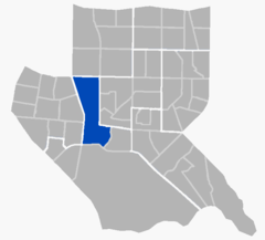
- Wenshan District
- Wanhua District
- Zhongzheng District
- Da'an District
- Datong District
- Beitou District
- Neihu District
- Songshan District
- Shilin District
- Zhongshan District
- Xinyi District
- Nangang District
Demographics
| Year | Population | % Change | Method |
|---|---|---|---|
| 2001 | 2,634,614 | - | Family register |
| 2002 | 2,641,856 | 0.27% | Family register |
| 2003 | 2,639,139 | -0.1% | Family register |
| 2004 | 2,624,858 | -0.54% | Family register |
| 2005 | 2,618,706 | -0.23% | Family register |
| 2006 | 2,623,783 | 0.19% | Family register |
| 2007 | 2,628,330 | 0.17% | Family register |
| 2008 | 2,622,933 | -0.21% | Family register |
| 2009 | 2,620,273 | -0.1% | Family register |
| 2010 | 2,618,772 | -0.06% | Family register |
| 2011 | 2,627,677 | 0.34% | Family register |
| 2012 | 2,658,685 | 1.17% | Family register |
| 2013 | 2,676,128 | 0.65% | Family register |
| 2014 | 2,688,140 | 0.45% | Family register |
| 2015 | 2,700,115 | 0.44% | Family register |
| 2016 | 2,702,925 | 0.1% | Family register |
| 2017 | 2,692,118 | -0.4% | Family register |
GJai Bac, Kota Taipei, Pan Kiao, Pan-ch'iao, Pan-ch'iao-chen, Pan-ch'iao-chieh, Pan-ch’iao, Pan-ch’iao-chen, Pan-ch’iao-chieh, T'ai-pei, T'ai-pei Shih, T'ai-pei-hsien, TPE, Taibei Shi, Taibei Shih, Taibejus, Taibėjus, Taipe, Taipeh, Taipeium, Taipejus, Taipé, Taipéi, Taipėjus, Tajbehj, Tajpej, Tajpeo, Tayipeh, Tayipèh, Tchaj-pej, T’ai-pei, T’ai-pei Shih, T’ai-pei-hsien, ta'ipe, ta'ipe'i, tai bei, tai bei shi, taibei, taibei si, taippei, thipe, Đài Bắc, Ταϊπέι, Тайбэй, Тайпей, Тајпеј, טאיפי, טאיפיי, تەيبېي, ताइपे, টাইপেই, ไทเป, ཐའེ་པེ, ታይፔ, 台北, 台北市, 臺北市, 타이베이, 타이베이 시, 타이뻬이, 타이페이
Map & Images (more maps)
01132
425 x 480
- 75,768k -
jpg
C389
460 x 480
- 53,184k -
jpg
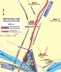
Ctoyac Mrt Shilin
1200 x 1409
- 202,849k -
png
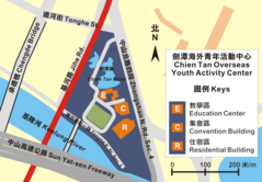
Ctoyac
1845 x 1280
- 142,579k -
png
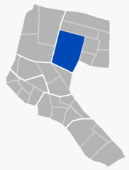
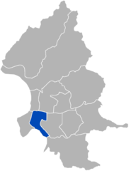
Longmenli In Daan
667 x 604
- 22,377k -
png
Old Taipei Revealing the Original City Wall And Gates
441 x 480
- 58,151k -
jpg
Red Building04
601 x 390
- 24,919k -
jpg
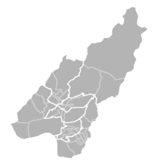
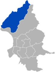
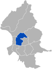
Taipei City Location Map
417 x 549
- 12,582k -
png
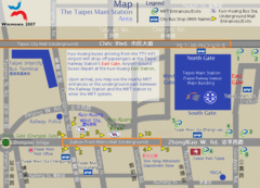
Taipei Main Sta Ground
900 x 650
- 82,978k -
gif
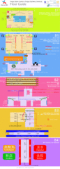
Taipei Main Station Floor Map
1000 x 2800
- 138,004k -
gif
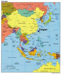
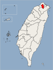
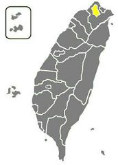
Taipei In East Asia
1017 x 1238
- 148,544k -
jpg
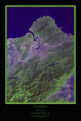
Taipei Taiwan Satellite Map
671 x 1000
- 96,736k -
jpg
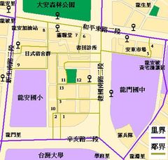
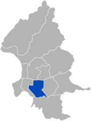
Taipei Daan Longmenli Map
447 x 424
- 55,535k -
jpg
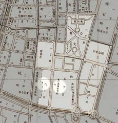
Taipei Zhongzheng Dongmenli
484 x 638
- 5,320k -
png
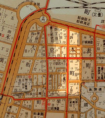
Taipei Map
214 x 299
- 8,889k -
jpg
Taipeibeitousubdistrictmap
650 x 680
- 6,596k -
png
Taipeibeitoudistrict
350 x 461
- 8,193k -
png
Taipeida Andistrict
350 x 461
- 8,186k -
png
Taipeidaanlimap
667 x 604
- 60,259k -
jpg
Taipeijhongjhengdistrict
350 x 461
- 8,398k -
png
Taipeijhongshandistrict
350 x 461
- 8,126k -
png