Pakistan (Islamic Republic of Pakistan), PK
Pakistan: Located in South Asia, with a coastline along the Arabian Sea, this country is the world's fifth-most populous, with over 241 million people.
About

Country Snapshot
Islamic Republic of Pakistan at a glance
Islamic Republic of Pakistan currently has 303 quality-checked populated place pages and 6 state or regional pages linked on MapSof.
Mapped cities & towns
303
These counts use a stricter populated-place filter so the main lists stay focused on real city and town pages.
States & regions
6
Open related pagesLargest city
KarachiPopulation 14,910,352
Top linked places
Quick Facts about Islamic Republic of Pakistan
| Population | 241,499,431 |
| Country | Pakistan |
| Plate code | PK |
| Area | 881913 km2 |
| Official name | République islamique du Pakistan, پاکستان, Pakistan |
| Continent | Asia |
| Northernmost point | Point(74.68 37.1) |
| Latitude & Longitude | 30.0000,70.0000 |
| Legislative body | Parliament of Pakistan |
| Named for | cleanliness |
| Official language | Arabic, English, Urdu |
| Capital | Islamabad |
| Establishment | August 14, 1947 (78 years ago) |
| Time Zone | UTC+05:00 |
| Local time | 00:05:49 (10th June 2026) |

Geography
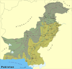
Islamic Republic of Pakistan is located at 30°0'0"N 70°0'0"E (30.0000000, 70.0000000). It has 4 neighbors: Iran, Afghanistan, India and China.
Pakistan map
The largest city of Islamic Republic of Pakistan is Lahore with a population of 10,665,000. Other cities include, Faisalabad population 3,203,846, Rawalpindi population 2,098,231, Multan population 1,606,481 and Gujranwala population 1,384,471. See all Islamic Republic of Pakistan cities & populated places.
Official website of Islamic Republic of Pakistan
Official WebsiteCompare Islamic Republic of Pakistan with
- Islamabad Capital Territory
- Sindh
- Punjab
- Gilgit-Baltistan
- Balochistan
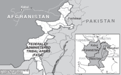
- Federally Administered Tribal Areas
- Khyber Pakhtunkhwa
Demographics
| Year | Population | % Change | Method |
|---|---|---|---|
| 1960 | 45,540,594 | - | census |
| 1961 | 46,673,627 | 2.43% | census |
| 1962 | 47,864,343 | 2.49% | census |
| 1963 | 49,109,360 | 2.54% | census |
| 1964 | 50,404,401 | 2.57% | census |
| 1965 | 51,746,670 | 2.59% | census |
| 1966 | 53,138,320 | 2.62% | census |
| 1967 | 54,581,657 | 2.64% | census |
| 1968 | 56,074,840 | 2.66% | census |
| 1969 | 57,615,471 | 2.67% | census |
| 1970 | 59,204,212 | 2.68% | census |
| 1971 | 60,840,513 | 2.69% | census |
| 1972 | 62,532,284 | 2.71% | census |
| 1973 | 64,299,241 | 2.75% | census |
| 1974 | 66,167,072 | 2.82% | census |
| 1975 | 68,155,252 | 2.92% | census |
| 1976 | 70,268,556 | 3.01% | census |
| 1977 | 72,505,126 | 3.08% | census |
| 1978 | 74,868,889 | 3.16% | census |
| 1979 | 77,362,155 | 3.22% | census |
| 1980 | 79,984,297 | 3.28% | census |
| 1981 | 82,733,080 | 3.32% | census |
| 1982 | 85,601,555 | 3.35% | census |
| 1983 | 88,577,077 | 3.36% | census |
| 1984 | 91,643,160 | 3.35% | census |
| 1985 | 94,783,463 | 3.31% | census |
| 1986 | 97,998,462 | 3.28% | census |
| 1987 | 101,278,129 | 3.24% | census |
| 1988 | 104,583,470 | 3.16% | census |
| 1989 | 107,865,403 | 3.04% | census |
| 1990 | 111,090,879 | 2.9% | census |
| 1991 | 114,229,172 | 2.75% | census |
| 1992 | 117,291,344 | 2.61% | census |
| 1993 | 120,336,722 | 2.53% | census |
| 1994 | 123,450,933 | 2.52% | census |
| 1995 | 126,689,577 | 2.56% | census |
| 1996 | 130,083,700 | 2.61% | census |
| 1997 | 133,597,492 | 2.63% | census |
| 1998 | 137,139,290 | 2.58% | census |
| 1999 | 140,580,398 | 2.45% | census |
| 2000 | 143,832,014 | 2.26% | census |
| 2001 | 146,857,081 | 2.06% | census |
| 2002 | 149,693,684 | 1.89% | census |
| 2003 | 152,419,974 | 1.79% | census |
| 2004 | 155,151,394 | 1.76% | census |
| 2005 | 157,971,415 | 1.79% | census |
| 2006 | 160,905,794 | 1.82% | census |
| 2007 | 163,928,329 | 1.84% | census |
| 2008 | 167,008,083 | 1.84% | census |
| 2009 | 170,093,999 | 1.81% | census |
| 2010 | 173,149,306 | 1.76% | census |
| 2011 | 176,166,353 | 1.71% | census |
| 2012 | 179,160,111 | 1.67% | census |
| 2013 | 182,142,594 | 1.64% | census |
| 2014 | 185,546,257 | 1.83% | census |
| 2015 | 189,380,513 | 2.02% | census |
| 2016 | 193,203,476 | 1.98% | census |
| 2017 | 197,015,955 | 1.94% | census |
| 2018 | 212,215,030 | 7.16% | census |
| 2019 | 216,565,318 | 2.01% | census |
| 2026 | 241,499,431 | 10.32% |
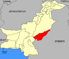
Map & Images (more maps)
Pakistan L
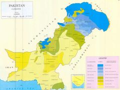
Pakistan Climate Map Jpg
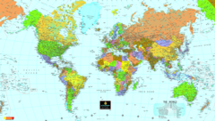
World Map
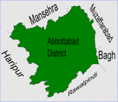
Abbottabad Thumb
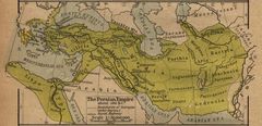
Achaemenid Empire
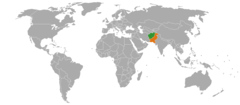
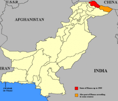
Afghanistan Pakistan Locator
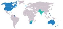
Anglophone Map

Ast Kkh
Bahawalpur Karte
Earthquake Information For Pakistan
Gao Usaid Map of Pakistan And Afghanistan
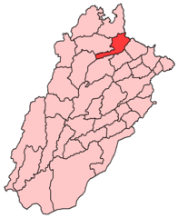
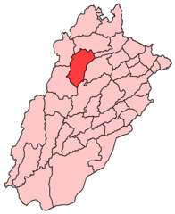
Hafizabad District
Hunza Map
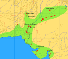
Ivc Map
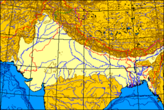
Indogangeticplain Map
Jhelum Png
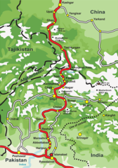
Kkh
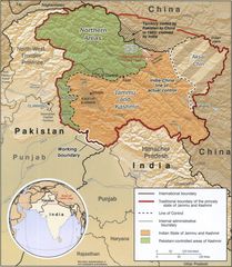
Kashmir Map Big
Khushab
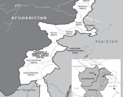
Map of Fata In Pakistan