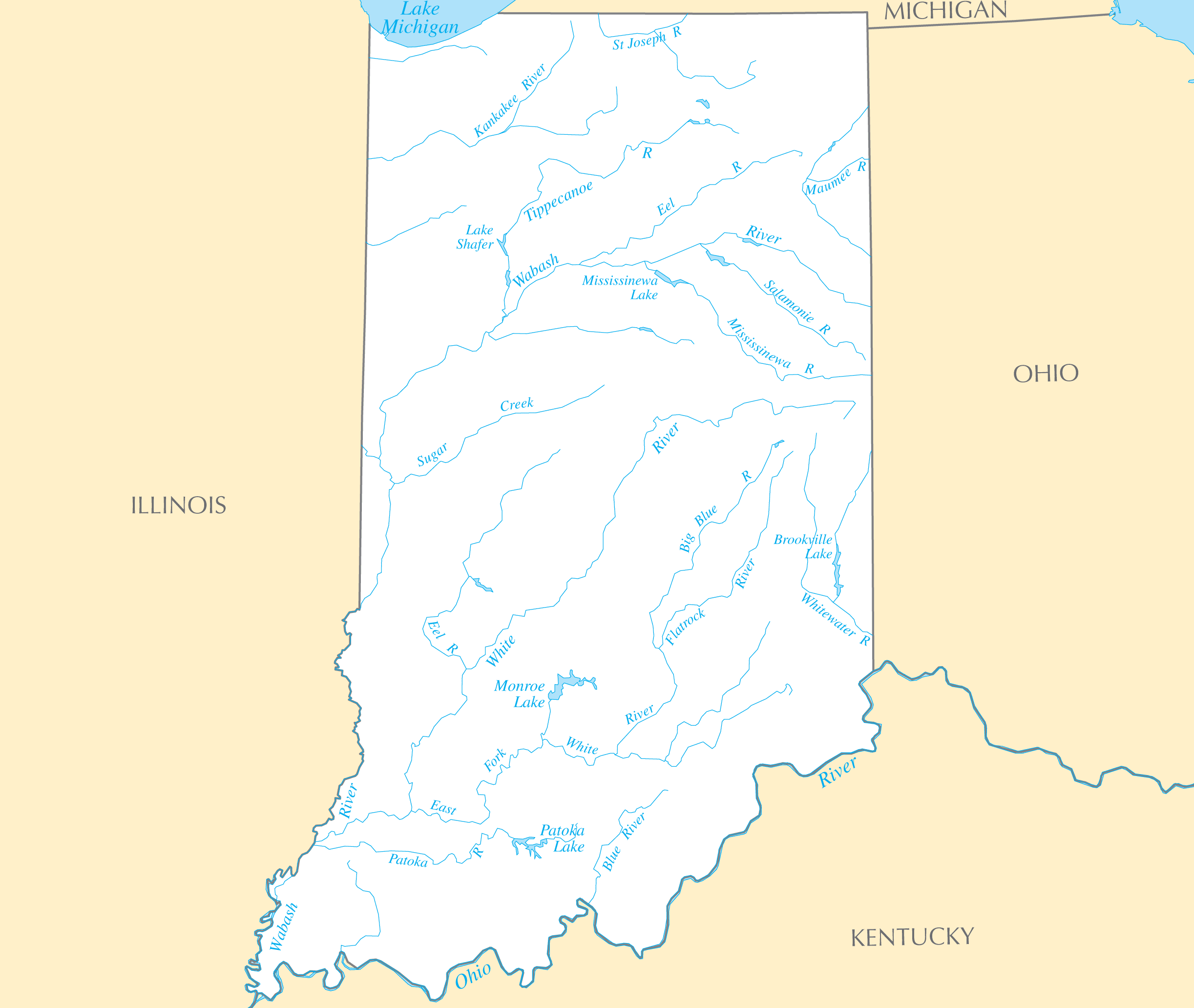
Indiana Rivers And Lakes
Indiana has several important river systems flowing through its landscape.
Ohio River
The Ohio River forms the southern border between Indiana and Kentucky. Facts about the Ohio River in Indiana:
- It flows over 1,000 miles from Pittsburgh to the Mississippi River.
- The Ohio River passes through the Indiana cities of Evansville and New Albany.
- Early settlements like Clarksville, Indiana were established along the river.
- Today it supports commercial barge transport and tourism along the Ohio River Scenic Byway.
Wabash River
The Wabash River is the main river flowing through Indiana from north to south. Details about the Wabash River:
- At over 475 miles long, it is one of the largest tributaries of the Ohio River.
- Cities along the Wabash include Lafayette, Terre Haute, and Vincennes, Indiana.
- Eugene V. Debs Bridge crosses the Wabash River in Terre Haute.
White River
The White River flows across central Indiana and joins the Wabash. Facts about the White River:
- It winds over 740 miles through Indiana and Arkansas.
- The White River flows through Indianapolis, the state capital.
- It supports wildlife habitats and recreational opportunities like canoeing.
Notable Lakes in Indiana
Some of the biggest lakes in Indiana include:
- Lake Michigan - Forms Indiana's northwestern border.
- Lake Monroe Reservoir - The largest lake and recreation area in Indiana.
- Cedar Lake - Located in northern Indiana near Lake Michigan.
- Patoka Lake - Situated in southern Indiana and popular for boating and fishing.
Indiana's rivers and lakes have played an integral part in its history, settlement, and economy.
Click on the Indiana Rivers And Lakes to view it full screen. File Type: PNG, File size: 116006 bytes (113.29 KB), Map Dimensions: 2445px x 2064px ( colors)