London, England
London: Located in southeastern England on the River Thames, this historic city is the capital and largest city of the United Kingdom.
About

Quick Facts about London
| Population | 8,908,081 |
| Country | Roman Empire, United Kingdom, Kingdom of England, Great Britain, United Kingdom of Great Britain and Ireland, Kingdom of Wessex, Kingdom of Mercia, Kingdom of Essex |
| State | England (United Kingdom) |
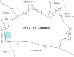
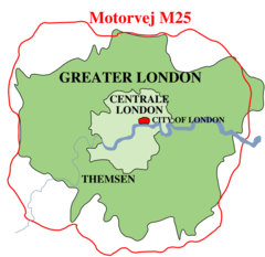
| County | Greater London |
| Different from | City of London, Greater London, London |
| Instagram username | ldn_gov |
| Twitter username | ldn_gov |
| Postal code | NW, CM, TW, WD, EN, HA, TN, E, DA, WC, W, BR, N, RM, KT, CR, IG, EC, UB, SW, SM, SE |
| Phone Area Codes | 1923, 20, 1689, 1992, 1737, 1708, 1959, 1322, 1895 |
| Area | 1572 km2 |
| Official name | London |
| Continent | Europe |
| Latitude & Longitude | 51.5085,-0.1257 |
| IATA airport code | LON |
| Altitude | 115 feet / 35 meters |
| Capital city | London is capital of The Protectorate, England, United Kingdom, British North America, British America, Kingdom of England, United Kingdom of Great Britain and Ireland, Commonwealth of England, British Empire, Kingdom of Essex, Great Britain |
| Establishment | January 01, 0047 (1979 years ago) |
| Time Zone | UTC±00:00, UTC+01:00, Greenwich Mean Time |
| Local time | 04:40:19 (31st July 2026) |

London Montage L image
Geography
London is located at 51°30'31"N 0°7'33"W (51.5085300, -0.1257400).
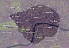
London map
Click "full screen"  icon to open full mode. View satellite images
- Algiers
- Amsterdam
- Arequipa
- Baku
- Beijing (2006 )
- Berlin (2000 )
- Bogota
- Bucharest
- Buenos Aires
- Delhi (2002 )
- Istanbul
- Jakarta
- Johannesburg
- Karachi
- Kuala Lumpur
- La Paz
- Los Angeles
- Moscow
- Mumbai
- New Delhi
- New York City (2001 )
- Oslo
- Phnom Penh
- Podgorica
- Santo Domingo
- Shanghai (2009 )
- Sofia
- Sylhet
- Tehran
- Tokyo (2015 )
- Zagreb
Demographics
| Year | Population | % Change | Method |
|---|---|---|---|
| 1801 | 1,011,157 | - | census |
| 1811 | 1,197,673 | 15.57% | census |
| 1821 | 1,450,122 | 17.41% | census |
| 1831 | 1,729,949 | 16.18% | census |
| 1841 | 1,917,013 | 9.76% | census |
| 1851 | 2,286,609 | 16.16% | census |
| 1861 | 3,094,391 | 26.1% | census |
| 1871 | 3,902,178 | 20.7% | census |
| 1881 | 4,709,960 | 17.15% | census |
| 1891 | 5,565,856 | 15.38% | census |
| 1911 | 7,157,875 | 22.24% | United Kingdom censuses of 1911 |
| 1921 | 7,553,526 | 5.24% | United Kingdom Census 1921 |
| 1931 | 8,098,942 | 6.73% | United Kingdom Census 1931 |
| 1941 | 7,987,936 | -1.39% | estimation process |
| 1951 | 8,164,416 | 2.16% | United Kingdom Census 1951 |
| 1971 | 7,449,184 | -9.6% | census |
| 1981 | 6,608,513 | -12.72% | census |
| 1991 | 6,887,280 | 4.05% | census |
| 2001 | 7,172,036 | 3.97% | census |
| 2005 | 7,781,342 | 7.83% | 1961-01-01T00:00:00Z |
| 2013 | 8,416,535 | 7.55% | estimation process |
| 2016 | 8,787,892 | 4.23% | estimation process |
| 2018 | 8,908,081 | 1.35% | estimation process |
ILondon, LON, Lakana, Landan, Landen, Ljondan, Llundain, Lodoni, Londain, Londan, Londar, Londe, Londen, Londin, Londinium, Londino, Londn, London osh, Londona, Londonas, Londoni, Londono, Londons, Londonu, Londra, Londres, Londrez, Londri, Londro, Londye, Londyn, Londýn, Lonn, Lontoo, Loundres, Luan GJon, Lun-tun, Lunden, Lundra, Lundun, Lundunir, Lundúnir, Lung-dung, Lunnainn, Lunnin, Lunnon, Lùn-tûn, Lùng-dŭng, Lûn-tun, Lākana, Lůndůn, Lọndọnu, Ranana, Rānana, ilantan, ladana, landana, leondeon, lndn, lun dui, lun dun, lwndwn, lxndxn, rondon, Łondra, Λονδίνο, Лондан, Лондон, Лондон ош, Лондонъ, Лёндан, Լոնդոն, לאנדאן, לונדון, لأندأن, لندن, لوندون, لەندەن, ܠܘܢܕܘܢ, लंडन, लंदन, लण्डन, लन्डन्, लन्दन, লন্ডন, ਲੰਡਨ, લંડન, ଲଣ୍ଡନ, இலண்டன், లండన్, ಲಂಡನ್, ലണ്ടൻ, ලන්ඩන්, ลอนดอน, ລອນດອນ, ལོན་ཊོན།, လန်ဒန်မြို့, ლონდონი, ለንደን, ᎫᎴ ᏗᏍᎪᏂᎯᏱ, ロンドン, 伦敦, 倫敦, 런던
Other places with the same name (5)
- London, Ohio city in Madison County, Ohio, United States with a population of 10,316 people.
- London, Kentucky city in Kentucky, United States with a population of 8,072 people.
- London, Michigan township in Monroe County, Michigan with a population of 2,919 people.
- London, Arkansas city in Pope County, Arkansas, United States with a population of 1,063 people.
- London, Minnesota human settlement in Freeborn County, Minnesota, United States of America with a population of 307 people.
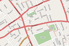
Map & Images (more maps)
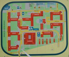
Bwfe Plan (cropped)
1707 x 1391
- 194,180k -
jpg
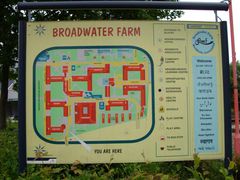
Bwfe Plan
1200 x 900
- 99,259k -
jpg
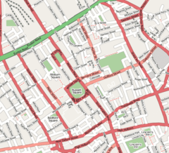
Bloomsbury Map 1
640 x 580
- 88,568k -
png
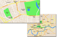
Central Kensington
787 x 512
- 39,823k -
png
City of London Map 01
4778 x 3708
- 344,432k -
jpg
Docklands Map
490 x 224
- 13,576k -
jpg
Drury Lane Map
427 x 270
- 35,686k -
png
Enfield Town Map 1
350 x 350
- 35,248k -
png
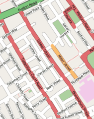
Gower Street Map
273 x 346
- 21,714k -
png
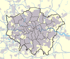
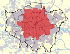
Greater London Outline Map Bw
600 x 500
- 45,162k -
png
Greater London Outline Map
600 x 500
- 19,216k -
png
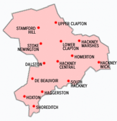
Hackney Districts
250 x 259
- 21,861k -
gif
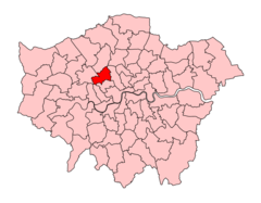
Hampsteadkilburnconstituency
920 x 718
- 40,188k -
png
High Holborn Map 1
660 x 440
- 44,674k -
png
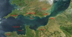
Kanal La Manche S Popisem
1800 x 935
- 163,507k -
jpg
London Postal District
561 x 439
- 38,141k -
png
London Boundaries Da
920 x 894
- 33,453k -
png
London Boundaries Fr
920 x 894
- 33,745k -
png
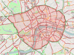
London Congestion Charge Zone
1513 x 1055
- 263,660k -
jpg
London Congestion Charge Zone 1
1400 x 1050
- 362,698k -
png
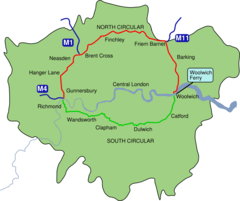
London North South Circulars
920 x 772
- 29,448k -
png