Libya, LY
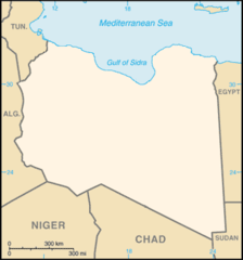
Libya: This North African country borders the Mediterranean Sea and is the fourth largest in Africa by area.
About
Country Snapshot
Libya at a glance
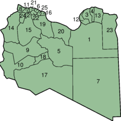
Libya currently has 36 quality-checked populated place pages and 39 state or regional pages linked on MapSof.
Mapped cities & towns
36
These counts use a stricter populated-place filter so the main lists stay focused on real city and town pages.
States & regions
39
Open related pagesLargest city
HūnPopulation 9,769,526
Top linked places
Quick Facts about Libya
| Population | 7,459,000 |
| Country | Libya |
| Plate code | LAR |
| Area | 1759541 km2 |
| Official name | Stato della Libia, l’État de Libye |
| Speed limit | 100 |
| Continent | Africa |
| Easternmost point | Point(25.14909 31.65736) |
| Northernmost point | Point(11.57 33.15) |
| Latitude & Longitude | 28.0000,17.0000 |
| Legislative body | House of Representatives, High Council of State |
| Official language | Arabic, Modern Standard Arabic |
| Capital | Tripoli |
| Time Zone | Eastern European Time, UTC+02:00 |
| Local time | 22:13:41 (9th June 2026) |
Geography
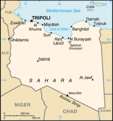
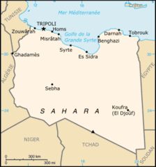
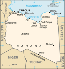
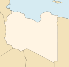
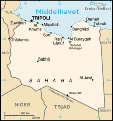
Libya is located at 28°0'0"N 17°0'0"E (28.0000000, 17.0000000).
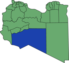
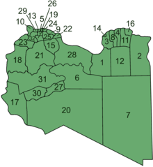
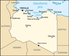
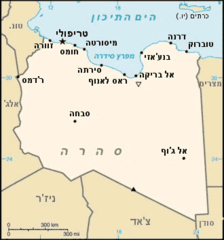
Libya map
The largest city of Libya is Tripoli with a population of 1,126,000. Other cities include, Mişrātah population 386,120, Al Khums population 201,943, Ajdabiya population 134,358 and Tobruk population 121,052. See all Libya cities & populated places.
- Tripoli
- Marj District
- Zawiya District
- Ghat
- Zawiya
- Ghat District
- Jafara
- Wadi al Shatii District
- Kufra District
- Jabal al Gharbi District
- Tripoli District
- Nalut
- Butnan District
- Murqub
- Jufra
- Jabal al Akhdar
- Wadi al Hayaa District
- Misrata
- Sabha District
- Nalut District
- Misrata District
- Murzuq District
- Al Wahat District
- Sirte District
- Derna District
- Nuqat al Khams
- Benghazi
Demographics
| Year | Population | % Change | Method |
|---|---|---|---|
| 1960 | 1,428,435 | - | |
| 1961 | 1,478,580 | 3.39% | |
| 1962 | 1,532,042 | 3.49% | |
| 1963 | 1,588,755 | 3.57% | |
| 1964 | 1,648,635 | 3.63% | |
| 1965 | 1,711,637 | 3.68% | |
| 1966 | 1,777,725 | 3.72% | |
| 1967 | 1,846,963 | 3.75% | |
| 1968 | 1,919,537 | 3.78% | |
| 1969 | 1,995,704 | 3.82% | |
| 1970 | 2,075,651 | 3.85% | |
| 1971 | 2,159,518 | 3.88% | |
| 1972 | 2,247,280 | 3.91% | |
| 1973 | 2,338,769 | 3.91% | |
| 1974 | 2,433,719 | 3.9% | |
| 1975 | 2,531,982 | 3.88% | |
| 1976 | 2,632,823 | 3.83% | |
| 1977 | 2,736,280 | 3.78% | |
| 1978 | 2,843,816 | 3.78% | |
| 1979 | 2,957,454 | 3.84% | |
| 1980 | 3,078,255 | 3.92% | |
| 1981 | 3,207,065 | 4.02% | |
| 1982 | 3,342,302 | 4.05% | |
| 1983 | 3,479,637 | 3.95% | |
| 1984 | 3,613,208 | 3.7% | |
| 1985 | 3,738,814 | 3.36% | |
| 1986 | 3,854,631 | 3% | |
| 1987 | 3,961,787 | 2.7% | |
| 1988 | 4,062,672 | 2.48% | |
| 1989 | 4,161,093 | 2.37% | |
| 1990 | 4,259,811 | 2.32% | |
| 1991 | 4,359,515 | 2.29% | |
| 1992 | 4,459,214 | 2.24% | |
| 1993 | 4,558,021 | 2.17% | |
| 1994 | 4,654,483 | 2.07% | |
| 1995 | 4,747,619 | 1.96% | |
| 1996 | 4,837,354 | 1.86% | |
| 1997 | 4,924,347 | 1.77% | |
| 1998 | 5,009,240 | 1.69% | |
| 1999 | 5,092,939 | 1.64% | |
| 2000 | 5,176,185 | 1.61% | |
| 2001 | 5,258,677 | 1.57% | |
| 2002 | 5,340,389 | 1.53% | |
| 2003 | 5,422,612 | 1.52% | |
| 2004 | 5,507,000 | 1.53% | |
| 2005 | 5,594,450 | 1.56% | |
| 2006 | 5,658,475 | 1.13% | |
| 2007 | 5,782,108 | 2.14% | |
| 2008 | 5,876,805 | 1.61% | |
| 2009 | 5,964,325 | 1.47% | |
| 2010 | 6,040,612 | 1.26% | |
| 2011 | 6,103,233 | 1.03% | |
| 2012 | 6,154,623 | 0.83% | |
| 2013 | 6,201,521 | 0.76% | |
| 2017 | 6,374,616 | 2.72% | |
| 2018 | 6,678,567 | 4.55% | |
| 2026 | 7,459,000 | 10.46% |
Map & Images (more maps)
Carte Libye
Flag Map of Libya
France Libya Locator
Karte Libyens
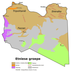
Libiese Etniese Groepe
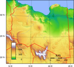
Libya Topography
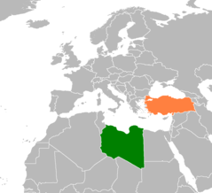
Libya Turkey Locator
Libya Location Map
Libya Map
Libya Equirect
Libya Equirect2
Libya Equirect3
Libyanumbered
Libyen Al Kufrah
Libyen Bani Walid
Libyen Murzuq
Libyen Neue Gemeinden Bezeichnet
Ly Map (lt)
Ly Map He
Ly Map No