Kuwait (State of Kuwait), KW
Kuwait: This Arabian country is situated in Western Asia, bordering Iraq and Saudi Arabia, with a coastline on the Persian Gulf.
About

Country Snapshot
State of Kuwait at a glance
State of Kuwait currently has 10 quality-checked populated place pages and 6 state or regional pages linked on MapSof.
Mapped cities & towns
10
These counts use a stricter populated-place filter so the main lists stay focused on real city and town pages.
States & regions
6
Open related pagesLargest city
Şabāḩ as SālimPopulation 139,163
Top linked places
Quick Facts about State of Kuwait
| Population | 4,881,254 |
| Country | Kuwait |
| Plate code | KWT |
| Area | 17818 km2 |
| Official name | Koweït |
| Continent | Asia |
| Easternmost point | Point(48.784722222 28.822777777) |
| Northernmost point | Point(47.5 30.1) |
| Latitude & Longitude | 29.5000,47.7500 |
| Legislative body | National Assembly |
| Official language | Arabic |
| Capital | Kuwait City |
| Establishment | February 26, 1991 (35 years ago) |
| Time Zone | UTC+03:00 |
| Local time | 05:59:06 (10th June 2026) |
Geography
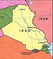
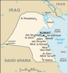
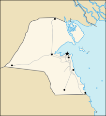
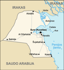
State of Kuwait is located at 29°30'0"N 47°45'0"E (29.5000000, 47.7500000). It has 2 neighbors: Iraq and Saudi Arabia.
Kuwait map
The largest city of State of Kuwait is Kuwait City with a population of 60,064. . See all State of Kuwait cities & populated places.
Official website of State of Kuwait
Official WebsiteCompare State of Kuwait with
- Mubarak Al-Kabeer Governorate
- Al Ahmadi Governorate
- Hawally Governorate
- Capital Governorate
- Al Farwaniyah Governorate
- Al Jahra Governorate
Demographics
| Year | Population | % Change | Method |
|---|---|---|---|
| 1960 | 269,029 | - | (Worldbank) |
| 1961 | 300,576 | 10.5% | (Worldbank) |
| 1962 | 337,348 | 10.9% | (Worldbank) |
| 1963 | 378,746 | 10.93% | (Worldbank) |
| 1964 | 423,898 | 10.65% | (Worldbank) |
| 1965 | 472,037 | 10.2% | (Worldbank) |
| 1966 | 523,166 | 9.77% | (Worldbank) |
| 1967 | 577,164 | 9.36% | (Worldbank) |
| 1968 | 632,899 | 8.81% | (Worldbank) |
| 1969 | 688,979 | 8.14% | (Worldbank) |
| 1970 | 744,450 | 7.45% | (Worldbank) |
| 1971 | 798,642 | 6.79% | (Worldbank) |
| 1972 | 851,916 | 6.25% | (Worldbank) |
| 1973 | 905,635 | 5.93% | (Worldbank) |
| 1974 | 961,770 | 5.84% | (Worldbank) |
| 1975 | 1,021,720 | 5.87% | (Worldbank) |
| 1976 | 1,085,861 | 5.91% | (Worldbank) |
| 1977 | 1,153,583 | 5.87% | (Worldbank) |
| 1978 | 1,224,067 | 5.76% | (Worldbank) |
| 1979 | 1,296,081 | 5.56% | (Worldbank) |
| 1980 | 1,368,677 | 5.3% | (Worldbank) |
| 1981 | 1,439,331 | 4.91% | (Worldbank) |
| 1982 | 1,507,645 | 4.53% | (Worldbank) |
| 1983 | 1,576,968 | 4.4% | (Worldbank) |
| 1984 | 1,652,150 | 4.55% | (Worldbank) |
| 1985 | 1,735,274 | 4.79% | (Worldbank) |
| 1986 | 1,832,310 | 5.3% | (Worldbank) |
| 1987 | 1,938,909 | 5.5% | (Worldbank) |
| 1988 | 2,034,857 | 4.72% | (Worldbank) |
| 1989 | 2,092,777 | 2.77% | (Worldbank) |
| 1990 | 2,095,344 | 0.12% | (Worldbank) |
| 1991 | 2,031,296 | -3.15% | (Worldbank) |
| 1995 | 1,605,901 | -26.49% | (Worldbank) |
| 1996 | 1,626,857 | 1.29% | (Worldbank) |
| 1997 | 1,710,256 | 4.88% | (Worldbank) |
| 1998 | 1,831,119 | 6.6% | (Worldbank) |
| 1999 | 1,951,636 | 6.18% | (Worldbank) |
| 2000 | 2,045,123 | 4.57% | (Worldbank) |
| 2001 | 2,103,282 | 2.77% | (Worldbank) |
| 2002 | 2,136,997 | 1.58% | (Worldbank) |
| 2003 | 2,161,626 | 1.14% | (Worldbank) |
| 2004 | 2,200,492 | 1.77% | (Worldbank) |
| 2005 | 2,213,403 | 0.58% | estimation process |
| 2006 | 2,373,672 | 6.75% | (Worldbank) |
| 2007 | 2,504,019 | 5.21% | (Worldbank) |
| 2008 | 2,656,009 | 5.72% | (Worldbank) |
| 2009 | 2,821,045 | 5.85% | (Worldbank) |
| 2010 | 2,991,884 | 5.71% | (Worldbank) |
| 2011 | 3,168,060 | 5.56% | (Worldbank) |
| 2012 | 3,348,853 | 5.4% | (Worldbank) |
| 2013 | 3,526,376 | 5.03% | (Worldbank) |
| 2014 | 3,690,941 | 4.46% | (Worldbank) |
| 2015 | 3,835,591 | 3.77% | (Worldbank) |
| 2016 | 3,956,875 | 3.07% | (Worldbank) |
| 2017 | 4,136,528 | 4.34% | estimation process |
| 2018 | 4,137,312 | 0.02% | (Worldbank) |
| 2019 | 4,600,000 | 10.06% | estimation process |
| 2026 | 4,881,254 | 5.76% |
Other places with the same name (1)
- Kuwait City, Al Asimah This major city is situated on the Persian Gulf, in the heart of Kuwait. with a population of 60,064 people.
Map & Images (more maps)
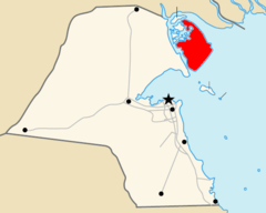
Bubiyanlocation
Burgan Field Map of Kuwait (lithuanian)
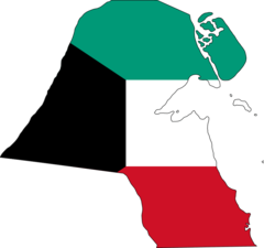
Flag Map of Kuwait
Highway of Death Map of Kuwait (lithuanian)
Ku Map He
Ku Map

Ku Map 1
Kuwait Id
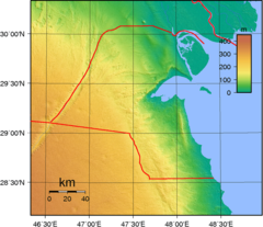
Kuwait Topography
Kuwait Governorates Blank
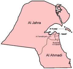
Kuwait Governorates English
Kuwait Map, 1913
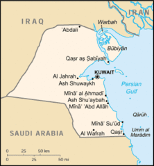
Kuwait Cia Wfb Map
Map Praying Mantis 4
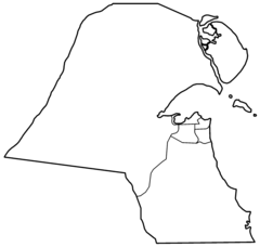
Map of Kuwait (blank)
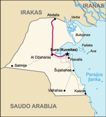
Map of Kuwait (lithuanian)
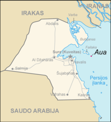
Map of Kuwait Aua (lithuanian)
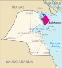
Map of Kuwait Bubijanas (lithuanian)
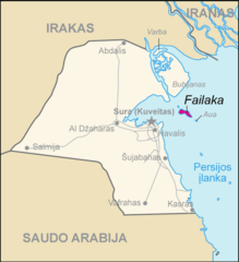
Map of Kuwait Failaka (lithuanian)
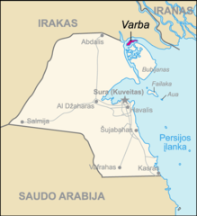
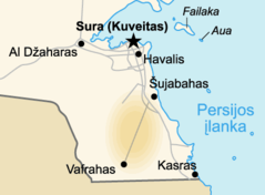
Map of Kuwait Varba (lithuanian)