Haiti (Republic of Haiti), HT
Haiti: Situated on the island of Hispaniola in the Caribbean Sea, this North American nation has a population of over 11 million.
About

Country Snapshot
Republic of Haiti at a glance
Republic of Haiti currently has 52 quality-checked populated place pages and 9 state or regional pages linked on MapSof.
Mapped cities & towns
52
These counts use a stricter populated-place filter so the main lists stay focused on real city and town pages.
States & regions
9
Open related pagesLargest city
Port-au-PrincePopulation 1,234,742
Top linked places
Quick Facts about Republic of Haiti
| Population | 11,867,032 |
| Country | Haiti |
| Plate code | RH |
| Area | 27750 km2 |
| Official name | Haïti, Ayiti, la République d’Haïti |
| Continent | North America |
| Easternmost point | Point(-71.62183 19.20649) |
| Northernmost point | Point(-72.8 20.08) |
| Latitude & Longitude | 19.0758,-72.2962 |
| Legislative body | Parliament of Haiti |
| Official language | Haitian Creole, French |
| Capital | Port-au-Prince |
| Establishment | January 01, 1804 (222 years ago) |
| Time Zone | UTC−05:00 |
| Local time | 18:46:35 (9th June 2026) |

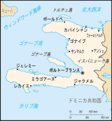
Geography
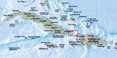
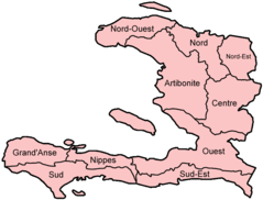
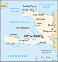
Republic of Haiti is located at 19°4'33"N 72°17'46"W (19.0758200, -72.2961600). It has 2 neighbors: Dominican Republic and United States.
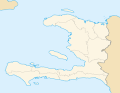
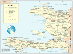
Haiti map
The largest city of Republic of Haiti is Port-au-Prince with a population of 1,234,742. Other cities include, Jacmel population 137,966, Okap population 134,815, Léogâne population 134,190 and Les Cayes population 125,799. See all Republic of Haiti cities & populated places.
Compare Republic of Haiti with
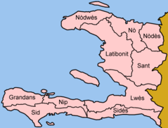
- Sud
- Centre
- Nord
- Nord-Est
- Nippes
- Grand'Anse
- Sud-Est
- Artibonite
- Ouest
- Nord-Ouest
Demographics
| Year | Population | % Change | Method |
|---|---|---|---|
| 1887 | 960,000 | - | Population registration in Sweden |
| 1909 | 2,029,700 | 52.7% | Population registration in Sweden |
| 1960 | 3,869,288 | 47.54% | Population registration in Sweden |
| 1961 | 3,946,666 | 1.96% | Population registration in Sweden |
| 1962 | 4,026,076 | 1.97% | Population registration in Sweden |
| 1963 | 4,107,392 | 1.98% | Population registration in Sweden |
| 1964 | 4,190,472 | 1.98% | Population registration in Sweden |
| 1965 | 4,275,135 | 1.98% | Population registration in Sweden |
| 1966 | 4,361,648 | 1.98% | Population registration in Sweden |
| 1967 | 4,449,858 | 1.98% | Population registration in Sweden |
| 1968 | 4,538,688 | 1.96% | Population registration in Sweden |
| 1969 | 4,626,727 | 1.9% | Population registration in Sweden |
| 1970 | 4,713,134 | 1.83% | Population registration in Sweden |
| 1971 | 4,797,534 | 1.76% | Population registration in Sweden |
| 1972 | 4,880,740 | 1.7% | Population registration in Sweden |
| 1973 | 4,964,593 | 1.69% | Population registration in Sweden |
| 1974 | 5,051,633 | 1.72% | Population registration in Sweden |
| 1975 | 5,143,815 | 1.79% | Population registration in Sweden |
| 1976 | 5,241,510 | 1.86% | Population registration in Sweden |
| 1977 | 5,344,538 | 1.93% | Population registration in Sweden |
| 1978 | 5,453,582 | 2% | Population registration in Sweden |
| 1979 | 5,569,289 | 2.08% | Population registration in Sweden |
| 1980 | 5,691,941 | 2.15% | Population registration in Sweden |
| 1981 | 5,821,974 | 2.23% | Population registration in Sweden |
| 1982 | 5,958,870 | 2.3% | Population registration in Sweden |
| 1983 | 6,100,718 | 2.33% | Population registration in Sweden |
| 1984 | 6,244,898 | 2.31% | Population registration in Sweden |
| 1985 | 6,389,424 | 2.26% | Population registration in Sweden |
| 1986 | 6,533,556 | 2.21% | Population registration in Sweden |
| 1987 | 6,677,487 | 2.16% | Population registration in Sweden |
| 1988 | 6,821,300 | 2.11% | Population registration in Sweden |
| 1989 | 6,965,413 | 2.07% | Population registration in Sweden |
| 1990 | 7,110,116 | 2.04% | Population registration in Sweden |
| 1991 | 7,255,042 | 2% | Population registration in Sweden |
| 1992 | 7,399,862 | 1.96% | Population registration in Sweden |
| 1993 | 7,544,982 | 1.92% | Population registration in Sweden |
| 1994 | 7,691,001 | 1.9% | Population registration in Sweden |
| 1995 | 7,838,241 | 1.88% | Population registration in Sweden |
| 1996 | 7,986,858 | 1.86% | Population registration in Sweden |
| 1997 | 8,136,372 | 1.84% | Population registration in Sweden |
| 1998 | 8,285,690 | 1.8% | Population registration in Sweden |
| 1999 | 8,433,339 | 1.75% | Population registration in Sweden |
| 2000 | 8,578,234 | 1.69% | Population registration in Sweden |
| 2001 | 8,720,247 | 1.63% | Population registration in Sweden |
| 2002 | 8,859,635 | 1.57% | Population registration in Sweden |
| 2003 | 8,996,229 | 1.52% | Population registration in Sweden |
| 2004 | 9,129,933 | 1.46% | Population registration in Sweden |
| 2005 | 9,260,879 | 1.41% | Population registration in Sweden |
| 2006 | 9,388,642 | 1.36% | Population registration in Sweden |
| 2007 | 9,513,714 | 1.31% | Population registration in Sweden |
| 2008 | 9,638,255 | 1.29% | Population registration in Sweden |
| 2009 | 9,765,153 | 1.3% | Population registration in Sweden |
| 2010 | 9,896,400 | 1.33% | Population registration in Sweden |
| 2011 | 10,032,864 | 1.36% | Population registration in Sweden |
| 2012 | 10,173,775 | 1.39% | Population registration in Sweden |
| 2013 | 10,317,461 | 1.39% | Population registration in Sweden |
| 2014 | 10,549,008 | 2.19% | (Worldbank) |
| 2015 | 10,695,542 | 1.37% | (Worldbank) |
| 2016 | 10,839,970 | 1.33% | (Worldbank) |
| 2017 | 10,981,229 | 1.29% | Population registration in Sweden |
| 2018 | 11,123,176 | 1.28% | (Worldbank) |
| 2019 | 11,263,077 | 1.24% | (Worldbank) |
| 2026 | 11,867,032 | 5.09% |
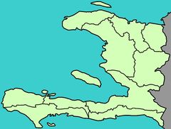
Map & Images (more maps)
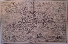
15thcenturyhispaniola
Ayitidepatmannonyo
Ha Map Ja
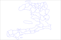
Haiti Arrondissements
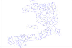
Haiti Communes
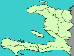
Haiti Departments 2
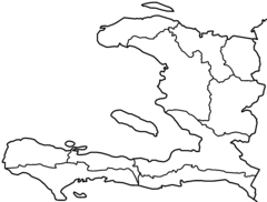
Haiti Departments Blank
Haiti Departments Named
Haiti Departments Nontransp
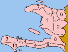
Haiti Departments Numbered
Haiti Departments
Haiti Locator Map
Haiti Map
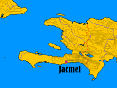
Haitijacmelsituation
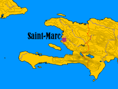
Haitisaintmarcsituation
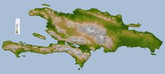
Hispaniola Lrg
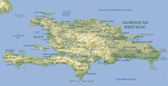
Hispaniola
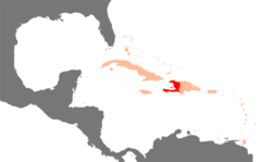
Karibik Haiti Position
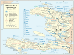
Minustah
Un Haiti