Estonia (Republic of Estonia), EE
Estonia: Located in Northern Europe, bordering the Baltic Sea, it is characterized by its diverse landscapes, more than 2, 000 islands, and a heavily forested terrain.
About

Country Snapshot
Republic of Estonia at a glance
Republic of Estonia currently has 50 quality-checked populated place pages and 15 state or regional pages linked on MapSof.
Mapped cities & towns
50
These counts use a stricter populated-place filter so the main lists stay focused on real city and town pages.
States & regions
15
Open related pagesLargest city
TallinnPopulation 437,619
Top linked places
Quick Facts about Republic of Estonia
| Population | 1,369,995 |
| Country | Estonia |
| Plate code | EST |
| Area | 45339 km2 |
| Official name | Republiek Estland, Estonská republika, רעפובליק פון עסטלאנד, Észt Köztársaság, Република Естонија, República da Estónia, Эстонская Рэспубліка, Естонська Республіка, Republika Estonija, Эстонская Республика, Republikken Estland, Republika Estonija, Republikken Estland, Република Естонија, Estonya Cumhuriyeti, Igaunijas Republika, Eesti Vabariik, Repubblica d'Estonia, Lýðveldið Eistland, ესტონეთის რესპუბლიკა, la République d’Estonie, Estijos Respublika, Viron tasavalta, république d’Estonie, Republica Estonia, República de Estonia, Republika Estońska, Republikken Estland, Republik Estland, Էստոնիայի Հանրապետություն, Estónska republika, Republiken Estland, Δημοκρατία της Εσθονίας, Republic of Estonia |
| Continent | Europe |
| Easternmost point | Point(28.20894778 59.37047831) |
| Northernmost point | Point(26.37 59.82) |
| Latitude & Longitude | 59.0000,26.0000 |
| Legislative body | Riigikogu |
| Named for | Ugandi County, Virumaa |
| Official language | Estonian |
| Capital | Tallinn |
| Establishment | February 24, 1918 (108 years ago) |
| Time Zone | Europe/Tallinn, Eastern European Time, UTC+02:00, Eastern European Summer Time, UTC+03:00 |
| Local time | 21:51:35 (9th June 2026) |

Geography
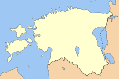
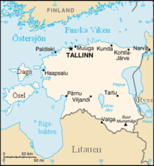
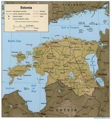
Republic of Estonia is located at 59°0'0"N 26°0'0"E (59.0, 26.0). It has 2 neighbors: Latvia and Russia.
Estonia map
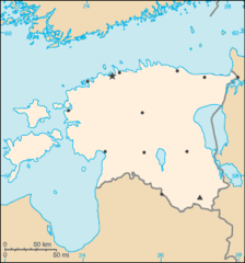
The largest city of Republic of Estonia is Tallinn with a population of 437,619. Other cities include, Narva population 54,409, Pärnu population 39,605 and Sillamäe population 12,480. See all Republic of Estonia cities & populated places.
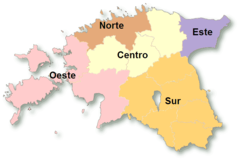
- Saare County
- Järva County
- Ida-Viru County
- Võru County
- Hiiu County
- Põlva County
- Jõgeva County
- Lääne County
- Tartu County
- Viljandi County
- Lääne-Viru County
- Valga County
- Rapla County
- Pärnu County
- Harju County
Demographics
| Year | Population | % Change | Method |
|---|---|---|---|
| 1960 | 1,211,537 | - | (Worldbank) |
| 1961 | 1,225,077 | 1.11% | (Worldbank) |
| 1962 | 1,241,623 | 1.33% | (Worldbank) |
| 1963 | 1,258,857 | 1.37% | (Worldbank) |
| 1964 | 1,277,086 | 1.43% | (Worldbank) |
| 1965 | 1,294,566 | 1.35% | (Worldbank) |
| 1966 | 1,308,597 | 1.07% | (Worldbank) |
| 1967 | 1,318,946 | 0.78% | (Worldbank) |
| 1968 | 1,331,214 | 0.92% | (Worldbank) |
| 1969 | 1,345,249 | 1.04% | (Worldbank) |
| 1970 | 1,360,076 | 1.09% | (Worldbank) |
| 1971 | 1,376,955 | 1.23% | (Worldbank) |
| 1972 | 1,392,518 | 1.12% | (Worldbank) |
| 1973 | 1,405,951 | 0.96% | (Worldbank) |
| 1974 | 1,418,169 | 0.86% | (Worldbank) |
| 1975 | 1,429,352 | 0.78% | (Worldbank) |
| 1976 | 1,439,576 | 0.71% | (Worldbank) |
| 1977 | 1,450,211 | 0.73% | (Worldbank) |
| 1978 | 1,460,188 | 0.68% | (Worldbank) |
| 1979 | 1,465,799 | 0.38% | census |
| 1980 | 1,477,219 | 0.77% | (Worldbank) |
| 1981 | 1,487,666 | 0.7% | (Worldbank) |
| 1982 | 1,498,414 | 0.72% | (Worldbank) |
| 1983 | 1,508,745 | 0.68% | (Worldbank) |
| 1984 | 1,518,617 | 0.65% | (Worldbank) |
| 1985 | 1,528,781 | 0.66% | (Worldbank) |
| 1986 | 1,540,190 | 0.74% | (Worldbank) |
| 1987 | 1,552,221 | 0.78% | (Worldbank) |
| 1988 | 1,561,900 | 0.62% | (Worldbank) |
| 1989 | 1,572,916 | 0.7% | census |
| 1990 | 1,569,174 | -0.24% | (Worldbank) |
| 1991 | 1,561,314 | -0.5% | (Worldbank) |
| 1992 | 1,533,091 | -1.84% | (Worldbank) |
| 1993 | 1,494,128 | -2.61% | (Worldbank) |
| 1994 | 1,462,514 | -2.16% | (Worldbank) |
| 1995 | 1,436,634 | -1.8% | (Worldbank) |
| 1996 | 1,415,594 | -1.49% | (Worldbank) |
| 1997 | 1,399,535 | -1.15% | (Worldbank) |
| 1998 | 1,386,156 | -0.97% | (Worldbank) |
| 1999 | 1,390,244 | 0.29% | (Worldbank) |
| 2000 | 1,396,985 | 0.48% | (Worldbank) |
| 2001 | 1,388,115 | -0.64% | (Worldbank) |
| 2002 | 1,379,350 | -0.64% | (Worldbank) |
| 2003 | 1,370,720 | -0.63% | (Worldbank) |
| 2004 | 1,362,550 | -0.6% | (Worldbank) |
| 2005 | 1,354,775 | -0.57% | (Worldbank) |
| 2006 | 1,346,810 | -0.59% | (Worldbank) |
| 2007 | 1,340,680 | -0.46% | (Worldbank) |
| 2008 | 1,337,090 | -0.27% | (Worldbank) |
| 2009 | 1,334,515 | -0.19% | (Worldbank) |
| 2010 | 1,331,475 | -0.23% | (Worldbank) |
| 2011 | 1,327,439 | -0.3% | (Worldbank) |
| 2012 | 1,322,696 | -0.36% | (Worldbank) |
| 2013 | 1,317,997 | -0.36% | (Worldbank) |
| 2014 | 1,315,819 | -0.17% | census |
| 2015 | 1,313,271 | -0.19% | demographic balance |
| 2016 | 1,315,944 | 0.2% | census |
| 2017 | 1,315,635 | -0.02% | census |
| 2018 | 1,319,133 | 0.27% | census |
| 2019 | 1,324,820 | 0.43% | demographic balance |
| 2020 | 1,328,976 | 0.31% | demographic balance |
| 2026 | 1,369,995 | 2.99% |
Map & Images (more maps)
000 Estonia Harta
300 Rapla Jarvakandi Vald
300 Rapla Juuru Vald
300 Rapla Marjamaa Vald
300 Rapla Raikkula Vald
300 Rapla Rapla Vald
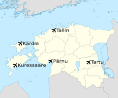
Aeropuertos De Estonia
Baltic States Borders
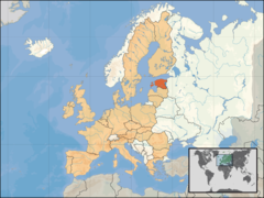
Eu Location Est
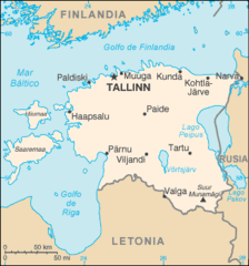
En Map Es
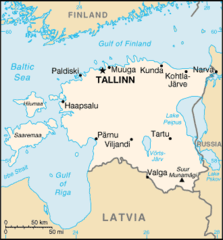
En Map
Estland Sv
Estonia 1999 Cia Map
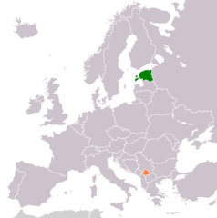
Estonia Kosovo Locator 2
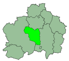
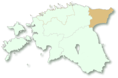
Estonia Nuts Center
Estonia Nuts East
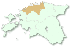
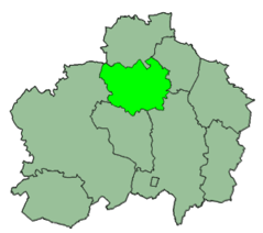
Estonia Nuts North
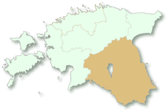
Estonia Nuts South
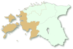
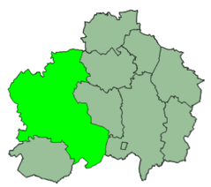
Estonia Nuts West
Estonia Nuts