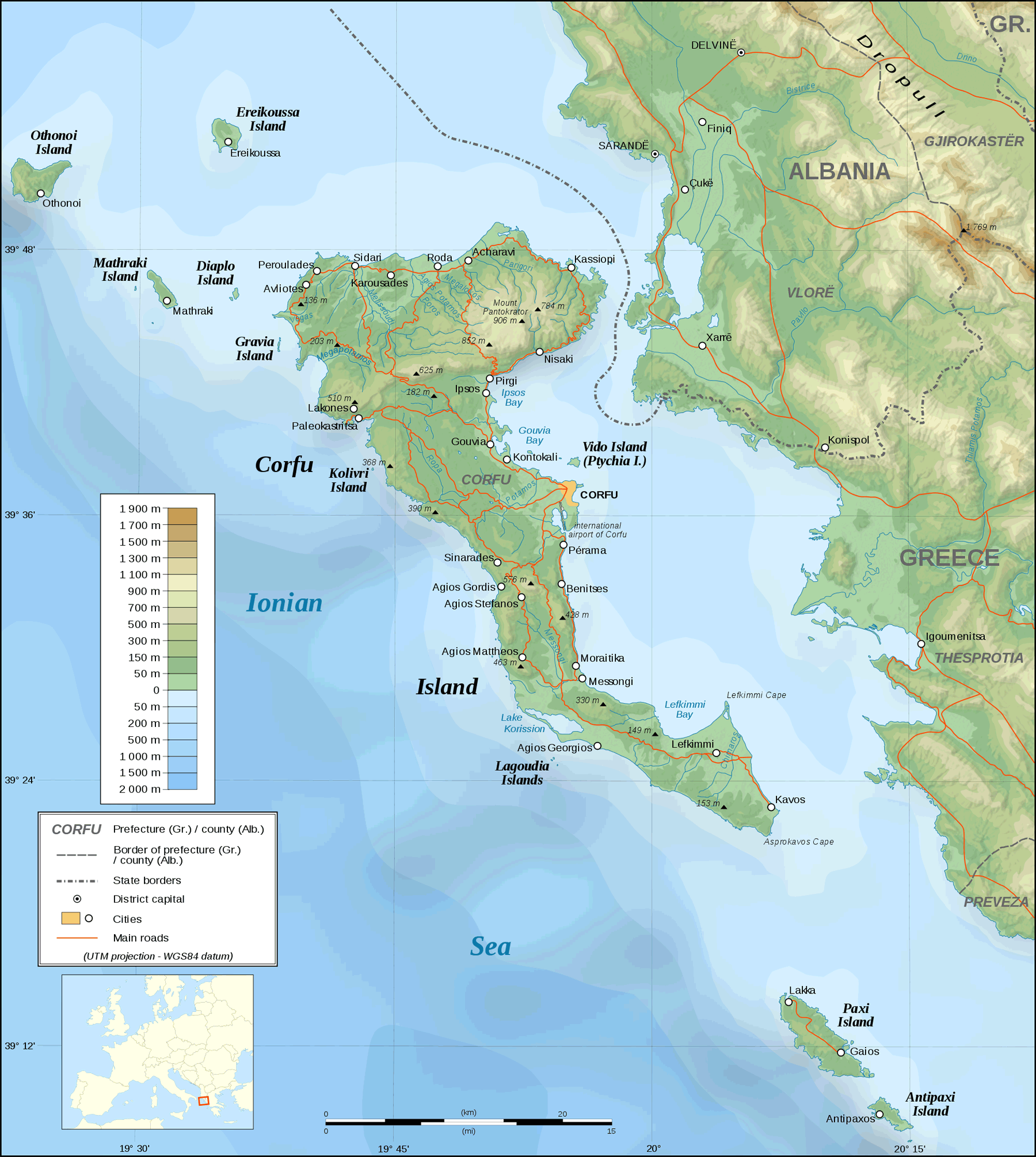
Corfu Topographic Map
The Greek island of Corfu features a varied topography ranging from dramatic mountainsides to pristine beaches. This diverse landscape contributes greatly to Corfu's beauty and appeal as a top tourist destination.
Mountainous Areas
The north and central regions contain mountainous areas with steep, rocky peaks. The tallest mountain is Pantokrator at 906 meters. Other notable mountains include San Salvatore and Santa Maria.
Mountains take up about 40 percent of the island's surface area. They are more rugged on the west side with deep valleys and rivers. The peaks provide stunning vistas of the island and ocean.
Lowlands and Hills
The northeast and southeast areas of Corfu are characterized by rolling lowlands and hills. The terrain is gentler and more undulating in these regions.
Several small rivers flow through the valleys and plains. The Messongi River in the south has created a wetland area important for migratory birds. Plains near the coast have been utilized for agriculture such as olive groves.
Coastal Areas
Being an island, Corfu has over 100 miles of scenic coastal landscape. The eastern shoreline tends to be flatter while the western and northern coasts are edged by cliffs.
Sandy beaches dominate the east and south shores. The long stretches of beach are ideal for swimming, water sports and relaxation with stunning sea views.
Corfu's diverse topography makes for dramatic natural contrasts across the island. Residents and visitors alike treasure the interplay between mountains, valleys, wetlands, and glittering coastlines that characterize the island's terrain.