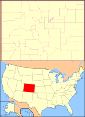
Colorado, US
Colorado: Located in the western United States, Colorado is known for its diverse landscape of mountains, forests, high plains, and desert lands.
About
Colorado is a western state known for its diverse landscape of mountains, plains, deserts, and canyons. It is bordered by Wyoming, Nebraska, Kansas, Oklahoma, New Mexico, Utah, and Arizona.
Some key facts about Colorado:
- Capital: Denver
- Population: Around 5.7 million
- Area: 104,094 square miles (8th largest state)
- Nickname: The Centennial State
Colorado is dominated by the Rocky Mountains which run north-south through the center of the state. Iconic peaks include Pikes Peak, Longs Peak, and Mount Elbert, the highest point in Colorado. The state also has high plains, deserts, and forests.
Denver is the state's largest city and cultural hub, located on the eastern edge of the Rockies. Other major cities include Colorado Springs, Aurora, and Boulder. Colorado is home to a vibrant craft beer scene and legalized recreational marijuana.
There are 55 mountain peaks over 14,000 feet in Colorado. Outdoor recreation like skiing, hiking, rafting, and camping are extremely popular. Major ski resorts include Vail, Aspen, and Breckenridge.
Climate varies from mild and sunny on the plains to cold and snowy in the mountains. Summers are warm but often dry. Colorado sees 300 days of sunshine per year on average.
In summary, Colorado is defined by its majestic Rocky Mountain landscapes, sunny weather, outdoor recreation, and cultural attractions in cosmopolitan Denver and beyond. The state's natural beauty and urban amenities make it a desirable place to live and visit.

State Snapshot
Colorado at a glance
Colorado currently has 309 quality-checked populated place pages and 64 county pages linked on MapSof.
Mapped cities & towns
309
These counts use a stricter populated-place filter so the main lists stay focused on real city and town pages.
County pages
64
Open related pagesLargest city
DenverPopulation 735,538
Top linked places
Quick Facts about Colorado
| Population | 5,807,719 |
| Country | United States of America |
| Area | 269837 km2 |
| Water as percent of area | 0.43% |
| Land as percent of area | 99.57% |
| Continent | Americas |
| Easternmost point | Point(-102.048666666 39.329555555) |
| Northernmost point | Point(-106.684833333 41.002388888) |
| Latitude & Longitude | 39.0003,-105.5008 |
| Legislative body | Colorado General Assembly |
| Named for | Colorado River |
| Official language | English |
| Altitude | 6,801 feet / 2073 meters |
| Capital | Denver |
| Establishment | August 01, 1876 (149 years ago) |
| Time Zone | UTC−07:00, America/Denver |
| Local time | 22:02:46 (8th June 2026) |

Geography
Colorado is located at 39°0'1"N 105°30'3"W (39.0002700, -105.5008300). It has 7 neighbors: Kansas, Oklahoma, Nebraska, New Mexico, Utah, Arizona and Wyoming.
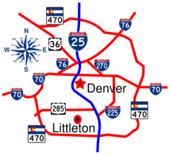
Colorado map
The largest city of Colorado is Denver with a population of 735,538. Other cities include, Colorado Springs population 482,131, Aurora population 387,377, Fort Collins population 168,234 and Lakewood population 157,429. See all Colorado cities & populated places.
Largest Cities in Colorado (more)
Cities, Towns, Villages, Neighborhoods & Other Populated Places in Colorado.
| City Name | County | Population |
|---|---|---|
| Denver | Denver | 735,538 |
| Colorado Springs | El Paso | 482,131 |
| Aurora | Adams | 387,377 |
| Fort Collins | Larimer | 168,234 |
| Lakewood | Jefferson | 157,429 |
| Thornton | Adams | 148,113 |
| Arvada | Jefferson | 121,936 |
| Westminster | Adams | 115,046 |
| Pueblo | Pueblo | 112,751 |
| Centennial | Arapahoe | 110,156 |
| Greeley | Weld | 108,958 |
| Boulder | Boulder | 107,645 |
| Longmont | Boulder | 98,445 |
| Highlands Ranch | Douglas | 96,713 |
| Loveland | Larimer | 83,517 |
| Broomfield | Broomfield | 72,236 |
Show more Colorado cities and populated places
Official website of Colorado
Official Website- Grand County
- Lake County
- Logan County
- Hinsdale County
- Denver
- Adams County
- Otero County
- Delta County
- Las Animas County
- Costilla County
- Bent County
- Montrose County
- Douglas County
- Montezuma County
- Fremont County
- Jackson County
- Elbert County
- Rio Grande County
- Morgan County
- Dolores County
- Larimer County
- Teller County
- Gunnison County
- Garfield County
- Weld County
- Lincoln County
- Moffat County
- Phillips County
- Summit County
- La Plata County
- Crowley County
- Mineral County
- San Miguel County
- Broomfield
- Sedgwick County
- Archuleta County
- Huerfano County
- Boulder County
- Rio Blanco County
- Pueblo County
- Alamosa County
- Kiowa County
- Yuma County
- San Juan County
- Prowers County
- Washington County
- Chaffee County
- Ouray County
- Pitkin County
- Jefferson County
- Gilpin County
- Eagle County
- Routt County
- Baca County
- Cheyenne County
- Mesa County
- Saguache County
- Kit Carson County
- Arapahoe County
- Park County
- Clear Creek County
- Conejos County
- El Paso County
- Custer County
Demographics
| Year | Population | % Change | Method |
|---|---|---|---|
| 1910 | 799,024 | - | census |
| 1920 | 939,629 | 14.96% | census |
| 1930 | 1,035,791 | 9.28% | census |
| 1940 | 1,123,296 | 7.79% | census |
| 1950 | 1,325,089 | 15.23% | census |
| 1960 | 1,753,947 | 24.45% | census |
| 1970 | 2,207,259 | 20.54% | census |
| 1980 | 2,889,964 | 23.62% | census |
| 1990 | 3,294,394 | 12.28% | census |
| 2000 | 4,301,261 | 23.41% | census |
| 2010 | 5,029,196 | 14.47% | census |
| 2011 | 5,121,108 | 1.79% | estimation process |
| 2012 | 5,192,647 | 1.38% | estimation process |
| 2013 | 5,269,035 | 1.45% | estimation process |
| 2014 | 5,350,101 | 1.52% | estimation process |
| 2015 | 5,450,623 | 1.84% | estimation process |
| 2016 | 5,539,215 | 1.6% | estimation process |
| 2017 | 5,611,885 | 1.29% | estimation process |
| 2018 | 5,691,287 | 1.4% | estimation process |
| 2019 | 5,758,736 | 1.17% | estimation process |
| 2020 | 5,807,719 | 0.84% | estimation process |
People born in Colorado (166)
People born in Colorado, including animator Dale Baer, movie actress and director Jewel De'Nyle, musician Josephine Foster, .
More notable people
- John Bevere (American author) he was born in 02/06/1959
- Gabe Newell (American computer programmer and businessman) he was born in 03/11/1962
- John Hickenlooper (American politician, businessman and the 42nd Governor of Colorado) he was born in 07/02/1952
- Roman Nose (Northern Cheyenne warrior) he was born in 01/01/1835
- J. Searle Dawley (American director and screenwriter) he was born in 13/05/1877
- Ralph Edwards (Radio and television host and producer) he was born in 13/06/1913
- Benjamin Kunkel (American writer) he was born in 14/12/1972
- Brandon Merrill (American actress) she was born in 01/01/2000
- Llewellyn Thompson (American diplomat) he was born in 24/08/1904
- David Leland (American actor (1921-1987)) he was born in 29/10/1921
- Bruce Darnell (American model and choreographer) he was born in 19/07/1957
- Cortney Palm (American actress) she was born in 20/02/1987
- Robert Woods (film actor) he was born in 19/07/1936
- Red Byron (racecar driver) he was born in 12/03/1915
- Chase Masterson (American actress) she was born in 26/02/1963
- Nicole LeFavour (American congresswoman in Idaho) she was born in 08/02/1964
- Arturo Bandini
- Mia Dillon (American actress) she was born in 09/07/1955
Other places with the same name (1)
- Colorado, Texas city in Texas, United States of America with a population of 3,875 people.
Colorado Counties (more)
Denver County
county in Colorado, United States, coterminous with the City of Denver
El Paso County

One of the 64 counties in the U.
Arapahoe County

county in Colorado, United States
| County Name | Population |
|---|---|
| Denver County | 735,538 |
| El Paso County | 728,310 |
| Arapahoe County | 657,452 |
| Jefferson County | 583,283 |
| Adams County | 519,883 |
| Douglas County | 360,750 |
| Larimer County | 360,428 |
| Weld County | 333,983 |
| Boulder County | 327,171 |
| Pueblo County | 169,823 |
| Mesa County | 155,603 |
| Broomfield County | 72,236 |
| Garfield County | 60,366 |
| La Plata County | 56,564 |
| Eagle County | 54,929 |
| Fremont County | 47,867 |
Show more Colorado counties
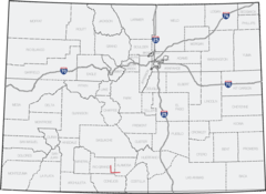
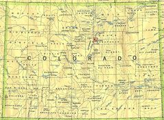
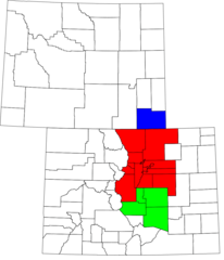
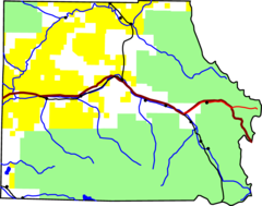
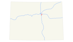
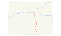
Map & Images (more maps)
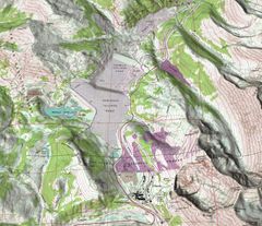
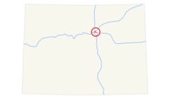
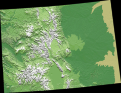
Climax Colorado Shaded Relief Perspective 3
Colorado 15 Map
Colorado 90
Colorado Locator Map With Us
Colorado Mpos
Colorado Springs Msa
Colorado Census Statistical Areas
Colorado Counties Zh
Colorado
Coloradomaphighlightingconejoscounty
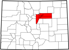
Denver Central Metropolitan Area
Denver Core Metropolitan Area
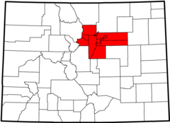
Denver Region
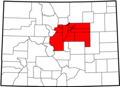
Denver Aurora Msa
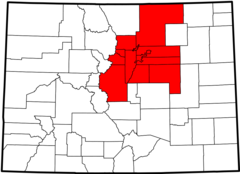
Denver Aurora Boulder Csa
Front Range Urban Corridor
Gore Creek, Colorado
I 225 (co) Map
I 25 (co) Map
I 25 Denver