Chile (Republic of Chile), CL
Chile: This South American country occupies a long, narrow strip of land between the Andes Mountains to the east and the Pacific Ocean to the west.
About

Country Snapshot
Republic of Chile at a glance
Republic of Chile currently has 84 quality-checked populated place pages and 13 state or regional pages linked on MapSof.
Mapped cities & towns
84
These counts use a stricter populated-place filter so the main lists stay focused on real city and town pages.
States & regions
13
Open related pagesLargest city
SantiagoPopulation 6,257,516
Top linked places
Quick Facts about Republic of Chile
| Population | 20,206,953 |
| Country | Chile |
| Plate code | RCH |
| Area | 756102 km2 |
| Official name | la République du Chili, Chile |
| Continent | South America |
| Easternmost point | Point(-66.41690522 -55.22008886) |
| Northernmost point | Point(-69.4683 -17.49848) |
| Latitude & Longitude | -30.0000,-71.0000 |
| Legislative body | National Congress of Chile |
| Official language | Spanish |
| Capital | Santiago |
| Establishment | September 18, 1810 (215 years ago) |
| Time Zone | UTC−05:00, UTC−04:00, UTC−03:00, UTC−03:00, UTC−06:00, UTC−05:00, UTC−05:00 |
| Local time | 14:21:26 (9th June 2026) |
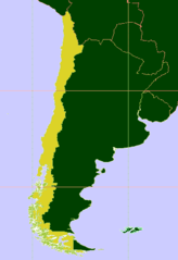
Geography
Republic of Chile is located at 30°0'0"S 71°0'0"W (-30.0000000, -71.0000000). It has 3 neighbors: Argentina, Bolivia and Peru.
Chile map
The largest city of Republic of Chile is Santiago with a population of 6,257,516. Other cities include, Viña del Mar population 332,875, Valparaíso population 296,655, Talcahuano population 252,968 and Temuco population 238,129. See all Republic of Chile cities & populated places.
Official website of Republic of Chile
Official WebsiteCompare Republic of Chile with
- Magellan and the Chilean Antarctic Region
- Tarapacá Region
- Atacama Region
- Aysén Region
- Los Lagos Region
- Biobío Region
- Santiago Metropolitan Region
- Ñuble Region
- Coquimbo Region
- Arica y Parinacota Region
- Araucanía Region
- Los Ríos Region
- Maule Region
- Antofagasta Region
- Valparaíso Region
- O'Higgins Region
Demographics
| Year | Population | % Change | Method |
|---|---|---|---|
| 1960 | 7,649,026 | - | census |
| 1961 | 7,845,746 | 2.51% | census |
| 1962 | 8,047,690 | 2.51% | census |
| 1963 | 8,251,999 | 2.48% | census |
| 1964 | 8,455,039 | 2.4% | census |
| 1965 | 8,654,071 | 2.3% | census |
| 1966 | 8,847,757 | 2.19% | census |
| 1967 | 9,036,236 | 2.09% | census |
| 1968 | 9,220,119 | 1.99% | census |
| 1969 | 9,400,705 | 1.92% | census |
| 1970 | 9,578,923 | 1.86% | census |
| 1971 | 9,755,352 | 1.81% | census |
| 1972 | 9,929,560 | 1.75% | census |
| 1973 | 10,100,403 | 1.69% | census |
| 1974 | 10,266,278 | 1.62% | census |
| 1975 | 10,426,432 | 1.54% | census |
| 1976 | 10,580,399 | 1.46% | census |
| 1977 | 10,729,757 | 1.39% | census |
| 1978 | 10,878,343 | 1.37% | census |
| 1979 | 11,031,280 | 1.39% | census |
| 1980 | 11,192,384 | 1.44% | census |
| 1981 | 11,363,219 | 1.5% | census |
| 1982 | 11,543,263 | 1.56% | census |
| 1983 | 11,731,654 | 1.61% | census |
| 1984 | 11,926,647 | 1.63% | census |
| 1985 | 12,126,956 | 1.65% | census |
| 1986 | 12,331,704 | 1.66% | census |
| 1987 | 12,541,298 | 1.67% | census |
| 1988 | 12,757,095 | 1.69% | census |
| 1989 | 12,981,032 | 1.73% | census |
| 1990 | 13,213,930 | 1.76% | census |
| 1991 | 13,456,476 | 1.8% | census |
| 1992 | 13,706,485 | 1.82% | census |
| 1993 | 13,958,378 | 1.8% | census |
| 1994 | 14,204,726 | 1.73% | census |
| 1995 | 14,440,103 | 1.63% | census |
| 1996 | 14,662,323 | 1.52% | census |
| 1997 | 14,872,458 | 1.41% | census |
| 1998 | 15,072,409 | 1.33% | census |
| 1999 | 15,265,536 | 1.27% | census |
| 2000 | 15,454,402 | 1.22% | census |
| 2001 | 15,639,289 | 1.18% | census |
| 2002 | 15,819,522 | 1.14% | census |
| 2003 | 15,995,658 | 1.1% | census |
| 2004 | 16,168,241 | 1.07% | census |
| 2005 | 16,337,749 | 1.04% | census |
| 2006 | 16,504,530 | 1.01% | census |
| 2007 | 16,668,892 | 0.99% | census |
| 2008 | 16,831,184 | 0.96% | census |
| 2009 | 16,991,729 | 0.94% | census |
| 2010 | 17,150,760 | 0.93% | census |
| 2011 | 17,308,449 | 0.91% | census |
| 2012 | 17,464,814 | 0.9% | census |
| 2013 | 17,619,708 | 0.88% | census |
| 2014 | 17,758,959 | 0.78% | (Worldbank) |
| 2015 | 17,969,353 | 1.17% | (Worldbank) |
| 2016 | 18,209,068 | 1.32% | (Worldbank) |
| 2017 | 17,373,831 | -4.81% | census |
| 2018 | 18,729,160 | 7.24% | (Worldbank) |
| 2019 | 18,952,038 | 1.18% | (Worldbank) |
| 2026 | 20,206,953 | 6.21% |
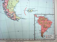
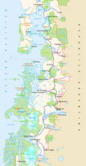
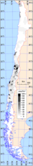
Map & Images (more maps)
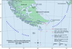
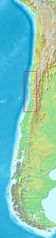
1984 De 1
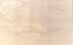
Alejandro Bertrand 1
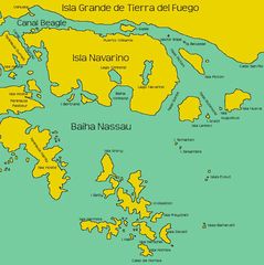
Algunasislasasurdelcanalbeagle 1
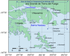
Algunasislasalsurdelcanalbeagle 1
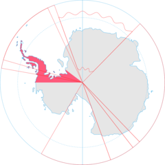
Antarctica, Chile Territorial Claim
Anuario Oficial Argentina 1912 3
Arbitration1898 1902 3
Argentinecartographiebeaglechannel 1
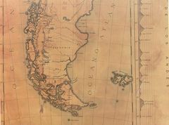
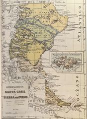
Atlante Mondiale Hoepli 1899 10

Barrosarana
Baselines Chile
Beagle 1984 En 1
Beagle1984 5
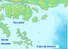
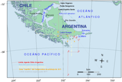
Cabo De Hornos
Canalmoraleda
Canalespatagonicos
Carolus Streit 1913 4
Carretera Austral
Chile Positionskarte
Chile Density