Benin (Republic of Benin), BJ
Benin: Country in West Africa
About

Quick Facts about Republic of Benin
| Population : | 11,175,692 |
| Country : | Benin |
| Different from : | Benin City |
| Head of government : | Prime Minister of Benin, President of Republic of Benin, Prime Minister of Benin, President of Republic of Benin, Prime Minister of Benin, President of Republic of Benin, Prime Minister of Benin, President of Republic of Benin, President of Republic of Benin |
| Plate code : | DY |
| Area : | 114763 km2 |
| Official name : | Bénin, la République du Bénin |
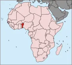
| Continent : | Africa |
| Easternmost point : | Point(3.84321 10.59263) |
| Northernmost point : | Point(2.8 12.42) |
| Legislative body : | National Assembly |
| Named for : | Bight of Benin |
| Official language : | French |
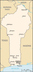
| Capital : | Porto-Novo |
| Establishment : | December 12, 1990 (35 years ago) |
| Time Zone : | UTC+01:00 |
| Local time : | 05:40:44 (21st March 2026) |

Geography
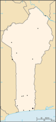
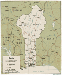
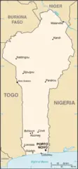
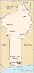
Republic of Benin is located at 9°30'0"N 2°15'0"E (9.5000000, 2.2500000). It has 4 neighbors: Nigeria, Burkina Faso, Togo and Niger.
Benin map
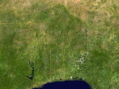
Click "full screen"  icon to open full mode. View satellite images
The largest city of Republic of Benin is Cotonou with a population of 780,000. Other cities include, Djougou population 237,040, Porto-Novo population 234,168, Parakou population 163,753 and Ouidah population 83,503. See all Republic of Benin cities & populated places.
- Official Website
Official website of Republic of Benin
- Patrice Talon , 2016-04-06T00:00:00Z
- Pascal Koupaki , 8 August, 2013 2011-05-28T00:00:00Z
- Lionel Zinsou , 6 April, 2016 2015-06-18T00:00:00Z
Republic of Benin has 4 neighbours.
- Federal Republic of Nigeria Independent country in West Africa
- Burkina Faso Independent country in Africa
- Togolese Republic Independent country in Africa
- Republic of Niger Independent country in Western Africa
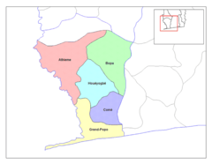
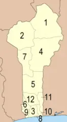
- Kouffo Department
- Littoral Department
- Ouémé Department
- Mono Department
- Alibori Department
- Plateau Department
- Donga Department
- Atakora Department
- Borgou Department
- Zou Department
- Atlantique Department
- Collines Department
Demographics
| Year | Population | % Change | Method |
| 1960 | 2,431,622 | - | (Worldbank) |
| 1961 | 2,465,867 | 1.39% | (Worldbank) |
| 1962 | 2,502,896 | 1.48% | (Worldbank) |
| 1963 | 2,542,859 | 1.57% | (Worldbank) |
| 1964 | 2,585,965 | 1.67% | (Worldbank) |
| 1965 | 2,632,356 | 1.76% | (Worldbank) |
| 1966 | 2,682,159 | 1.86% | (Worldbank) |
| 1967 | 2,735,307 | 1.94% | (Worldbank) |
| 1968 | 2,791,590 | 2.02% | (Worldbank) |
| 1969 | 2,850,661 | 2.07% | (Worldbank) |
| 1970 | 2,912,340 | 2.12% | (Worldbank) |
| 1971 | 2,976,572 | 2.16% | (Worldbank) |
| 1972 | 3,043,567 | 2.2% | (Worldbank) |
| 1973 | 3,113,675 | 2.25% | (Worldbank) |
| 1974 | 3,187,412 | 2.31% | (Worldbank) |
| 1975 | 3,265,165 | 2.38% | (Worldbank) |
| 1976 | 3,347,173 | 2.45% | (Worldbank) |
| 1977 | 3,433,439 | 2.51% | (Worldbank) |
| 1978 | 3,523,938 | 2.57% | (Worldbank) |
| 1979 | 3,618,526 | 2.61% | (Worldbank) |
| 1980 | 3,717,165 | 2.65% | (Worldbank) |
| 1981 | 3,820,128 | 2.7% | (Worldbank) |
| 1982 | 3,927,714 | 2.74% | (Worldbank) |
| 1983 | 4,039,949 | 2.78% | (Worldbank) |
| 1984 | 4,156,819 | 2.81% | (Worldbank) |
| 1985 | 4,278,501 | 2.84% | (Worldbank) |
| 1986 | 4,404,506 | 2.86% | (Worldbank) |
| 1987 | 4,535,263 | 2.88% | (Worldbank) |
| 1988 | 4,672,852 | 2.94% | (Worldbank) |
| 1989 | 4,820,016 | 3.05% | (Worldbank) |
| 1990 | 5,001,271 | 3.62% | census |
| 1991 | 5,182,525 | 3.5% | census |
| 1992 | 5,378,226 | 3.64% | census |
| 1993 | 5,582,420 | 3.66% | census |
| 1994 | 5,786,794 | 3.53% | census |
| 1995 | 5,985,658 | 3.32% | census |
| 1996 | 6,176,318 | 3.09% | census |
| 1997 | 6,361,301 | 2.91% | census |
| 1998 | 6,546,493 | 2.83% | census |
| 1999 | 6,740,491 | 2.88% | census |
| 2000 | 6,949,366 | 3.01% | census |
| 2001 | 7,174,911 | 3.14% | census |
| 2002 | 7,414,744 | 3.23% | census |
| 2003 | 7,665,681 | 3.27% | census |
| 2004 | 7,922,796 | 3.25% | census |
| 2005 | 8,182,362 | 3.17% | census |
| 2006 | 8,443,671 | 3.09% | census |
| 2007 | 8,707,490 | 3.03% | census |
| 2008 | 8,973,293 | 2.96% | census |
| 2009 | 9,240,783 | 2.89% | census |
| 2010 | 9,509,798 | 2.83% | census |
| 2011 | 9,779,795 | 2.76% | census |
| 2012 | 10,050,702 | 2.7% | census |
| 2013 | 10,008,749 | -0.42% | census |
| 2014 | 10,286,842 | 2.7% | (Worldbank) |
| 2015 | 10,575,952 | 2.73% | (Worldbank) |
| 2016 | 10,872,067 | 2.72% | (Worldbank) |
| 2017 | 11,175,692 | 2.72% | census |
| 2018 | 11,485,048 | 2.69% | (Worldbank) |
| 2019 | 11,801,151 | 2.68% | (Worldbank) |
Be-nanh, Be-nanh (Benin), Beinin, Bene, Benee, Beneen, Benen, Benim, Benin, Benin nutome, Benina, Beninaen, Beninas, Benini, Benino, Beninum, Beninän, Benëen, Benín, Benɛ, Benɛn, Bhenini, Biniin, Binin, Bènin, Bénin, Bê-nanh, Bê-nanh (Benin), Bênîn, Bɛnin, Dahome, Mpenin, Orileede Bene, Orílẹ́ède Bẹ̀nẹ̀, Penini, People's Republic of Benin, People’s Republic of Benin, Republic of Benin, Republic of Dahomey, Republica de Benin, Republique Populaire du Benin, Republique du Benin, Republique du Dahomey, República de Benín, République Populaire du Bénin, République du Bénin, République du Dahomey, bei ning, benaeng, benan, beneng, beni n, benin, benin gong he guo, benina, benini, bnyn, bynn, i-Benin, penin, pra thes beni n, Μπένιν, Μπενίν, Бенин, Бенін, Բենին, בנין, بنين, بنین, بینن, بېنىن, बेनिन, বেনিন, બેનિન, ବେନିନ୍, பெனின், బెనిన్, ಬೆನಿನ್, ബെനിന്, බෙනින්, ประเทศเบนิน, เบนิน, ເບນິນ, བཱེ་ནིན།, ბენინი, ቤኒን, បេណាំង, ベナン, ベニン, ベニン共和国, 贝宁, 베냉, 베넹
Map & Images (more maps)
000 Benini Harta
Benin 2 36499e 9 31385n
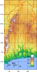
Benin Topography

Benin Carte
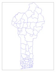
Benin Communes
Benin Departements
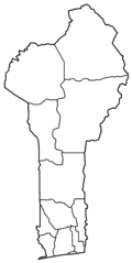
Benin Departments Blank
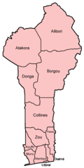
Benin Departments Named
Benin Map
Benin Map 1

Benin Cia Wfb Map
Benin Pos
Beninkaart
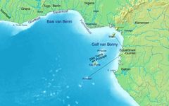
Golf Van Guinee 4
Golf Von Guinea 4
.jpg)
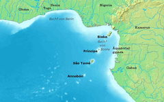
Gulf of Guinea (english) 4
.jpg)
Gulf of Guinea (blank) 4

Gulf of Guinea Fr 4
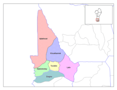
Kouffo Communes
Mapa Beninu