Arizona, US
Arizona: Located in the southwestern United States, this state is known for its desert landscape and the Grand Canyon.
About
Arizona became the 48th and last contiguous state admitted to the Union on February 14, 1912. Its diverse landscape and climate support a rapidly growing population.
Geography and Climate
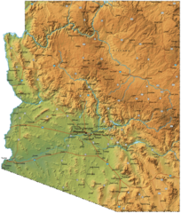
Arizona covers 113,990 square miles of mountains, plateaus, canyons and deserts. It shares borders with Utah, Nevada, California and Mexico. The famous Grand Canyon National Park is located in Northern Arizona.
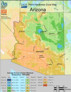
Arizona is mostly arid. Summers are extremely hot while winters are mild in southern Arizona but cold in mountainous northern parts.
Economy and Industries
Major industries include aerospace and defense, technology, tourism, copper mining and agriculture. Prominent companies headquartered in Arizona include Avnet, PetSmart and Freeport-McMoRan.
Popular tourist destinations are the Grand Canyon, Monument Valley Navajo Tribal Park, and cities like Scottsdale, Phoenix and Tucson. Arizona produces significant amounts of copper along with vegetables, cattle and cotton.
Culture and Demographics
Arizona has about 7 million residents. The population is diverse with large Hispanic/Latino, White and Native American communities. The culture reflects a mix of Western frontier, Native American, and Hispanic influences.
Government and Politics
The state capital and largest city is Phoenix. The current governor is Doug Ducey, Republican. Arizona has voted Republican in recent presidential elections.
Arizona is known for its desert climate, copper production, breathtaking national parks and rapidly expanding technology hub in Phoenix. Tourism, mining and aerospace anchor the economy while offering scenic natural attractions.

State Snapshot
Arizona at a glance
Arizona currently has 169 quality-checked populated place pages and 15 county pages linked on MapSof.
Mapped cities & towns
169
These counts use a stricter populated-place filter so the main lists stay focused on real city and town pages.
County pages
15
Open related pagesLargest city
PhoenixPopulation 1,708,127
Top linked places
Quick Facts about Arizona
| Population | 7,421,401 |
| Country | United States of America |
| Area | 295234 km2 |
| Water as percent of area | 0.35% |
| Land as percent of area | 99.65% |
| Continent | North America |
| Latitude & Longitude | 34.5003,-111.5010 |
| Legislative body | Arizona State Legislature |
| Official language | English |
| Altitude | 4,101 feet / 1250 meters |
| Capital | Phoenix |
| Establishment | February 14, 1912 (114 years ago) |
| Time Zone | UTC−07:00, America/Phoenix |
| Local time | 19:03:00 (8th June 2026) |

Geography
Arizona is located at 34°30'1"N 111°30'4"W (34.5003000, -111.5009800). It has 7 neighbors: Estado de Sonora, Estado de Baja California, California, Colorado, New Mexico, Nevada and Utah.
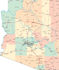
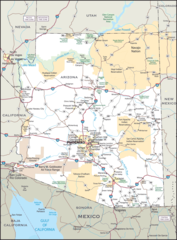
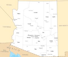
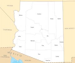
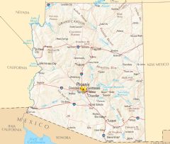
Arizona map
The largest city of Arizona is Phoenix with a population of 1,708,127. Other cities include, Tucson population 553,571, Mesa population 528,159, Chandler population 265,398 and Scottsdale population 262,647. See all Arizona cities & populated places.
Largest Cities in Arizona (more)
Cities, Towns, Villages, Neighborhoods & Other Populated Places in Arizona.
| City Name | County | Population |
|---|---|---|
| Phoenix | Maricopa | 1,708,127 |
| Tucson | Pima | 553,571 |
| Mesa | Maricopa | 528,159 |
| Chandler | Maricopa | 265,398 |
| Scottsdale | Maricopa | 262,647 |
| Gilbert | Maricopa | 257,658 |
| Glendale | Maricopa | 255,307 |
| Maryvale | Maricopa | 208,189 |
| Tempe | Maricopa | 200,402 |
| Peoria | Maricopa | 179,872 |
| Tempe Junction | Maricopa | 158,368 |
| Surprise | Maricopa | 147,965 |
| Yuma | Yuma | 99,811 |
| Goodyear | Maricopa | 90,622 |
| Avondale | Maricopa | 88,914 |
| Buckeye | Maricopa | 85,224 |
Show more Arizona cities and populated places
Official website of Arizona
Official Website- Gila County
- Yuma County
- Navajo County
- Coconino County
- Greenlee County
- Cochise County
- Graham County
- Pinal County
- Maricopa County
- Apache County
- Santa Cruz County
- Mohave County
- La Paz County
- Pima County
- Yavapai County
Demographics
| Year | Population | % Change | Method |
|---|---|---|---|
| 1901 | 131,000 | - | census |
| 1920 | 334,162 | 60.8% | census |
| 1930 | 435,573 | 23.28% | census |
| 1940 | 499,261 | 12.76% | census |
| 1950 | 749,587 | 33.4% | census |
| 1960 | 1,302,161 | 42.44% | census |
| 1970 | 1,770,900 | 26.47% | census |
| 1980 | 2,718,215 | 34.85% | census |
| 1990 | 3,665,228 | 25.84% | census |
| 2000 | 5,130,632 | 28.56% | census |
| 2010 | 6,392,017 | 19.73% | census |
| 2011 | 6,472,643 | 1.25% | estimation process |
| 2012 | 6,554,978 | 1.26% | estimation process |
| 2013 | 6,632,764 | 1.17% | estimation process |
| 2014 | 6,730,413 | 1.45% | estimation process |
| 2015 | 6,829,676 | 1.45% | estimation process |
| 2016 | 6,941,072 | 1.6% | estimation process |
| 2017 | 7,044,008 | 1.46% | estimation process |
| 2018 | 7,158,024 | 1.59% | estimation process |
| 2019 | 7,278,717 | 1.66% | estimation process |
| 2020 | 7,421,401 | 1.92% | estimation process |
People born in Arizona (109)
People born in Arizona, including astronomer Jocelyn Gill, actress Brooke Langton, film director Duncan Tucker, .
More notable people
- Yoo Gun (South Korean film actor, singer and actor) he was born in 21/01/1983
- Alex Randolph (American game designer) he was born in 04/05/1922
- Gory Guerrero (Mexican-American professional wrestler (1921-1990)) he was born in 11/01/1921
- Carlos Montezuma (Native American activist) he was born in 01/01/1866
- Russell Moore (Pima jazz musician) he was born in 13/08/1912
- Janet Varney (American actress) she was born in 16/02/1976
- Tom Godwin (American writer) he was born in 06/06/1915
- Travis Walton (American alleged alien abductee) he was born in 10/02/1953
- Oscar Noriega (American musician) he was born in 01/01/2000
- Tylor Chase (American actor) he was born in 06/09/1989
- Patrizia von Brandenstein (production designer) she was born in 15/04/1943
- Rudy Diaz (American actor (1918-2006)) he was born in 16/10/1918
- José Joaquín Moraga (explorer, Californio) he was born in 22/08/1745
- Richard Joseph Paul (American actor) he was born in 04/09/1956
- Reggie Lanning he was born in 06/10/1893
- Bentley Little (American writer) he was born in 01/01/1960
- Nick Miller (American football player) he was born in 29/03/1987
- Aleksander Akerjordet (association football player) he was born in 01/01/1975
Other places with the same name (1)
- Arizona, Nebraska an unincorporated community in Burt County, Nebraska, in the United States. with a population of 307 people.
Arizona Counties
Maricopa County

county in Arizona, United States
Pima County

county in Arizona, United States
Pinal County

county in Arizona, United States
| County Name | Population |
|---|---|
| Maricopa County | 4,579,081 |
| Pima County | 1,061,175 |
| Pinal County | 480,828 |
| Yavapai County | 240,226 |
| Yuma County | 217,824 |
| Mohave County | 217,206 |
| Coconino County | 142,481 |
| Cochise County | 127,450 |
| Navajo County | 112,112 |
| Apache County | 71,875 |
| Gila County | 54,303 |
| Santa Cruz County | 46,808 |
| Graham County | 39,211 |
| La Paz County | 21,480 |
| Greenlee County | 9,341 |
Show more Arizona counties
Map & Images (more maps)
Arizona Flag Map
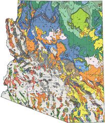
Arizona Geologic Map
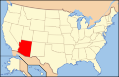
Arizona Location
Arizona Physical Map
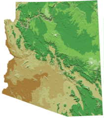
Arizona Relief Map
Arizona Road Map
Arizona State Map
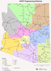
Engineering Districts Arizona
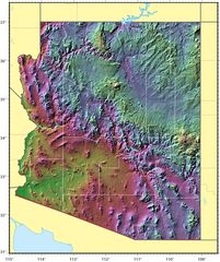
Arizona Relief Map 1
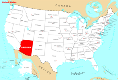
Where Is Arizona Located
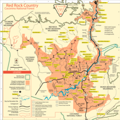
Coconino National Forest Map
Arizona Cities And Towns
Arizona County Map
Arizona Reference Map
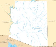
Arizona Rivers And Lakes