Algiers, Algiers
Algiers: This major Mediterranean port city is located on the Bay of Algiers, on the country's north-central coast.
About

Quick Facts about Algiers
| Population | 3,415,811 |
| Country | French Algeria, Algeria |
| State | Algiers (Algeria) |
| Postal code | 16000–16132 |
| Phone Area Codes | (0)213 |
| Area | 363000000 km2 |
| Official name | الجزائر |
| Latitude & Longitude | 36.7323,3.0875 |
| Official language | Arabic |
| Altitude | 0 feet / 0 meters |
| Capital city | Algiers is capital of French Algeria, Eyalet of Algiers, Algeria, France, Algiers Province, Alger Department, Territoires du Sud |
| Establishment | January 01, 0944 (1082 years ago) |
| Time Zone | UTC+01:00 |
| Local time | 22:48:55 (9th June 2026) |

Argel 3 image
Geography
Algiers is located at 36°43'56"N 3°5'15"E (36.7322500, 3.0874600).
Algiers map
Click "full screen"  icon to open full mode. View satellite images
- Amman (1998 )
- Amsterdam
- Asunción
- Barcelona
- Beijing
- Berlin
- Bosaso
- Cairo
- Caracas
- Casablanca
- Dakar
- Laayoune
- London
- Montreal
- Moscow
- New York City
- Pyongyang
- Sofia
- Sousse
- Surakarta
- Tripoli
- Tyre
Demographics
| Year | Population | % Change | Method |
|---|---|---|---|
| 1838 | 30,395 | - | census |
| 1881 | 70,747 | 57.04% | census |
| 1900 | 97,000 | 27.06% | census |
| 1940 | 300,000 | 67.67% | census |
| 1960 | 900,000 | 66.67% | census |
| 1963 | 600,000 | -50% | census |
| 1977 | 1,523,000 | 60.6% | census |
| 1987 | 1,507,241 | -1.05% | census |
| 1998 | 2,086,212 | 27.75% | census |
| 2008 | 2,364,230 | 11.76% | census |
| 2011 | 3,415,811 | 30.79% | census |
ALG, Al Jazair, Al-jezair, Alcher, Alge, Algeirsborg, Alger, Algeri, Algero, Algier, Algir, Alg·èr, Algê, Algír, Alje, Aljer, Aljir, Alse, Alxer, Alzer, Alzhir, Alzhir khot, Alzhir shaary, Alzhyr, Alziir, Alzir, Alzira, Alzirs, Alzyras, Alĝero, Alžiir, Alžir, Alžyras, Alžír, Alžěr, Alžīra, Alžīrs, Argel, Argier, Argièr, Arhel, Arjel, Arxel, Caesair, Cathair na hAilgeire, Cathair na hAilgéire, Cezayir, Cäsair, Icosium, Jazoir, Zzayer, a er ji er, ala-jaza'ira, alajiyarsa, alji'ersa, aljiyars, aljiyarsa, aljyrz, aljzayr, aljzayr (mdynt), aljzayr alʿasmt, aljzyrh, alzhiri, aruje, jەzayyr, mdynt aljzayr, yaljyr, Əlcəzair, ʼlgyr, Αλγέρι, Алжир, Алжир хот, Алжир шаары, Алжыр, Алҷазоир, Ալժիր, אלגיר, אלזשירס, ئالجىر, الجزائر, الجزائر (مدينة), الجزائر العاصمة, الجزائر شہر, الجزيره, الجزیره, الجیرز, جەزائیر, مدينة الجزائر, ܓܙܐܐܪ, अल्जीएर्स, अल्जीयर्स, আলজিয়ার্স, ਅਲ-ਜਜ਼ਾਇਰ, அல்ஜியர்ஸ், അൾജിയേഴ്സ്, แอลเจียร์, ཨཱལ་ཇི་ཡར་སི།, အယ်လဂျီးယားမြို့, ალჟირი, አልጀርስ, アルジェ, 阿爾及爾, 알제
Map & Images (more maps)
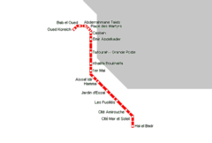
Algiers Metro Map
650 x 439
- 6,383k -
png