Algeria (People’s Democratic Republic of Algeria), DZ
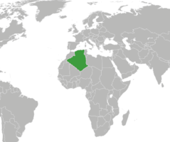
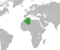
Algeria: Located in North Africa, it is the largest country in Africa by area, bordering the Mediterranean Sea.
About

Country Snapshot
People’s Democratic Republic of Algeria at a glance
People’s Democratic Republic of Algeria currently has 137 quality-checked populated place pages and 48 state or regional pages linked on MapSof.
Mapped cities & towns
137
These counts use a stricter populated-place filter so the main lists stay focused on real city and town pages.
States & regions
48
Open related pagesLargest city
AlgiersPopulation 3,415,811
Top linked places
Quick Facts about People’s Democratic Republic of Algeria
| Population | 47,400,000 |
| Country | Algeria |
| Plate code | DZ |
| Area | 2381741 km2 |
| Official name | الجمهورية الجزائرية الديمقراطية الشعبية, la République algérienne démocratique populaire |
| Continent | Africa |
| Easternmost point | Point(11.99999811 23.49999976) |
| Northernmost point | Point(7.22 37.08), Point(7.20329 37.09503) |
| Latitude & Longitude | 28.0000,3.0000 |
| Legislative body | Parliament of Algeria |
| Official language | Arabic, Standard Algerian Berber |
| Capital | Algiers |
| Time Zone | UTC+01:00 |
| Local time | 23:47:29 (9th June 2026) |

Geography
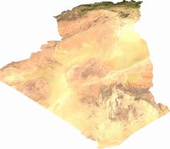
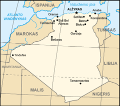
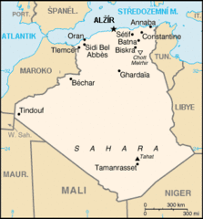
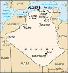
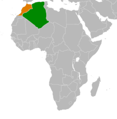
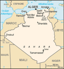
People’s Democratic Republic of Algeria is located at 28°0'0"N 3°0'0"E (28.0000000, 3.0000000). It has 6 neighbors: Mauritania, Niger, Mali, Western Sahara, Tunisia and Morocco.
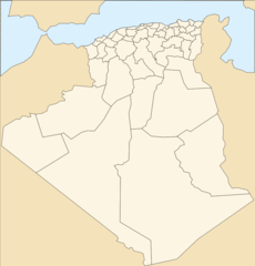
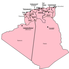
Algeria map
The largest city of People’s Democratic Republic of Algeria is Algiers with a population of 3,415,811. Other cities include, Oran population 645,984, Constantine population 450,097, Mansoûra population 439,348 and Sidi Bel Abbès population 191,769. See all People’s Democratic Republic of Algeria cities & populated places.
Compare People’s Democratic Republic of Algeria with
- Souk Ahras Province
- Béjaïa Province
- Naama Province
- Tipasa Province
- Tlemcen Province
- Skikda Province
- Béchar Province
- Mascara Province
- El Tarf Province
- Annaba Province
- Tébessa Province
- Mila Province
- Relizane Province
- El Oued Province
- Bordj Bou Arréridj Province
- El Bayadh Province
- Tizi Ouzou Province
- Ghardaïa Province
- Illizi Province
- Aïn Defla Province
- Oran Province
- Boumerdès Province
- Guezzam Province
- In Salah Province
- Touggourt Province
- Timimoun Province
- Beni Abbes Province
- Bordj Baji Mokhtar Province
- Ouled Djellal Province
- El Meniaa Province
- El M'Ghair Province
- Djanet Province
- Aïn Témouchent Province
- Tindouf Province
- Bouïra Province
- Guelma Province
- Adrar Province
- Batna Province
- Khenchela Province
- Chlef Province
- Blida Province
- Médéa Province
- Biskra Province
- M'Sila Province
- Saïda Province
- Tamanghasset Province
- Algiers Province
- Tiaret Province
- Tissemsilt Province
- Sétif Province
- Mostaganem Province
- Ouargla Province
- Oum El Bouaghi Province
- Sidi Bel Abbès Province
- Jijel Province
- Laghouat Province
- Djelfa Province
- Constantine Province
Demographics
| Year | Population | % Change | Method |
|---|---|---|---|
| 1960 | 11,057,863 | - | |
| 1961 | 11,336,339 | 2.46% | |
| 1962 | 11,619,828 | 2.44% | |
| 1963 | 11,912,803 | 2.46% | |
| 1964 | 12,221,675 | 2.53% | |
| 1965 | 12,550,885 | 2.62% | |
| 1966 | 12,902,627 | 2.73% | |
| 1967 | 13,275,026 | 2.81% | |
| 1968 | 13,663,583 | 2.84% | |
| 1969 | 14,061,722 | 2.83% | |
| 1970 | 14,464,985 | 2.79% | |
| 1971 | 14,872,250 | 2.74% | |
| 1972 | 15,285,990 | 2.71% | |
| 1973 | 15,709,825 | 2.7% | |
| 1974 | 16,149,025 | 2.72% | |
| 1975 | 16,607,707 | 2.76% | |
| 1976 | 17,085,801 | 2.8% | |
| 1977 | 17,582,904 | 2.83% | |
| 1978 | 18,102,266 | 2.87% | |
| 1979 | 18,647,815 | 2.93% | |
| 1980 | 19,221,665 | 2.99% | |
| 1981 | 19,824,301 | 3.04% | |
| 1982 | 20,452,902 | 3.07% | |
| 1983 | 21,101,875 | 3.08% | |
| 1984 | 21,763,575 | 3.04% | |
| 1985 | 22,431,502 | 2.98% | |
| 1986 | 23,102,389 | 2.9% | |
| 1987 | 23,774,284 | 2.83% | |
| 1988 | 24,443,467 | 2.74% | |
| 1989 | 25,106,190 | 2.64% | |
| 1990 | 25,758,869 | 2.53% | |
| 1991 | 26,400,479 | 2.43% | |
| 1992 | 27,028,326 | 2.32% | |
| 1993 | 27,635,515 | 2.2% | |
| 1994 | 28,213,774 | 2.05% | |
| 1995 | 28,757,785 | 1.89% | |
| 1996 | 29,266,405 | 1.74% | |
| 1997 | 29,742,979 | 1.6% | |
| 1998 | 30,192,754 | 1.49% | |
| 1999 | 30,623,406 | 1.41% | |
| 2000 | 31,042,235 | 1.35% | |
| 2001 | 31,451,514 | 1.3% | |
| 2002 | 31,855,109 | 1.27% | |
| 2003 | 32,264,157 | 1.27% | |
| 2004 | 32,692,163 | 1.31% | |
| 2005 | 33,149,724 | 1.38% | |
| 2006 | 33,641,002 | 1.46% | |
| 2007 | 34,166,972 | 1.54% | |
| 2008 | 34,730,608 | 1.62% | |
| 2009 | 35,333,881 | 1.71% | |
| 2010 | 35,977,455 | 1.79% | |
| 2011 | 36,661,444 | 1.87% | |
| 2012 | 37,383,887 | 1.93% | |
| 2013 | 38,140,132 | 1.98% | |
| 2014 | 38,923,687 | 2.01% | |
| 2015 | 39,728,025 | 2.02% | |
| 2016 | 40,551,404 | 2.03% | |
| 2017 | 41,389,198 | 2.02% | |
| 2018 | 42,228,429 | 1.99% | |
| 2019 | 43,053,054 | 1.92% | |
| 2026 | 47,400,000 | 9.17% |
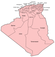
Map & Images (more maps)
Ag Map Lt
Ag Map
Ag Map 1
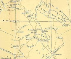
Ahaggar map
Algeria France Locator

Algeria Germany Locator
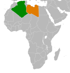
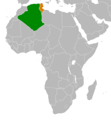
Algeria Libya Locator
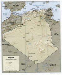
Algeria Map
Algeria Morocco Locator
Algeria Rasd Locator
Algeria Russia Locator
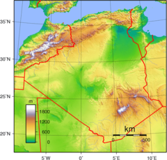
Algeria Topography
Algeria Tunisia Locator
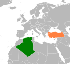
Algeria Turkey Locator
Algeria Alternative
Algeria Departments 1957 1974
Algeria Departments 1974 1983
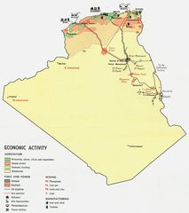
Algeria Economy 1971
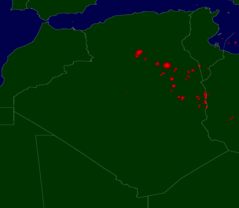
Algeria Flares
Algeria Map Fr