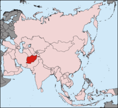
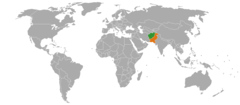
Afghanistan, AF
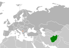
Afghanistan: Independent country situated at the confluence of Western, Central, and South Asia
About

Country Snapshot
Afghanistan at a glance
Afghanistan currently has 64 quality-checked populated place pages and 32 state or regional pages linked on MapSof.
Mapped cities & towns
64
These counts use a stricter populated-place filter so the main lists stay focused on real city and town pages.
States & regions
32
Open related pagesLargest city
KabulPopulation 3,043,532
Top linked places
Quick Facts about Afghanistan
| Population | 43,844,000 |
| Country | Afghanistan |
| Plate code | AFG |
| Area | 652230 km2 |
| Official name | la République islamique d’Afghanistan, Islamskie Państwo Afganistanu |
| Water as percent of area | 0% |
| Land as percent of area | 100% |
| Continent | Asia |
| Easternmost point | Point(74.889861111 37.234083333) |
| Northernmost point | Point(70.989055555 38.490861111) |
| Latitude & Longitude | 34.4008,66.2089 |
| Legislative body | National Assembly of Afghanistan |
| Official language | Arabic, Uzbek, Turkmen, Dari, Pashto |
| Capital | Kabul |
| Time Zone | UTC+04:30 |
| Local time | 13:44:39 (10th June 2026) |

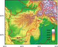
Geography
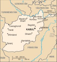
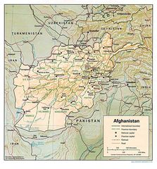
Afghanistan is located at 34°24'3"N 66°12'32"E (34.400787436026725, 66.2089092626413). It has 6 neighbors: Iran, Pakistan, Turkmenistan, Tajikistan, Uzbekistan and China.
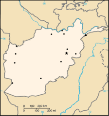
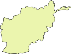
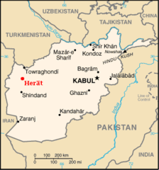
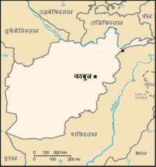
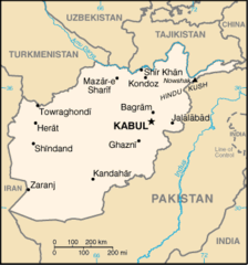
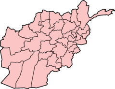
Afghanistan map
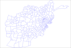
The largest city of Afghanistan is Kabul with a population of 3,043,532. Other cities include, Tagāb population 61,985, Pul-e Khumrī population 56,369, Andkhōy population 29,208 and Kushk population 16,952. See all Afghanistan cities & populated places.
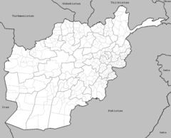
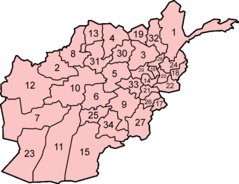
- Zabul
- Nuristan
- Urozgan
- Maidan Wardak
- Ghazni
- Herat
- Badghis
- Samangan
- Parwan
- Kunduz Province
- Badakhshan
- Takhar
- Ghōr
- Bamyan
- Kandahar
- Paktia
- Logar
- Farah
- Daykundi
- Kapisa
- Jowzjan
- Nangarhar
- Khost
- Balkh
- Laghman
- Paktika
- Nimruz
- Helmand
- Sar-e Pol
- Panjshir
- Baghlan
- Faryab
- Kunar
- Kabul
Demographics
| Year | Population | % Change | Method |
|---|---|---|---|
| 1960 | 8,996,973 | - | 1688-01-01T00:00:00Z |
| 1961 | 9,169,410 | 1.88% | census |
| 1962 | 9,351,441 | 1.95% | estimation process |
| 1963 | 9,543,205 | 2.01% | 1688-01-01T00:00:00Z |
| 1964 | 9,744,781 | 2.07% | estimation process |
| 1965 | 9,956,320 | 2.12% | census |
| 1966 | 10,174,836 | 2.15% | census |
| 1967 | 10,399,926 | 2.16% | estimation process |
| 1968 | 10,637,063 | 2.23% | 1688-01-01T00:00:00Z |
| 1969 | 10,893,776 | 2.36% | estimation process |
| 1970 | 11,173,642 | 2.5% | estimation process |
| 1971 | 11,475,445 | 2.63% | estimation process |
| 1972 | 11,791,215 | 2.68% | census |
| 1973 | 12,108,963 | 2.62% | 1688-01-01T00:00:00Z |
| 1974 | 12,412,950 | 2.45% | 1688-01-01T00:00:00Z |
| 1975 | 12,689,160 | 2.18% | estimation process |
| 1976 | 12,943,093 | 1.96% | estimation process |
| 1977 | 13,171,306 | 1.73% | 1688-01-01T00:00:00Z |
| 1978 | 13,341,198 | 1.27% | estimation process |
| 1979 | 13,411,056 | 0.52% | 1688-01-01T00:00:00Z |
| 1980 | 13,356,511 | -0.41% | 1688-01-01T00:00:00Z |
| 1981 | 13,171,673 | -1.4% | census |
| 1982 | 12,882,528 | -2.24% | 1688-01-01T00:00:00Z |
| 1983 | 12,537,730 | -2.75% | estimation process |
| 1984 | 12,204,292 | -2.73% | estimation process |
| 1985 | 11,938,208 | -2.23% | estimation process |
| 1986 | 11,736,179 | -1.72% | census |
| 1987 | 11,604,534 | -1.13% | estimation process |
| 1988 | 11,618,005 | 0.12% | estimation process |
| 1989 | 11,868,877 | 2.11% | estimation process |
| 1990 | 12,412,308 | 4.38% | estimation process |
| 1991 | 13,299,017 | 6.67% | 1688-01-01T00:00:00Z |
| 1992 | 14,485,546 | 8.19% | 1688-01-01T00:00:00Z |
| 1993 | 15,816,603 | 8.42% | estimation process |
| 1994 | 17,075,727 | 7.37% | estimation process |
| 1995 | 18,110,657 | 5.71% | 1688-01-01T00:00:00Z |
| 1996 | 18,853,437 | 3.94% | estimation process |
| 1997 | 19,357,126 | 2.6% | 1688-01-01T00:00:00Z |
| 1998 | 19,737,765 | 1.93% | estimation process |
| 1999 | 20,170,844 | 2.15% | estimation process |
| 2000 | 20,779,953 | 2.93% | estimation process |
| 2001 | 21,606,988 | 3.83% | estimation process |
| 2002 | 22,600,770 | 4.4% | estimation process |
| 2003 | 23,680,871 | 4.56% | estimation process |
| 2004 | 24,726,684 | 4.23% | estimation process |
| 2005 | 25,654,277 | 3.62% | 1688-01-01T00:00:00Z |
| 2006 | 26,433,049 | 2.95% | estimation process |
| 2007 | 27,100,536 | 2.46% | 1688-01-01T00:00:00Z |
| 2008 | 27,722,276 | 2.24% | estimation process |
| 2009 | 28,394,813 | 2.37% | estimation process |
| 2010 | 29,185,507 | 2.71% | estimation process |
| 2011 | 30,117,413 | 3.09% | 1688-01-01T00:00:00Z |
| 2012 | 31,161,376 | 3.35% | estimation process |
| 2013 | 32,269,589 | 3.43% | estimation process |
| 2014 | 33,370,794 | 3.3% | |
| 2015 | 34,413,603 | 3.03% | |
| 2016 | 35,383,128 | 2.74% | |
| 2017 | 36,296,400 | 2.52% | |
| 2018 | 37,172,386 | 2.36% | estimation process |
| 2019 | 38,041,754 | 2.29% | |
| 2020 | 36,643,815 | -3.81% | estimation process |
| 2026 | 43,844,000 | 16.42% |
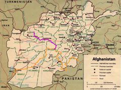
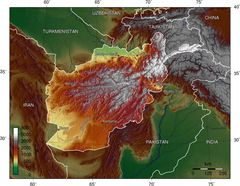
Map & Images (more maps)
000 Afghanistan Harta
1996afghan
Af Mapa
Afganistan Locator Map1
Afganistan Map
Afghan Topo En
Afghan Topo
Afghan Big
Afghanistan District
Afghanistan Kosovo Locator 1
Afghanistan Locator
Afghanistan Pakistan Locator 1
Afghanistan Topography
Afghanistan Districts
Afghanistan Insurgency 1985
Afghanistan Map Herat
Afghanistan Map Hindi
Afghanistan Map
Afghanistan Provinces Numbered
Afghanistan Provinces