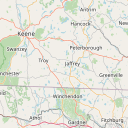
How far is Windham, NH from East Concord, NH?
Fastest route
The distance between Windham, New Hampshire 03087, and East Concord, Concord, NH 03301, is approximately 37.1 miles (about 60 kilometers). The fastest route, considering traffic conditions, is via I-93 N, but please note that this route involves tolls.
Directions
-
🚗 Get on I-93 N from NH-111 E: Start by heading southeast toward Lowell Rd. Then, turn right at the first cross street onto NH-111 E. Finally, turn left to merge onto I-93 N toward Derry/Manchester.
-
🛣️ Follow I-93 N to W Portsmouth St in Concord: Keep on I-93 N, following the signs for Interstate 93 N/NH-101 E/Concord/Seacoast. Continue to keep left to stay on I-93 N.
-
🔄 Keep left at the fork to stay on I-93 N: Follow the signs for Concord Plymouth. Be aware that this segment of the road includes tolls.
-
🛣️ Take exit 16 toward NH-132/E. Concord: After the toll road section, take exit 16 to reach NH-132/E. Concord.
-
🚗 Drive to Mountain Rd: Turn right onto W Portsmouth St, and then proceed to the traffic circle. At the traffic circle, take the 3rd exit onto Mountain Rd.
Tips & Suggestions
-
🛣️ Check Traffic Conditions: Before embarking on your journey, it's a good idea to check the traffic conditions on I-93 N to plan for any potential delays.
-
💵 Prepare for Tolls: Keep in mind that this route involves tolls, so be prepared with cash or an electronic toll pass.
-
⛽ Fuel Up: Ensure your vehicle has enough fuel to cover the distance, especially if there are limited gas stations along the route.
-
🚦 Stay Alert: While driving, stay attentive to road signs and follow the directions carefully to avoid missing exits or turns.
-
🕐 Allow Extra Time: Consider giving yourself some extra time, as traffic or unexpected delays may impact your estimated travel time.
-
📱 Keep a Navigation App Handy: Having a GPS navigation app on your phone can be helpful in case you need to re-route or find nearby amenities.
-
🚗 Take Breaks if Needed: If it's a long journey, plan for occasional breaks to stretch, rest, and refresh yourself during the drive.
Distance by Flight
Shortest distance between Windham and East Concord is 32.71 miles (52.63 km).
Flight distance from Windham, NH to East Concord, NH is 32.71 miles. Estimated flight time is 00 hours 04 minutes.


Driving distance
The driving distance from Windham, New Hampshire to East Concord, New Hampshire is: 37.45 miles (60.26 km) by car.
Driving from Windham to East Concord will take approximately 00 hours 40 minutes.

#1 Windham
City in New Hampshire
| Population | 14865 |
|---|---|
| GPS Coordinates | 42°48'2"N 71°18'15"W |
| Latitude | 42.8006400 |
| Longitude | -71.3042300 |
| Altitude | 60 |
| Country | United States |
#2 East Concord
A census-designated place in Merrimack County, New Hampshire. It is located on the east bank of the Merrimack River in the southeastern part of the state. East Concord is known for its many parks and green spaces, its many historical sites, and its many attractions, such as the East Concord Historical Society and the East Concord Public Library.
| Population | 42605 |
|---|---|
| GPS Coordinates | 43°14'31"N 71°32'17"W |
| Latitude | 43.2420200 |
| Longitude | -71.5381300 |
| Altitude | 95 |
| Country | United States |
Ending point in East Concord: (-71.538188,43.2421)
Estimated Travel Time Between Windham and East Concord
The distance between Windham and East Concord is 60 km if you choose to drive by road. You can go 00 hours 40 minutes if you drive your car at an average speed of 90 kilometers / hour. For different choices, please review the avg. speed travel time table on the below.
There is no time difference between Windham and East Concord. The current time is 18:47:14.
| Average Speed | Travel Time |
|---|---|
| 30 mph (48.3 km/h) | 01 hours 14 minutes |
| 40 mph (64.37 km/h) | 00 hours 56 minutes |
| 50 mph (80.47 km/h) | 00 hours 44 minutes |
| 60 mph (96.56 km/h) | 00 hours 37 minutes |
| 70 mph (112.65 km/h) | 00 hours 32 minutes |
| 75 mph (120.7 km/h) | 00 hours 29 minutes |
| 80 mph (128.75 km/h) | 00 hours 28 minutes |
Gas Consumption
A car with a fuel efficiency of 8.3 l/100 km will need 5 liters (1.32 gallon) of gas to cover the route between Windham and East Concord.
The estimated cost of gas to go from Windham to East Concord is $4.62 (diesel $5.79).
New Hampshire gas prices.
| Gasoline | Mid Grade | Premium | Diesel | |
|---|---|---|---|---|
| Gallon | $3.5 | $3.96 | $4.38 | $4.38 |
| Total | $4.62 | $5.23 | $5.79 | $5.79 |
Take a look at our Gas Cost Calculator feature. It will figure out how much it will cost to drive this particular distance.
The average gas price (in New Hampshire ) per gallon of daily gas for calculations is $3.496 (Diesel $4.384) /gallon. Last changed prices on August 14, 2025.
How did we calculate the distance?
The place names are translated into coordinates to approximate the distance between Windham and East Concord (latitude and longitude). Cities, states, and countries each have their own regional center. The Haversine formula is used to measure the radius.


