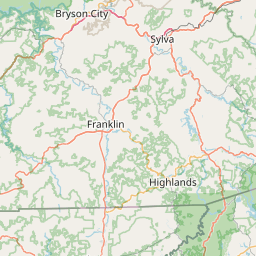
How far is Sevierville, TN from Franklin, TN?
Fastest route
The distance between Sevierville, Tennessee, and Franklin, Tennessee is approximately 224 miles (360 kilometers). The estimated travel time is about 3 hours and 30 minutes. The fastest route to reach your destination is via I-40 W.
Directions
To get to Franklin from Sevierville, follow these directions:
- Head south toward E Main St.
- Turn right onto E Main St.
- Use the right two lanes to turn right onto North Pkwy.
- Use the right three lanes to turn right onto Winfield Dunn Pkwy.
- Continue straight to stay on Winfield Dunn Pkwy.
- Continue onto Winfield Dunn Pkwy.
- Use the middle lane to merge onto I-40 W via the ramp to Knoxville.
- Keep following I-40 W.
- Take exit 65 from I-65 S toward Franklin.
- Keep right at the fork to stay on I-40 W, following signs for Nashville.
- Use the left three lanes to take exit 213A for I-440 W toward Memphis.
- Use the right two lanes to merge onto I-65 S toward Huntsville.
- Use the right two lanes to take exit 65 for TN-96 toward Franklin/Murfreesboro.
- Follow TN-96 W to your destination.
- Use the right two lanes to turn right onto TN-96 W/Murfreesboro Rd.
- Continue to follow TN-96 W.
- You will reach your destination.
Tips & Suggestions
- 🚗 Plan your trip in advance to ensure a smooth journey.
- ⛽ Make sure your vehicle has enough fuel before starting the trip.
- 🚦 Check the traffic conditions along the route to anticipate any potential delays.
- 📱 Use a reliable navigation app or GPS device to guide you during the trip.
- 🚧 Stay alert for construction zones or road closures that may affect your route.
- 🍴 Pack some snacks or plan stops at restaurants along the way to stay refreshed.
- ⏰ Consider the time zone difference between Sevierville and Franklin when planning your departure and arrival times.
Distance by Flight
Shortest distance between Sevierville and Franklin is 185.13 miles (297.94 km).
Flight distance from Sevierville, TN to Franklin, TN is 185.13 miles. Estimated flight time is 00 hours 26 minutes.
It takes 00 hours 24 minutes to travel from Sevierville to Franklin with an airplane (average speed of 550 miles).


Driving distance
The driving distance from Sevierville, Tennessee to Franklin, Tennessee is: 223.67 miles (359.96 km) by car.
Driving from Sevierville to Franklin will take approximately 03 hours 35 minutes.

#1 Sevierville
Town in Seiver County, Tennessee, USA
| Population | 18426 |
|---|---|
| GPS Coordinates | 35°52'5"N 83°33'43"W |
| Latitude | 35.8681500 |
| Longitude | -83.5618400 |
| Altitude | 275 |
| Country | United States |

#2 Franklin
The second most populous city in Williamson County, Tennessee. It is located in the Nashville metropolitan area. Franklin is known for its many parks and green spaces, its many historical sites, and its many attractions, such as the Carnton Plantation and the Frist Art Museum.
| Population | 85316 |
|---|---|
| GPS Coordinates | 35°55'30"N 86°52'8"W |
| Latitude | 35.9250600 |
| Longitude | -86.8688900 |
| Altitude | 196 |
| Country | United States |
Ending point in Franklin: Public Square (-86.868874,35.925004)
Estimated Travel Time Between Sevierville and Franklin
The distance between Sevierville and Franklin is 360 km if you choose to drive by road. You can go 03 hours 59 minutes if you drive your car at an average speed of 90 kilometers / hour. For different choices, please review the avg. speed travel time table on the below.
Please keep in mind that there is a 1 hour time gap between Sevierville, TN and Franklin, TN. The current time in Sevierville is 01:16:46, although it is 00:16:46 in Franklin.
| Average Speed | Travel Time |
|---|---|
| 30 mph (48.3 km/h) | 07 hours 27 minutes |
| 40 mph (64.37 km/h) | 05 hours 35 minutes |
| 50 mph (80.47 km/h) | 04 hours 28 minutes |
| 60 mph (96.56 km/h) | 03 hours 43 minutes |
| 70 mph (112.65 km/h) | 03 hours 11 minutes |
| 75 mph (120.7 km/h) | 02 hours 58 minutes |
| 80 mph (128.75 km/h) | 02 hours 47 minutes |
Gas Consumption
A car with a fuel efficiency of 8.3 l/100 km will need 29.88 liters (7.89 gallon) of gas to cover the route between Sevierville and Franklin.
The estimated cost of gas to go from Sevierville to Franklin is $24.78 (diesel $33.01).
Tennessee gas prices.
| Gasoline | Mid Grade | Premium | Diesel | |
|---|---|---|---|---|
| Gallon | $3.14 | $3.56 | $3.93 | $4.18 |
| Total | $24.78 | $28.08 | $31.04 | $33.01 |
Take a look at our Gas Cost Calculator feature. It will figure out how much it will cost to drive this particular distance.
The average gas price (in Tennessee ) per gallon of daily gas for calculations is $3.140 (Diesel $4.183) /gallon. Last changed prices on July 29, 2025.
How did we calculate the distance?
The place names are translated into coordinates to approximate the distance between Sevierville and Franklin (latitude and longitude). Cities, states, and countries each have their own regional center. The Haversine formula is used to measure the radius.
Distance to Other Cities
Driving distance from East Chattanooga, TN to Sevierville 136.73 miles (220 km)
Driving distance from Johnson, TN to Sevierville 76.91 miles (124 km)


