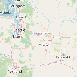
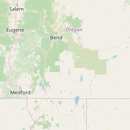
How far is Priest River, ID from Nampa, ID?
Fastest route
The journey from Priest River, Idaho, to Nampa, Idaho covers a distance of approximately 458 miles (737 kilometers) and takes around 7 hours and 1 minute via I-84 E. The destination is in a different time zone.
Directions
- Head west on Albeni Rd/U.S. Rte 2 W toward Church St, continuing to follow U.S. Rte 2 W. Enter Washington state.
- Turn left onto US-2 W/N Washington Ave (signs for Spokane) and then take a slight right onto U.S. Rte 2 W. Pass by Subway (on the left in 36.1 mi).
- Use the right lane to merge onto US-395 S via the ramp to Francis Ave.
- Continue onto N Spokane Corridor and then onto US-395/N Spokane Corridor.
- Take the exit toward N Freya St and at the traffic circle, take the 2nd exit onto N Freya St.
- Continue straight to stay on N Freya St and then turn right onto E Upriver Dr, followed by a right toward E Carlisle Ave.
- Continue onto E Carlisle Ave, turn right onto N Greene St, and then continue straight to stay on N Greene St.
- Continue onto N Freya Way and turn right onto E 2nd Ave.
- Take a slight left to merge onto I-90 W toward Seattle.
- Keep right to continue on US-395 S, following signs for Ritzville/Pasco.
- Take the exit onto US-12 E toward Walla Walla.
- Get on I-84 E in Pendleton from US-730 W, OR-37 S, S Cold Spring Rd, and OR-37 S/Northgate.
- Turn right onto S Cold Spring Rd/County 850 Rd, and continue to follow S Cold Spring Rd. Then, turn left to stay on S Cold Spring Rd.
- Turn right onto OR-37 S/Northgate, and then left onto Westgate Pl.
- Turn right onto SW Court Ave, pass by Aaron's (on the left in 0.5 mi), and then turn right after Taco Bell (on the left).
- Turn right onto SW Emigrant Ave and left onto the I-84 E/US 395 S ramp to La Grande.
- Follow I-84 E to N Franklin Blvd in Nampa, and take exit 36 from I-84 E.
- Finally, turn right onto N Franklin Blvd and follow N Franklin Blvd and I-84BL W to 1st St S.
Tips & Suggestions
- 🚗 Plan for a rest stop: Considering the 7-hour duration of the journey, plan for rest stops along the way to stretch and recharge.
- ⛽ Fuel up before long stretches: Make sure to have a full tank of gas before embarking on the longer stretches of the route, especially in remote areas.
- 🚧 Check traffic updates: Before starting, check for real-time traffic conditions to choose the best possible route and avoid delays.
- 🕑 Time zone change: Be aware of the time zone change at your destination to adjust your plans accordingly.
- 🗺️ Keep a map handy: While GPS navigation is helpful, it's always good to have a physical map in case of any technology issues.
- 🍴 Pack snacks and drinks: Bring some snacks and drinks along to keep yourself refreshed during the journey.
- 🛣️ Familiarize with the route: Before setting out, familiarize yourself with the route to have a general idea of the landmarks and turns.
Distance by Flight
Shortest distance between Priest River and Nampa is 321.05 miles (516.67 km).
Flight distance from Priest River, ID to Nampa, ID is 321.05 miles. Estimated flight time is 00 hours 53 minutes.
It takes 00 hours 48 minutes to travel from Priest River to Nampa with an airplane (average speed of 550 miles).


Driving distance
The driving distance from Priest River, Idaho to Nampa, Idaho is: 446.47 miles (718.53 km) by car.
Driving from Priest River to Nampa will take approximately 08 hours 09 minutes.

#1 Priest River
City in Bonner County, Idaho
| Population | 1893 |
|---|---|
| GPS Coordinates | 48°10'51"N 116°54'42"W |
| Latitude | 48.1809700 |
| Longitude | -116.9115700 |
| Altitude | 652 |
| Country | United States |

#2 Nampa
The most populous city in Canyon County, Idaho. It is located on the Snake River in southwestern Idaho. Nampa is known for its many parks and green spaces, its many historical sites, and its many attractions, such as the Nampa Civic Center and the Nampa Museum of Art.
| Population | 99277 |
|---|---|
| GPS Coordinates | 43°32'27"N 116°33'48"W |
| Latitude | 43.5407200 |
| Longitude | -116.5634600 |
| Altitude | 767 |
| Country | United States |
Ending point in Nampa: Stony Meadow Drive (-116.563329,43.541003)
Estimated Travel Time Between Priest River and Nampa
The distance between Priest River and Nampa is 719 km if you choose to drive by road. You can go 07 hours 59 minutes if you drive your car at an average speed of 90 kilometers / hour. For different choices, please review the avg. speed travel time table on the below.
Please keep in mind that there is a 1 hour time gap between Priest River, ID and Nampa, ID. The current time in Priest River is 01:21:36, although it is 02:21:36 in Nampa.
| Average Speed | Travel Time |
|---|---|
| 30 mph (48.3 km/h) | 14 hours 52 minutes |
| 40 mph (64.37 km/h) | 11 hours 09 minutes |
| 50 mph (80.47 km/h) | 08 hours 55 minutes |
| 60 mph (96.56 km/h) | 07 hours 26 minutes |
| 70 mph (112.65 km/h) | 06 hours 22 minutes |
| 75 mph (120.7 km/h) | 05 hours 57 minutes |
| 80 mph (128.75 km/h) | 05 hours 34 minutes |
Gas Consumption
A car with a fuel efficiency of 8.3 l/100 km will need 59.64 liters (15.75 gallon) of gas to cover the route between Priest River and Nampa.
The estimated cost of gas to go from Priest River to Nampa is $61.65 (diesel $73.65).
Idaho gas prices.
| Gasoline | Mid Grade | Premium | Diesel | |
|---|---|---|---|---|
| Gallon | $3.91 | $4.15 | $4.38 | $4.68 |
| Total | $61.65 | $65.33 | $69.05 | $73.65 |
Take a look at our Gas Cost Calculator feature. It will figure out how much it will cost to drive this particular distance.
The average gas price (in Idaho ) per gallon of daily gas for calculations is $3.913 (Diesel $4.675) /gallon. Last changed prices on June 18, 2025.
How did we calculate the distance?
The place names are translated into coordinates to approximate the distance between Priest River and Nampa (latitude and longitude). Cities, states, and countries each have their own regional center. The Haversine formula is used to measure the radius.


