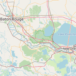
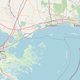
How far is Port Gibson, MS from Gulfport, MS?
Distance by Flight
Shortest distance between Port Gibson and Gulfport is 156.92 miles (252.53 km).
Flight distance from Port Gibson, MS to Gulfport, MS is 156.92 miles. Estimated flight time is 00 hours 26 minutes.
It takes 00 hours 24 minutes to travel from Port Gibson to Gulfport with an airplane (average speed of 550 miles).

Driving distance
The driving distance from Port Gibson, Mississippi to Gulfport, Mississippi is: 222.38 miles (357.89 km) by car.
Driving from Port Gibson to Gulfport will take approximately 03 hours 40 minutes.

#1 Port Gibson
City in Mississippi, USA
| Population | 1287 |
|---|---|
| GPS Coordinates | 31°57'40"N 90°59'2"W |
| Latitude | 31.9609900 |
| Longitude | -90.9839900 |
| Altitude | 36 |
| Country | United States |

#2 Gulfport
The second most populous city in Harrison County, Mississippi. It is located on the Gulf of Mexico in the Mississippi Gulf Coast. Gulfport is known for its many beaches, its many parks and green spaces, and its many attractions, such as the Gulfport Fishing Pier and the Gulfport Museum of Coastal History.
| Population | 71438 |
|---|---|
| GPS Coordinates | 30°22'3"N 89°5'34"W |
| Latitude | 30.3674200 |
| Longitude | -89.0928200 |
| Altitude | 6 |
| Country | United States |
Ending point in Gulfport: 25th Avenue (-89.092823,30.36742)
Estimated Travel Time Between Port Gibson and Gulfport
The distance between Port Gibson and Gulfport is 358 km if you choose to drive by road. You can go 03 hours 58 minutes if you drive your car at an average speed of 90 kilometers / hour. For different choices, please review the avg. speed travel time table on the below.
There is no time difference between Port Gibson and Gulfport. The current time is 04:15:54.
| Average Speed | Travel Time |
|---|---|
| 30 mph (48.3 km/h) | 07 hours 24 minutes |
| 40 mph (64.37 km/h) | 05 hours 33 minutes |
| 50 mph (80.47 km/h) | 04 hours 26 minutes |
| 60 mph (96.56 km/h) | 03 hours 42 minutes |
| 70 mph (112.65 km/h) | 03 hours 10 minutes |
| 75 mph (120.7 km/h) | 02 hours 57 minutes |
| 80 mph (128.75 km/h) | 02 hours 46 minutes |
Gas Consumption
A car with a fuel efficiency of 8.3 l/100 km will need 29.7 liters (7.85 gallon) of gas to cover the route between Port Gibson and Gulfport.
The estimated cost of gas to go from Port Gibson to Gulfport is $23.6 (diesel $31.46).
Mississippi gas prices.
| Gasoline | Mid Grade | Premium | Diesel | |
|---|---|---|---|---|
| Gallon | $3.01 | $3.4 | $3.76 | $4.01 |
| Total | $23.6 | $26.7 | $29.54 | $31.46 |
Take a look at our Gas Cost Calculator feature. It will figure out how much it will cost to drive this particular distance.
The average gas price (in Mississippi ) per gallon of daily gas for calculations is $3.008 (Diesel $4.009) /gallon. Last changed prices on June 21, 2025.
How did we calculate the distance?
The place names are translated into coordinates to approximate the distance between Port Gibson and Gulfport (latitude and longitude). Cities, states, and countries each have their own regional center. The Haversine formula is used to measure the radius.
Distance to Other Cities
Driving distance from Auburn, MS to Port Gibson 248.87 miles (401 km)


Driving distance from West Gulfport, MS to Port Gibson 219.88 miles (354 km)