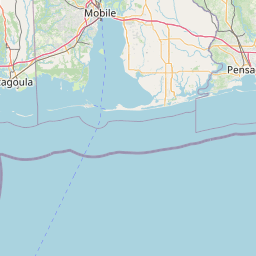
How far is Ocean Springs, MS from Brandon, MS?
Distance by Flight
Shortest distance between Ocean Springs and Brandon is 145.67 miles (234.43 km).
Flight distance from Ocean Springs, MS to Brandon, MS is 145.67 miles. Estimated flight time is 00 hours 19 minutes.
It takes 00 hours 17 minutes to travel from Ocean Springs to Brandon with an airplane (average speed of 550 miles).


Driving distance
The driving distance from Ocean Springs, Mississippi to Brandon, Mississippi is: 164.34 miles (264.48 km) by car.
Driving from Ocean Springs to Brandon will take approximately 02 hours 45 minutes.

#1 Ocean Springs
City in Jackson County, Mississippi, United States
| Population | 17791 |
|---|---|
| GPS Coordinates | 30°24'41"N 88°49'40"W |
| Latitude | 30.4113100 |
| Longitude | -88.8278100 |
| Altitude | 7 |
| Country | United States |

#2 Brandon
City in Mississippi
| Population | 24396 |
|---|---|
| GPS Coordinates | 32°16'24"N 89°59'9"W |
| Latitude | 32.2732000 |
| Longitude | -89.9859200 |
| Altitude | 147 |
| Country | United States |
Ending point in Brandon: East Government Street (-89.985921,32.273109)
Estimated Travel Time Between Ocean Springs and Brandon
The distance between Ocean Springs and Brandon is 264 km if you choose to drive by road. You can go 02 hours 56 minutes if you drive your car at an average speed of 90 kilometers / hour. For different choices, please review the avg. speed travel time table on the below.
There is no time difference between Ocean Springs and Brandon. The current time is 18:20:31.
| Average Speed | Travel Time |
|---|---|
| 30 mph (48.3 km/h) | 05 hours 28 minutes |
| 40 mph (64.37 km/h) | 04 hours 06 minutes |
| 50 mph (80.47 km/h) | 03 hours 17 minutes |
| 60 mph (96.56 km/h) | 02 hours 44 minutes |
| 70 mph (112.65 km/h) | 02 hours 20 minutes |
| 75 mph (120.7 km/h) | 02 hours 11 minutes |
| 80 mph (128.75 km/h) | 02 hours 03 minutes |
Gas Consumption
A car with a fuel efficiency of 8.3 l/100 km will need 21.95 liters (5.8 gallon) of gas to cover the route between Ocean Springs and Brandon.
The estimated cost of gas to go from Ocean Springs to Brandon is $17.44 (diesel $23.25).
Mississippi gas prices.
| Gasoline | Mid Grade | Premium | Diesel | |
|---|---|---|---|---|
| Gallon | $3.01 | $3.4 | $3.76 | $4.01 |
| Total | $17.44 | $19.73 | $21.83 | $23.25 |
Take a look at our Gas Cost Calculator feature. It will figure out how much it will cost to drive this particular distance.
The average gas price (in Mississippi ) per gallon of daily gas for calculations is $3.008 (Diesel $4.009) /gallon. Last changed prices on July 11, 2025.
How did we calculate the distance?
The place names are translated into coordinates to approximate the distance between Ocean Springs and Brandon (latitude and longitude). Cities, states, and countries each have their own regional center. The Haversine formula is used to measure the radius.


