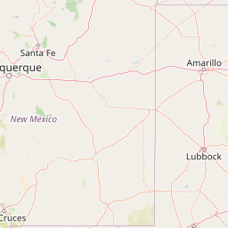
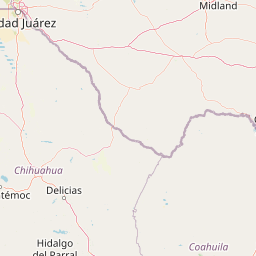
How far is Muleshoe, TX from Montopolis, TX?
Fastest route
The distance from Muleshoe, Texas 79347 to Montopolis, Austin, TX 78741 is approximately 448 miles (721 kilometers). The estimated travel time is 6 hours and 57 minutes. The fastest route currently is via US-183 Hwy S, but please note that this route has tolls.
Directions
To get from Muleshoe to Montopolis, follow these directions:
- Head southwest on N 1st St toward W American Blvd.
- Turn left at the 1st cross street onto US-84 E/E American Blvd. Continue to follow US-84 E.
- Turn right to merge onto TX-289 Loop E.
- Take the Southeast Dr exit.
- Turn right onto Southeast Dr. Use any lane to turn slightly left onto E Hwy 84/Slaton Rd/US 84 E.
- Continue to follow E Hwy 84/US 84 E. Continue straight onto US-84 E/
- Use the left lane to merge onto I-20 E toward Abilene.
- Take exit 244 toward TX-70BUS/TX-70 S/Sweetwater/San Angelo.
- Merge onto SW Georgia Ave/I-20 Frontage Rd. Turn right onto State Hwy 70 S/Lamar St. Continue to follow State Hwy 70 S.
- Slight left onto US-283 S/US-84 E. Continue to follow US-84 E. Pass by Dairy Queen (on the left in 7.5 mi).
- Turn right onto US-84 E/US-183 Hwy S. Continue straight onto US-183 Hwy S.
- Slight right onto US-183 Hwy S/N US Hwy 183/N U.S. Hwy 281. Continue to follow US-183 Hwy S/N US Hwy 183. Pass by McDonald's (on the right in 1.6 mi).
- Continue onto Route 183A S (Toll road). Keep left to continue on Route 183A S (Toll road).
- Continue onto US-183 Hwy S (Toll road). Keep left to continue on 183 Toll (Toll road).
- Take US-183 Hwy S and Montopolis Dr to Porter St.
- Continue onto US-183 Hwy S. Use the right lane to stay on US-183 Hwy S. Use the right 2 lanes to turn right at the 1st cross street onto Montopolis Dr.
Tips & Suggestions
- 🧭 Plan your trip and check for real-time traffic updates before starting your journey.
- 🚗 Stay attentive to road signs and follow the indicated routes.
- 🛣️ Take breaks during the long drive to rest and stretch your legs.
- ⛽ Make sure to refuel your vehicle before embarking on the trip.
- 🍴 Pack some snacks and drinks for the journey to stay refreshed.
- 💳 Keep some cash or a card with you for toll payments along the route.
- 📱 Use a GPS navigation system or a reliable mapping app for accurate directions throughout the journey.
Distance by Flight
Shortest distance between Muleshoe and Montopolis is 402.72 miles (648.11 km).
Flight distance from Muleshoe, TX to Montopolis, TX is 402.72 miles. Estimated flight time is 00 hours 53 minutes.
It takes 00 hours 48 minutes to travel from Muleshoe to Montopolis with an airplane (average speed of 550 miles).


Driving distance
The driving distance from Muleshoe, Texas to Montopolis, Texas is: 447.21 miles (719.72 km) by car.
Driving from Muleshoe to Montopolis will take approximately 07 hours 06 minutes.

#1 Muleshoe
City in Texas, USA
| Population | 4822 |
|---|---|
| GPS Coordinates | 34°13'35"N 102°43'26"W |
| Latitude | 34.2264700 |
| Longitude | -102.7238300 |
| Altitude | 1156 |
| Country | United States |
#2 Montopolis
A neighborhood located in Austin, Texas. It is known for its diversity and its rich history.
| Population | 912791 |
|---|---|
| GPS Coordinates | 30°14'36"N 97°41'26"W |
| Latitude | 30.2432700 |
| Longitude | -97.6905600 |
| Altitude | 143 |
| Country | United States |
Ending point in Montopolis: 183 Toll (-97.690637,30.243248)
Estimated Travel Time Between Muleshoe and Montopolis
The distance between Muleshoe and Montopolis is 720 km if you choose to drive by road. You can go 07 hours 59 minutes if you drive your car at an average speed of 90 kilometers / hour. For different choices, please review the avg. speed travel time table on the below.
There is no time difference between Muleshoe and Montopolis. The current time is 06:45:11.
| Average Speed | Travel Time |
|---|---|
| 30 mph (48.3 km/h) | 14 hours 54 minutes |
| 40 mph (64.37 km/h) | 11 hours 10 minutes |
| 50 mph (80.47 km/h) | 08 hours 56 minutes |
| 60 mph (96.56 km/h) | 07 hours 27 minutes |
| 70 mph (112.65 km/h) | 06 hours 23 minutes |
| 75 mph (120.7 km/h) | 05 hours 57 minutes |
| 80 mph (128.75 km/h) | 05 hours 34 minutes |
Gas Consumption
A car with a fuel efficiency of 8.3 l/100 km will need 59.74 liters (15.78 gallon) of gas to cover the route between Muleshoe and Montopolis.
The estimated cost of gas to go from Muleshoe to Montopolis is $47.67 (diesel $63.01).
Texas gas prices.
| Gasoline | Mid Grade | Premium | Diesel | |
|---|---|---|---|---|
| Gallon | $3.02 | $3.45 | $3.78 | $3.99 |
| Total | $47.67 | $54.36 | $59.6 | $63.01 |
Take a look at our Gas Cost Calculator feature. It will figure out how much it will cost to drive this particular distance.
The average gas price (in Texas ) per gallon of daily gas for calculations is $3.021 (Diesel $3.993) /gallon. Last changed prices on July 15, 2025.
How did we calculate the distance?
The place names are translated into coordinates to approximate the distance between Muleshoe and Montopolis (latitude and longitude). Cities, states, and countries each have their own regional center. The Haversine formula is used to measure the radius.


