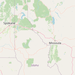
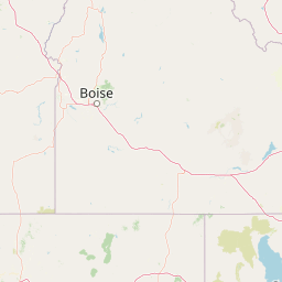
How far is Montpelier, ID from Coeur d'Alene, ID?
Fastest route
The distance between Montpelier, Idaho 83254 and Coeur d'Alene, Idaho is approximately 598 miles (962 kilometers). The estimated travel time is 9 hours and 36 minutes via I-90 W. Here are some tips and suggestions for your journey:
Directions
- 🚗 Head north on US-30 W/N 4th St toward Garfield St.
- 🛣️ Continue to follow US-30 W and merge onto I-15 N/US-30 W/US-91 N via the ramp to Inkom/Pocatello.
- 🚧 Take exit 143 for ID-33 toward Rexburg/Salmon.
- 🚙 Turn left onto ID-28 N/ID-33 W/E 1500 N and continue on ID-28 N.
- 🏞️ Follow US-93 N to I-90/E Sherman Ave in Kootenai County, Idaho.
- 🛣️ Take exit 15 from I-90 W.
- 🚗 Turn left onto I-90/E Sherman Ave and continue on E Sherman Ave.
Tips & Suggestions
- 📌 Tip: Plan for a break during the long drive to stay refreshed and alert.
- ⛽ Tip: Ensure your vehicle has enough fuel before starting the journey and consider refueling along the way if necessary.
- 🚧 Tip: Stay updated on road conditions and potential detours by checking local traffic reports or using a navigation app.
- 🍽️ Tip: Pack snacks and drinks for the trip to keep yourself energized.
- 📱 Tip: Keep your mobile phone fully charged and have a car charger available for emergencies.
- 🧴 Tip: Pack essential items such as a first aid kit, sunscreen, and hand sanitizer for a comfortable journey.
- 🌆 Tip: Enjoy the scenic views along the way, especially when passing through Idaho's beautiful landscapes.
Distance by Flight
Shortest distance between Montpelier and Coeur d'Alene is 456.55 miles (734.75 km).
Flight distance from Montpelier, ID to Coeur d'Alene, ID is 456.55 miles. Estimated flight time is 01 hours 13 minutes.
It takes 01 hours 06 minutes to travel from Montpelier to Coeur d'Alene with an airplane (average speed of 550 miles).


Driving distance
The driving distance from Montpelier, Idaho to Coeur d'Alene, Idaho is: 611.7 miles (984.43 km) by car.
Driving from Montpelier to Coeur d'Alene will take approximately 09 hours 27 minutes.

#1 Montpelier
City in Bear Lake County, Idaho, United States
| Population | 2538 |
|---|---|
| GPS Coordinates | 42°19'20"N 111°17'52"W |
| Latitude | 42.3221500 |
| Longitude | -111.2977000 |
| Altitude | 1823 |
| Country | United States |

#2 Coeur d'Alene
A city in Kootenai County, Idaho. It is located on Lake Coeur d'Alene in northern Idaho. Coeur d'Alene is known for its many parks and green spaces, its many historical sites, and its many attractions, such as the Coeur d'Alene Resort and the Coeur d'Alene Museum.
| Population | 52414 |
|---|---|
| GPS Coordinates | 47°40'40"N 116°46'50"W |
| Latitude | 47.6776800 |
| Longitude | -116.7804700 |
| Altitude | 667 |
| Country | United States |
Ending point in Coeur d'Alene: East Garden Avenue (-116.780472,47.677573)
Estimated Travel Time Between Montpelier and Coeur d'Alene
The distance between Montpelier and Coeur d'Alene is 984 km if you choose to drive by road. You can go 10 hours 56 minutes if you drive your car at an average speed of 90 kilometers / hour. For different choices, please review the avg. speed travel time table on the below.
Please keep in mind that there is a 1 hour time gap between Montpelier, ID and Coeur d'Alene, ID. The current time in Montpelier is 05:42:19, although it is 04:42:19 in Coeur d'Alene.
| Average Speed | Travel Time |
|---|---|
| 30 mph (48.3 km/h) | 20 hours 22 minutes |
| 40 mph (64.37 km/h) | 15 hours 17 minutes |
| 50 mph (80.47 km/h) | 12 hours 14 minutes |
| 60 mph (96.56 km/h) | 10 hours 11 minutes |
| 70 mph (112.65 km/h) | 08 hours 44 minutes |
| 75 mph (120.7 km/h) | 08 hours 09 minutes |
| 80 mph (128.75 km/h) | 07 hours 37 minutes |
Gas Consumption
A car with a fuel efficiency of 8.3 l/100 km will need 81.71 liters (21.58 gallon) of gas to cover the route between Montpelier and Coeur d'Alene.
The estimated cost of gas to go from Montpelier to Coeur d'Alene is $84.46 (diesel $100.91).
Idaho gas prices.
| Gasoline | Mid Grade | Premium | Diesel | |
|---|---|---|---|---|
| Gallon | $3.91 | $4.15 | $4.38 | $4.68 |
| Total | $84.46 | $89.51 | $94.61 | $100.91 |
Take a look at our Gas Cost Calculator feature. It will figure out how much it will cost to drive this particular distance.
The average gas price (in Idaho ) per gallon of daily gas for calculations is $3.913 (Diesel $4.675) /gallon. Last changed prices on July 30, 2025.
How did we calculate the distance?
The place names are translated into coordinates to approximate the distance between Montpelier and Coeur d'Alene (latitude and longitude). Cities, states, and countries each have their own regional center. The Haversine formula is used to measure the radius.


