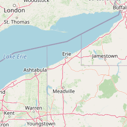
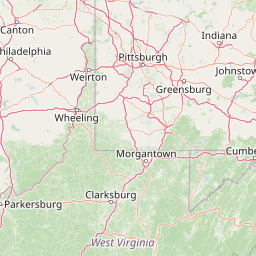
How far is Marion, PA from Erie, PA?
Fastest route
The distance from Marion, Pennsylvania 17202 to Erie, Pennsylvania is approximately 282 miles (453 kilometers). The suggested route includes using US-422 W and I-79 N, which has tolls. The estimated travel time is around 5 hours.
Directions
To get to Erie, Pennsylvania from Marion, Pennsylvania 17202, follow these directions:
-
Start by getting on I-70 W in Breezewood from US-30 W.
- Head northwest on Colorado St toward Front St.
- Turn left onto Social Island Rd.
- Continue straight onto Jack Rd.
- Turn left onto US-30 W/Lincoln Way W.
- Continue to follow US-30 W.
- Turn left onto the I-70 W ramp to I-76/Turnpike (Toll road).
-
Follow I-70 W/I-76 W, I-99 N/US-220 N, and US-22 W to Rowena Dr in Ebensburg. Take the exit toward Ebensburg/Loretto from US-22 W (Toll road).
- Take the exit onto I-70 W/I-76 W toward Pittsburgh (Toll road).
- Take exit 146 toward US-220 BUS N (Toll road).
- Use any lane to turn left onto US-220 BUS N.
- Turn left onto the I-99/US-220 ramp to US-30/Cumberland/Altoona.
- Keep right at the fork, follow signs for I-99 N/US-220 N/Altoona and merge onto I-99 N/US-220 N.
- Take exit 28 toward US-22 W.
- Keep left, follow signs for US-22 W/Ebensburg.
- Take the exit toward Ebensburg/Loretto.
- Keep right at the fork and merge onto Rowena Dr.
-
Continue on Rowena Dr. Drive to US-422 BUS W in Ebensburg.
- Continue to Fenelton.
- Use the right lane to keep left at the fork and continue toward US-422 BUS W.
- Continue onto US-422 BUS W.
-
Take the ramp onto US-422 W.
- Use the right lane to take the ramp onto US-422 W.
-
Take I-79 N to W Bayfront Pkwy in Erie.
- Continue straight to stay on US-422 W.
- Use the left lane to merge onto I-79 N toward Erie.
-
Continue on W Bayfront Pkwy. Drive to State St.
- Continue onto W Bayfront Pkwy (signs for Bayfront).
You will reach your destination in Erie, Pennsylvania.
Tips & Suggestions
- 🛣️ Use US-422 W and I-79 N for a quicker route with tolls.
- ⛽ Make sure to fuel up before starting your journey.
- 🚗 Consider checking for any traffic updates before leaving.
- 🚧 Be aware of any road closures or construction along the way.
- 🍽️ Plan for meal stops or pack snacks for the journey.
- 🚫 Avoid rush hours, if possible, to minimize traffic delays.
- 🚙 Take breaks during the drive to stretch and rest.
- 📱 Use a navigation app or GPS device for real-time directions.
- 🌆 Enjoy the scenic views during your road trip.
Distance by Flight
Shortest distance between Marion and Erie is 200.41 miles (322.53 km).
Flight distance from Marion, PA to Erie, PA is 200.41 miles. Estimated flight time is 00 hours 34 minutes.
It takes 00 hours 31 minutes to travel from Marion to Erie with an airplane (average speed of 550 miles).


Driving distance
The driving distance from Marion, Pennsylvania to Erie, Pennsylvania is: 286.68 miles (461.37 km) by car.
Driving from Marion to Erie will take approximately 04 hours 45 minutes.
#1 Marion
Census-designated place in Pennsylvania, United States
| Population | 1269 |
|---|---|
| GPS Coordinates | 39°51'26"N 77°41'43"W |
| Latitude | 39.8573100 |
| Longitude | -77.6952700 |
| Altitude | 193 |
| Country | United States |

#2 Erie
The second most populous city in Pennsylvania. It is located on the shore of Lake Erie in northwestern Pennsylvania. Erie is known for its many parks and green spaces, its many historical sites, and its many attractions, such as the Erie Maritime Museum and the Erie Art Museum.
| Population | 95077 |
|---|---|
| GPS Coordinates | 42°7'45"N 80°5'6"W |
| Latitude | 42.1292200 |
| Longitude | -80.0850600 |
| Altitude | 199 |
| Country | United States |
Ending point in Erie: State Street (-80.085094,42.129207)
Estimated Travel Time Between Marion and Erie
The distance between Marion and Erie is 461 km if you choose to drive by road. You can go 05 hours 07 minutes if you drive your car at an average speed of 90 kilometers / hour. For different choices, please review the avg. speed travel time table on the below.
There is no time difference between Marion and Erie. The current time is 20:14:57.
| Average Speed | Travel Time |
|---|---|
| 30 mph (48.3 km/h) | 09 hours 33 minutes |
| 40 mph (64.37 km/h) | 07 hours 10 minutes |
| 50 mph (80.47 km/h) | 05 hours 44 minutes |
| 60 mph (96.56 km/h) | 04 hours 46 minutes |
| 70 mph (112.65 km/h) | 04 hours 05 minutes |
| 75 mph (120.7 km/h) | 03 hours 49 minutes |
| 80 mph (128.75 km/h) | 03 hours 34 minutes |
Gas Consumption
A car with a fuel efficiency of 8.3 l/100 km will need 38.29 liters (10.12 gallon) of gas to cover the route between Marion and Erie.
The estimated cost of gas to go from Marion to Erie is $37.6 (diesel $48.22).
Pennsylvania gas prices.
| Gasoline | Mid Grade | Premium | Diesel | |
|---|---|---|---|---|
| Gallon | $3.72 | $4.12 | $4.44 | $4.77 |
| Total | $37.6 | $41.71 | $44.94 | $48.22 |
Take a look at our Gas Cost Calculator feature. It will figure out how much it will cost to drive this particular distance.
The average gas price (in Pennsylvania ) per gallon of daily gas for calculations is $3.717 (Diesel $4.767) /gallon. Last changed prices on June 22, 2025.
How did we calculate the distance?
The place names are translated into coordinates to approximate the distance between Marion and Erie (latitude and longitude). Cities, states, and countries each have their own regional center. The Haversine formula is used to measure the radius.


