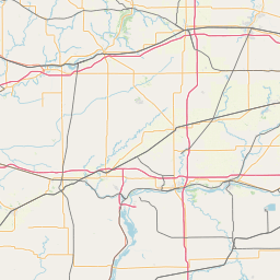
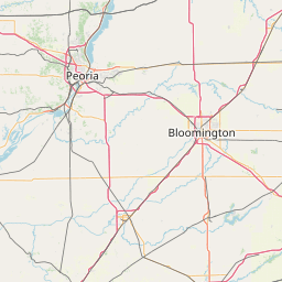
How far is Macomb, IL from Cicero, IL?
Fastest route
This trip from Macomb, Illinois (ZIP code 61455) to Cicero, Illinois involves a distance of approximately 245 miles (394 kilometers). The directions include taking I-474 E/US-24 E in Peoria, then merging onto I-74 E and later onto I-55 N toward Chicago. The endpoint is S Central Ave in Forest View, Cicero.
Directions
- Start by heading south on N Lafayette St/West Side Square toward W Jackson St.
- Continue to follow West Side Square, then turn left onto S Side Square.
- Turn left onto East Side Square, and then turn right at the 1st cross street onto E Jackson.
- Continue onto US Hwy 136 E, and then keep straight to stay on IL-95 E.
- Turn left onto IL-97 E/N State Rte 97, and then turn right onto E Main St.
- Turn left at the 2nd cross street onto N 9th St, and then turn right onto E Jackson St.
- E Jackson St will turn left and become Co Rd 5/N 10th St. Continue to follow Co Rd 5 and then onto County Hwy 5 Ct/W Hickory St.
- Turn right onto S Main St, and then use the right lane to merge onto I-474 E/US-24 E via the ramp to Bloomington.
- Follow I-474 E and take the Interstate 74 E exit toward Indianapolis.
- Use the left lane to take exit 127 to merge onto I-55 N toward Chicago.
- Take exit 285 for Central Ave.
Tips & Suggestions
- 🚗 Plan for a long journey, as the trip is approximately 245 miles (394 kilometers) long.
- 🛣️ Make sure to follow the directions carefully to avoid getting lost along the way.
- ⛽ Don't forget to fill up your gas tank before hitting the road to avoid any inconvenience.
- 🍴 Consider packing some snacks and drinks for the drive, as it may take several hours to reach your destination.
- 🚓 Be mindful of speed limits and traffic rules to ensure a safe and smooth trip.
- 🚧 Check for any potential road closures or construction before starting your journey to avoid delays.
- 📱 Keep your phone charged and have a car charger handy in case you need to use navigation or make emergency calls.
Distance by Flight
Shortest distance between Macomb and Cicero is 179.48 miles (288.85 km).
Flight distance from Macomb, IL to Cicero, IL is 179.48 miles. Estimated flight time is 00 hours 28 minutes.
It takes 00 hours 26 minutes to travel from Macomb to Cicero with an airplane (average speed of 550 miles).


Driving distance
The driving distance from Macomb, Illinois to Cicero, Illinois is: 239.01 miles (384.65 km) by car.
Driving from Macomb to Cicero will take approximately 03 hours 53 minutes.

#1 Macomb
City in and the county seat of McDonough County, Illinois, United States
| Population | 17206 |
|---|---|
| GPS Coordinates | 40°27'33"N 90°40'18"W |
| Latitude | 40.4592100 |
| Longitude | -90.6718000 |
| Altitude | 215 |
| Country | United States |

#2 Cicero
Town in Illinois
| Population | 79727 |
|---|---|
| GPS Coordinates | 41°50'44"N 87°45'14"W |
| Latitude | 41.8455900 |
| Longitude | -87.7539400 |
| Altitude | 184 |
| Country | United States |
Ending point in Cicero: South Laramie Avenue (-87.753926,41.84559)
Estimated Travel Time Between Macomb and Cicero
The distance between Macomb and Cicero is 385 km if you choose to drive by road. You can go 04 hours 16 minutes if you drive your car at an average speed of 90 kilometers / hour. For different choices, please review the avg. speed travel time table on the below.
There is no time difference between Macomb and Cicero. The current time is 09:28:29.
| Average Speed | Travel Time |
|---|---|
| 30 mph (48.3 km/h) | 07 hours 57 minutes |
| 40 mph (64.37 km/h) | 05 hours 58 minutes |
| 50 mph (80.47 km/h) | 04 hours 46 minutes |
| 60 mph (96.56 km/h) | 03 hours 59 minutes |
| 70 mph (112.65 km/h) | 03 hours 24 minutes |
| 75 mph (120.7 km/h) | 03 hours 11 minutes |
| 80 mph (128.75 km/h) | 02 hours 58 minutes |
Gas Consumption
A car with a fuel efficiency of 8.3 l/100 km will need 31.93 liters (8.43 gallon) of gas to cover the route between Macomb and Cicero.
The estimated cost of gas to go from Macomb to Cicero is $30.42 (diesel $36.27).
Illinois gas prices.
| Gasoline | Mid Grade | Premium | Diesel | |
|---|---|---|---|---|
| Gallon | $3.61 | $4.11 | $4.55 | $4.3 |
| Total | $30.42 | $34.68 | $38.38 | $36.27 |
Take a look at our Gas Cost Calculator feature. It will figure out how much it will cost to drive this particular distance.
The average gas price (in Illinois ) per gallon of daily gas for calculations is $3.607 (Diesel $4.300) /gallon. Last changed prices on March 26, 2025.
How did we calculate the distance?
The place names are translated into coordinates to approximate the distance between Macomb and Cicero (latitude and longitude). Cities, states, and countries each have their own regional center. The Haversine formula is used to measure the radius.


