How far is Keyser, WV from Beckley, WV?
Fastest route
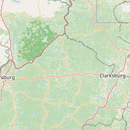
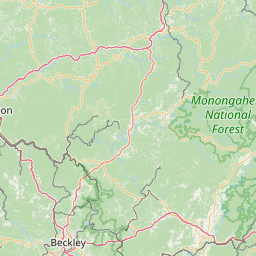
The route from Keyser, West Virginia 26726, USA to Beckley, West Virginia 25801, USA is approximately 213 miles long and takes about 4 hours and 6 minutes via WV-92 S. The directions involve several turns and merges onto different roads.
Directions
- Head southeast on Armstrong St toward N Main St.
- Turn right onto N Water St and continue onto Harley O Staggers Dr/Harley O. Staggers, Senior Dr/New Creek Dr.
- Continue to WV-93 W and then make a slight left to stay on WV-93 W.
- Turn right onto Jordan Run Rd, then right onto WV-28 S/WV-55 W, and continue to follow WV-28 S.
- Turn right to stay on WV-28 S and follow it until you reach WV-92 S.
- Turn left onto WV-28 S/WV-92 S and continue to follow WV-92 S.
- Turn right to stay on WV-92 S and then turn right onto US-60 W/E Main St. Continue to follow US-60 W.
- Turn left onto Harts Run Rd and then right to merge onto I-64 W toward Beckley.
- Take exit 124 toward US-19/Beckley/Eisenhower Drive and continue onto Joe L Smith Dr.
- Turn left at Brookshire Ln, then turn right onto S Eisenhower Dr.
- Drive to S Kanawha St and turn right onto S Kanawha St. You will reach Beckley, West Virginia 25801, USA.
Tips & Suggestions
- 🚗 Make sure to follow the specified road names and directions to stay on the correct route.
- ⛽ Plan your trip ahead and consider refueling if needed before embarking on the journey.
- 🚧 Be mindful of any road closures, construction, or detours that may affect the route.
- 🗺️ Carry a map or use a GPS navigation system to assist you during the trip.
- 🕒 Take into account traffic conditions and potential delays, especially during peak hours.
- 📱 Keep your mobile phone charged and accessible in case you need to contact assistance or access navigation apps.
- 🚦 Observe traffic laws, signs, and signals for a safe and smooth journey.
Distance by Flight
Shortest distance between Keyser and Beckley is 165.79 miles (266.82 km).
Flight distance from Keyser, WV to Beckley, WV is 165.79 miles. Estimated flight time is 00 hours 27 minutes.
It takes 00 hours 24 minutes to travel from Keyser to Beckley with an airplane (average speed of 550 miles).


Driving distance
The driving distance from Keyser, West Virginia to Beckley, West Virginia is: 226.35 miles (364.28 km) by car.
Driving from Keyser to Beckley will take approximately 04 hours 09 minutes.

#1 Keyser
City in West Virginia, United States
| Population | 4863 |
|---|---|
| GPS Coordinates | 39°26'27"N 78°58'26"W |
| Latitude | 39.4409300 |
| Longitude | -78.9739200 |
| Altitude | 246 |
| Country | United States |

#2 Beckley
City in and county seat of Raleigh County, West Virginia, United States
| Population | 15805 |
|---|---|
| GPS Coordinates | 37°46'41"N 81°11'17"W |
| Latitude | 37.7781700 |
| Longitude | -81.1881600 |
| Altitude | 738 |
| Country | United States |
Ending point in Beckley: North Kanawha Street (-81.188043,37.778209)
Estimated Travel Time Between Keyser and Beckley
The distance between Keyser and Beckley is 364 km if you choose to drive by road. You can go 04 hours 02 minutes if you drive your car at an average speed of 90 kilometers / hour. For different choices, please review the avg. speed travel time table on the below.
There is no time difference between Keyser and Beckley. The current time is 16:46:33.
| Average Speed | Travel Time |
|---|---|
| 30 mph (48.3 km/h) | 07 hours 32 minutes |
| 40 mph (64.37 km/h) | 05 hours 39 minutes |
| 50 mph (80.47 km/h) | 04 hours 31 minutes |
| 60 mph (96.56 km/h) | 03 hours 46 minutes |
| 70 mph (112.65 km/h) | 03 hours 14 minutes |
| 75 mph (120.7 km/h) | 03 hours 01 minutes |
| 80 mph (128.75 km/h) | 02 hours 49 minutes |
Gas Consumption
A car with a fuel efficiency of 8.3 l/100 km will need 30.24 liters (7.99 gallon) of gas to cover the route between Keyser and Beckley.
The estimated cost of gas to go from Keyser to Beckley is $27.02 (diesel $33.85).
West Virginia gas prices.
| Gasoline | Mid Grade | Premium | Diesel | |
|---|---|---|---|---|
| Gallon | $3.38 | $3.73 | $4.07 | $4.24 |
| Total | $27.02 | $29.78 | $32.52 | $33.85 |
Take a look at our Gas Cost Calculator feature. It will figure out how much it will cost to drive this particular distance.
The average gas price (in West Virginia ) per gallon of daily gas for calculations is $3.383 (Diesel $4.238) /gallon. Last changed prices on June 30, 2025.
How did we calculate the distance?
The place names are translated into coordinates to approximate the distance between Keyser and Beckley (latitude and longitude). Cities, states, and countries each have their own regional center. The Haversine formula is used to measure the radius.


