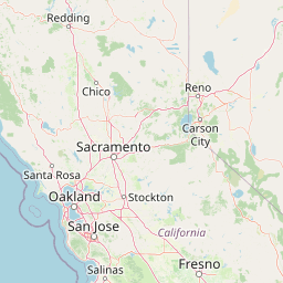
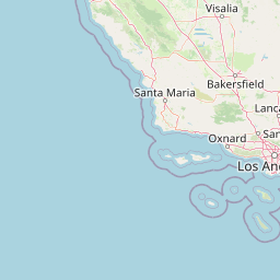
How far is Inglewood, CA from Oakland, CA?
Fastest route
The route from Inglewood, California, USA to Oakland, California, USA is approximately 374 miles and takes about 5 hours and 42 minutes. The suggested route is via I-5 N, and here are some tips and suggestions to follow.
Directions
- Get on I-405 N: Head west on Manchester Ave toward S La Brea Ave, then turn right to merge onto I-405 N.
- Take I-5 N and I-580 W to 6th St in Oakland: Keep right at the fork to continue on Interstate 5 Truck Rte N. Use the left 2 lanes to merge onto I-5 N toward Sacramento. Keep right at the fork to stay on I-5 N, following signs for San Francisco/Sacramento. Keep left at the fork to continue on I-580 W, following signs for Tracy/San Francisco.
- Keep left at the fork to continue on I-238 N, following signs for I-880.
- Use the left 2 lanes to take the exit toward I-880 N.
- Keep left, following signs for I-880 N/Oakland, and merge onto I-880 N.
- Take exit 41B toward Broadway/Downtown.
- Drive to Broadway.
Tips & Suggestions
- 🚗 Make sure to check the current traffic conditions and adjust your departure time accordingly.
- ⛽ Plan for fuel stops along the way, especially if your vehicle has a limited range.
- 📱 Use a GPS navigation system or a map app on your phone to stay on track.
- 🚧 Be aware of construction or road closures that may affect the route. Stay updated with real-time traffic information.
- 🍴 Consider stopping for meals or snacks at rest areas or restaurants along the way.
- 📝 Take note of landmarks or notable points of interest for reference during the journey.
- 🚘 Ensure your vehicle is in good condition, including checking tire pressure and fluid levels, before embarking on a long drive.
Distance by Flight
Shortest distance between Inglewood and Oakland is 344.29 miles (554.09 km).
Flight distance from Inglewood, CA to Oakland, CA is 344.29 miles. Estimated flight time is 00 hours 45 minutes.
It takes 00 hours 40 minutes to travel from Inglewood to Oakland with an airplane (average speed of 550 miles).


Driving distance
The driving distance from Inglewood, California to Oakland, California is: 374.44 miles (602.6 km) by car.
Driving from Inglewood to Oakland will take approximately 05 hours 52 minutes.

#1 Inglewood
The most populous city in Los Angeles County, California. It is located in the southwestern part of the county. Inglewood is known for its many sports teams, its many parks and green spaces, and its many attractions, such as the Forum and the SoFi Stadium.
| Population | 107203 |
|---|---|
| GPS Coordinates | 33°57'42"N 118°21'11"W |
| Latitude | 33.9616800 |
| Longitude | -118.3531300 |
| Altitude | 40 |
| Country | United States |

#2 Oakland
The third most populous city in California, Oakland is a major center for business, manufacturing, and culture. The city is home to the Oakland International Airport, the Oakland Raiders, and the Golden State Warriors. Oakland is also home to a number of universities, such as the University of California, Berkeley and the Mills College.
| Population | 424891 |
|---|---|
| GPS Coordinates | 37°48'16"N 122°16'15"W |
| Latitude | 37.8043700 |
| Longitude | -122.2708000 |
| Altitude | 13 |
| Country | United States |
Ending point in Oakland: 14th Street (-122.270903,37.804207)
Estimated Travel Time Between Inglewood and Oakland
The distance between Inglewood and Oakland is 603 km if you choose to drive by road. You can go 06 hours 41 minutes if you drive your car at an average speed of 90 kilometers / hour. For different choices, please review the avg. speed travel time table on the below.
There is no time difference between Inglewood and Oakland. The current time is 19:00:01.
| Average Speed | Travel Time |
|---|---|
| 30 mph (48.3 km/h) | 12 hours 28 minutes |
| 40 mph (64.37 km/h) | 09 hours 21 minutes |
| 50 mph (80.47 km/h) | 07 hours 29 minutes |
| 60 mph (96.56 km/h) | 06 hours 14 minutes |
| 70 mph (112.65 km/h) | 05 hours 20 minutes |
| 75 mph (120.7 km/h) | 04 hours 59 minutes |
| 80 mph (128.75 km/h) | 04 hours 40 minutes |
Gas Consumption
A car with a fuel efficiency of 8.3 l/100 km will need 50.02 liters (13.21 gallon) of gas to cover the route between Inglewood and Oakland.
The estimated cost of gas to go from Inglewood to Oakland is $70.75 (diesel $81.87).
California gas prices.
| Gasoline | Mid Grade | Premium | Diesel | |
|---|---|---|---|---|
| Gallon | $5.36 | $5.59 | $5.74 | $6.2 |
| Total | $70.75 | $73.89 | $75.88 | $81.87 |
Take a look at our Gas Cost Calculator feature. It will figure out how much it will cost to drive this particular distance.
The average gas price (in California ) per gallon of daily gas for calculations is $5.355 (Diesel $6.196) /gallon. Last changed prices on July 28, 2025.
How did we calculate the distance?
The place names are translated into coordinates to approximate the distance between Inglewood and Oakland (latitude and longitude). Cities, states, and countries each have their own regional center. The Haversine formula is used to measure the radius.


