How far is Glenn Heights, TX from Laredo, TX?
Fastest route
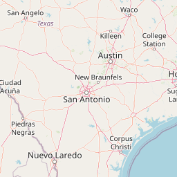
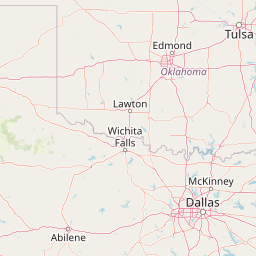
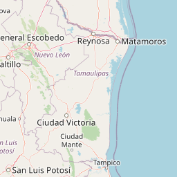
The distance between Glenn Heights, Texas 75154 and Laredo, Texas is approximately 416 miles (669 kilometers). The estimated travel time is 6 hours and 27 minutes. Here are the directions:
Directions
- Start your journey on E Bear Creek Rd in Glenn Heights, Texas.
- Head south on E Bear Creek Rd toward W Bear Creek Rd.
- Turn right onto S Beckley Rd/S Interstate 35 East Service Rd S.
- Continue straight and pass by Jack in the Box on your right.
- Use the left lane to take the ramp onto I-35E S.
- Continue on I-35E S for approximately 52.9 miles.
- Keep left at the fork to stay on I-35 S.
- Continue to follow I-35 S for about 363 miles.
- Keep left at the fork to stay on I-35 S, following signs for Laredo.
- Merge onto Santa Ursula Ave.
- Turn right to stay on Santa Ursula Ave.
- Turn right onto Iturbide St.
- You have reached your destination in Laredo, Texas.
Tips & Suggestions
- 🚗 Plan for rest stops and refueling along the way to ensure a comfortable journey.
- ⛽ Check your vehicle's fuel level before starting the trip and fill up if necessary.
- 🍴 Pack some snacks and water for the journey to stay refreshed.
- 📱 Use a navigation app or GPS device to help you stay on the right track.
- 🚧 Be aware of any road construction or traffic updates that may affect your route.
- 📅 Consider checking the weather forecast for your travel dates to prepare accordingly.
- 🚘 Observe speed limits and follow traffic regulations for a safe and enjoyable trip.
Distance by Flight
Shortest distance between Glenn Heights and Laredo is 382.74 miles (615.96 km).
Flight distance from Glenn Heights, TX to Laredo, TX is 382.74 miles. Estimated flight time is 00 hours 52 minutes.
It takes 00 hours 47 minutes to travel from Glenn Heights to Laredo with an airplane (average speed of 550 miles).


Driving distance
The driving distance from Glenn Heights, Texas to Laredo, Texas is: 432.75 miles (696.45 km) by car.
Driving from Glenn Heights to Laredo will take approximately 06 hours 33 minutes.

#1 Glenn Heights
City in Dallas County, Texas, United States
| Population | 14333 |
|---|---|
| GPS Coordinates | 32°32'55"N 96°51'24"W |
| Latitude | 32.5487500 |
| Longitude | -96.8566700 |
| Altitude | 206 |
| Country | United States |

#2 Laredo
The third most populous city in Texas and the center of the Laredo metropolitan area. It is located on the Rio Grande River in southern Texas. Laredo is known for its Mexican culture, its many border crossings, and its many attractions, such as the Laredo Children's Museum and the Laredo Museum of Art.
| Population | 263640 |
|---|---|
| GPS Coordinates | 27°30'23"N 99°30'27"W |
| Latitude | 27.5064100 |
| Longitude | -99.5075400 |
| Altitude | 126 |
| Country | United States |
Ending point in Laredo: Matamoros Street (-99.507507,27.506385)
Estimated Travel Time Between Glenn Heights and Laredo
The distance between Glenn Heights and Laredo is 696 km if you choose to drive by road. You can go 07 hours 44 minutes if you drive your car at an average speed of 90 kilometers / hour. For different choices, please review the avg. speed travel time table on the below.
There is no time difference between Glenn Heights and Laredo. The current time is 12:01:19.
| Average Speed | Travel Time |
|---|---|
| 30 mph (48.3 km/h) | 14 hours 25 minutes |
| 40 mph (64.37 km/h) | 10 hours 49 minutes |
| 50 mph (80.47 km/h) | 08 hours 39 minutes |
| 60 mph (96.56 km/h) | 07 hours 12 minutes |
| 70 mph (112.65 km/h) | 06 hours 10 minutes |
| 75 mph (120.7 km/h) | 05 hours 46 minutes |
| 80 mph (128.75 km/h) | 05 hours 23 minutes |
Gas Consumption
A car with a fuel efficiency of 8.3 l/100 km will need 57.81 liters (15.27 gallon) of gas to cover the route between Glenn Heights and Laredo.
The estimated cost of gas to go from Glenn Heights to Laredo is $46.13 (diesel $60.98).
Texas gas prices.
| Gasoline | Mid Grade | Premium | Diesel | |
|---|---|---|---|---|
| Gallon | $3.02 | $3.45 | $3.78 | $3.99 |
| Total | $46.13 | $52.61 | $57.68 | $60.98 |
Take a look at our Gas Cost Calculator feature. It will figure out how much it will cost to drive this particular distance.
The average gas price (in Texas ) per gallon of daily gas for calculations is $3.021 (Diesel $3.993) /gallon. Last changed prices on August 01, 2025.
How did we calculate the distance?
The place names are translated into coordinates to approximate the distance between Glenn Heights and Laredo (latitude and longitude). Cities, states, and countries each have their own regional center. The Haversine formula is used to measure the radius.


