How far is Gaylord, MI from Macomb, MI?
Distance by Flight
Shortest distance between Gaylord and Macomb is 182.05 miles (292.98 km).
Flight distance from Gaylord, MI to Macomb, MI is 182.05 miles. Estimated flight time is 00 hours 27 minutes.
It takes 00 hours 24 minutes to travel from Gaylord to Macomb with an airplane (average speed of 550 miles).


Driving distance
The driving distance from Gaylord, Michigan to Macomb, Michigan is: 224.08 miles (360.63 km) by car.
Driving from Gaylord to Macomb will take approximately 03 hours 23 minutes.

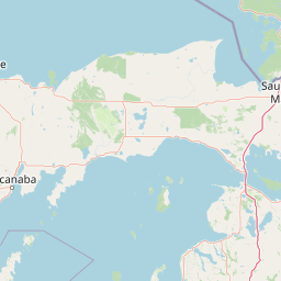
#1 Gaylord
City in Michigan, United States
| Population | 3665 |
|---|---|
| GPS Coordinates | 45°1'39"N 84°40'29"W |
| Latitude | 45.0275100 |
| Longitude | -84.6747500 |
| Altitude | 411 |
| Country | United States |

#2 Macomb
A city in Macomb County, Michigan. It is located in the northern part of the county. Macomb is known for its many parks and green spaces, its many historical sites, and its many attractions, such as the Macomb Public Library and the Macomb Historic Village.
| Population | 92131 |
|---|---|
| GPS Coordinates | 42°42'3"N 82°57'33"W |
| Latitude | 42.7008700 |
| Longitude | -82.9590900 |
| Altitude | 191 |
| Country | United States |
Ending point in Macomb: Romeo Plank Road (-82.958996,42.700872)
Estimated Travel Time Between Gaylord and Macomb
The distance between Gaylord and Macomb is 361 km if you choose to drive by road. You can go 04 hours 00 minutes if you drive your car at an average speed of 90 kilometers / hour. For different choices, please review the avg. speed travel time table on the below.
There is no time difference between Gaylord and Macomb. The current time is 03:11:50.
| Average Speed | Travel Time |
|---|---|
| 30 mph (48.3 km/h) | 07 hours 27 minutes |
| 40 mph (64.37 km/h) | 05 hours 36 minutes |
| 50 mph (80.47 km/h) | 04 hours 28 minutes |
| 60 mph (96.56 km/h) | 03 hours 44 minutes |
| 70 mph (112.65 km/h) | 03 hours 12 minutes |
| 75 mph (120.7 km/h) | 02 hours 59 minutes |
| 80 mph (128.75 km/h) | 02 hours 47 minutes |
Gas Consumption
A car with a fuel efficiency of 8.3 l/100 km will need 29.93 liters (7.91 gallon) of gas to cover the route between Gaylord and Macomb.
The estimated cost of gas to go from Gaylord to Macomb is $26.53 (diesel $34.05).
Michigan gas prices.
| Gasoline | Mid Grade | Premium | Diesel | |
|---|---|---|---|---|
| Gallon | $3.36 | $3.86 | $4.35 | $4.31 |
| Total | $26.53 | $30.48 | $34.4 | $34.05 |
Take a look at our Gas Cost Calculator feature. It will figure out how much it will cost to drive this particular distance.
The average gas price (in Michigan ) per gallon of daily gas for calculations is $3.355 (Diesel $4.306) /gallon. Last changed prices on July 06, 2025.
How did we calculate the distance?
The place names are translated into coordinates to approximate the distance between Gaylord and Macomb (latitude and longitude). Cities, states, and countries each have their own regional center. The Haversine formula is used to measure the radius.


