How far is East Hampton, CT from Milford, CT?
Fastest route
The distance from East Hampton, Connecticut to Milford, Connecticut is approximately 45.4 miles (73.1 kilometers). The estimated travel time is 59 minutes via CT-66 W and CT-15 S.
Directions
- Head southeast on Main St.
- Turn right at the 1st cross street onto Barton Hill Rd.
- Use any lane to turn left onto Main St.
- Turn right onto CT-66 W/Washington St.
- Continue to follow CT-66 W, passing by Wells Fargo Bank on the left.
- Take exit 1B on the left to merge onto I-91 S toward CT-15 S/New Haven/W Cross Pkwy.
- Follow CT-15 S to Meadow St in Milford. Take exit 1B from Milford Pkwy.
- Take exit 54 toward I-95/US 1/Milford.
- Continue onto Milford Pkwy.
- Take exit 1B toward US-1 S.
- Turn right onto Meadow St.
- Turn left onto Boston Post Rd.
Tips & Suggestions
- 🚗 Plan ahead and check for traffic conditions to avoid delays.
- ⛽ Make sure to have enough fuel for the journey, especially if it's a long drive.
- 🚧 Follow the road signs and pay attention to exit numbers to stay on the correct route.
- 🍔 Consider packing some snacks and drinks for the trip, especially if there are no convenient stops along the way.
- 📱 Keep a GPS or a navigation app handy to help you navigate through the route.
- 🕑 Allow some extra time for unforeseen delays or rest breaks during the journey.
- 🛣️ Enjoy the scenic drive and stay safe on the road!
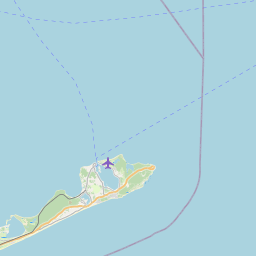
Distance by Flight
Shortest distance between East Hampton and Milford is 37.7 miles (60.67 km).
Flight distance from East Hampton, CT to Milford, CT is 37.7 miles. Estimated flight time is 00 hours 06 minutes.


Driving distance
The driving distance from East Hampton, Connecticut to Milford, Connecticut is: 52.71 miles (84.84 km) by car.
Driving from East Hampton to Milford will take approximately 00 hours 59 minutes.

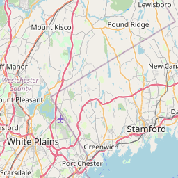
#1 East Hampton
Town in Middlesex County, Connecticut, United States
| Population | 12747 |
|---|---|
| GPS Coordinates | 41°34'33"N 72°30'9"W |
| Latitude | 41.5759300 |
| Longitude | -72.5025900 |
| Altitude | 122 |
| Country | United States |

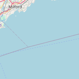
#2 Milford
A city in New Haven County, Connecticut. It is located on Long Island Sound in southeastern Connecticut. Milford is known for its many parks and green spaces, its many historical sites, and its many attractions, such as the Milford Historical Society and the Milford Arts Council.
| Population | 53259 |
|---|---|
| GPS Coordinates | 41°13'20"N 73°3'23"W |
| Latitude | 41.2223200 |
| Longitude | -73.0565000 |
| Altitude | 8 |
| Country | United States |
Ending point in Milford: Factory Lane (-73.056608,41.222268)
Estimated Travel Time Between East Hampton and Milford
The distance between East Hampton and Milford is 85 km if you choose to drive by road. You can go 00 hours 56 minutes if you drive your car at an average speed of 90 kilometers / hour. For different choices, please review the avg. speed travel time table on the below.
There is no time difference between East Hampton and Milford. The current time is 10:05:43.
| Average Speed | Travel Time |
|---|---|
| 30 mph (48.3 km/h) | 01 hours 45 minutes |
| 40 mph (64.37 km/h) | 01 hours 19 minutes |
| 50 mph (80.47 km/h) | 01 hours 03 minutes |
| 60 mph (96.56 km/h) | 00 hours 52 minutes |
| 70 mph (112.65 km/h) | 00 hours 45 minutes |
| 75 mph (120.7 km/h) | 00 hours 42 minutes |
| 80 mph (128.75 km/h) | 00 hours 39 minutes |
Gas Consumption
A car with a fuel efficiency of 8.3 l/100 km will need 7.04 liters (1.86 gallon) of gas to cover the route between East Hampton and Milford.
The estimated cost of gas to go from East Hampton to Milford is $6.72 (diesel $8.51).
Connecticut gas prices.
| Gasoline | Mid Grade | Premium | Diesel | |
|---|---|---|---|---|
| Gallon | $3.61 | $4.19 | $4.59 | $4.58 |
| Total | $6.72 | $7.79 | $8.54 | $8.51 |
Take a look at our Gas Cost Calculator feature. It will figure out how much it will cost to drive this particular distance.
The average gas price (in Connecticut ) per gallon of daily gas for calculations is $3.611 (Diesel $4.575) /gallon. Last changed prices on July 06, 2025.
How did we calculate the distance?
The place names are translated into coordinates to approximate the distance between East Hampton and Milford (latitude and longitude). Cities, states, and countries each have their own regional center. The Haversine formula is used to measure the radius.


