How far is Doylestown, PA from Harrisburg, PA?
Fastest route
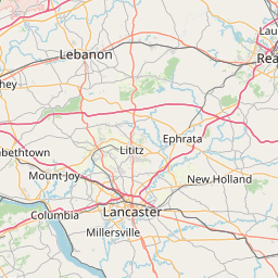
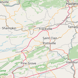
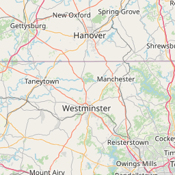
The route from Doylestown, Pennsylvania 18901 to Harrisburg, Pennsylvania is approximately 115 miles and takes about 1 hour and 53 minutes via I-76 W. The route includes tolls.
Directions
To get from Doylestown to Harrisburg, follow these directions:
- Start by heading southwest on E State St toward S Main St.
- Turn left at the 1st cross street onto S Main St.
- Continue onto S Easton Rd.
- Use the right lane to take the ramp to PA-611 S/S Easton Rd.
- Continue onto PA-611 S/S Easton Rd.
- Use the right lane to merge onto I-276 W via the ramp to Harrisburg (Toll road).
- Follow I-276 W and I-76 W to Harrisburg. Take exit 43 from I-83 (Toll road).
- Keep left to stay on I-283 N (Toll road).
- Use the left lane to take exit 3A toward I-83 S/Harrisburg.
- Take exit 43 toward Capitol/2nd St.
- Use the left lane to keep left at the fork and continue toward S 2nd St.
- Continue on S 2nd St.
- Drive to N 6th St.
- Continue straight onto S 2nd St.
- Turn right onto Forster St.
- Turn left onto Commonwealth Ave.
- Arrive at Harrisburg, Pennsylvania.
Tips & Suggestions
- 🚗 Make sure to plan your trip ahead of time and check for any traffic conditions or construction updates.
- 💰 Keep in mind that this route includes tolls, so be prepared with cash or electronic toll payment methods.
- 📱 Consider using a navigation app or GPS device to help guide you along the way.
- ⛽ It's a good idea to have a full tank of gas before embarking on a long drive.
- 📅 Allow some extra time for unexpected delays or rest stops during the journey.
- 🍽 If you're hungry, look for nearby restaurants or eateries along the route for a quick meal.
- 🛏️ If you plan to stay overnight in Harrisburg, make accommodation arrangements in advance.
Distance by Flight
Shortest distance between Doylestown and Harrisburg is 92.5 miles (148.86 km).
Flight distance from Doylestown, PA to Harrisburg, PA is 92.5 miles. Estimated flight time is 00 hours 13 minutes.
It takes 00 hours 12 minutes to travel from Doylestown to Harrisburg with an airplane (average speed of 550 miles).


Driving distance
The driving distance from Doylestown, Pennsylvania to Harrisburg, Pennsylvania is: 115.15 miles (185.32 km) by car.
Driving from Doylestown to Harrisburg will take approximately 02 hours 01 minutes.

#1 Doylestown
Borough and county seat of Bucks County, Pennsylvania in the United States
| Population | 8248 |
|---|---|
| GPS Coordinates | 40°18'36"N 75°7'48"W |
| Latitude | 40.3101100 |
| Longitude | -75.1298900 |
| Altitude | 129 |
| Country | United States |

#2 Harrisburg
The capital of Pennsylvania. It is located on the Susquehanna River in the central part of the state. Harrisburg is known for its many parks and green spaces, its many historical sites, and its many attractions, such as the State Capitol Building and the Harrisburg Symphony Orchestra.
| Population | 49322 |
|---|---|
| GPS Coordinates | 40°16'25"N 76°53'4"W |
| Latitude | 40.2737000 |
| Longitude | -76.8844200 |
| Altitude | 101 |
| Country | United States |
Ending point in Harrisburg: North 7th Street (-76.884584,40.273641)
Estimated Travel Time Between Doylestown and Harrisburg
The distance between Doylestown and Harrisburg is 185 km if you choose to drive by road. You can go 02 hours 03 minutes if you drive your car at an average speed of 90 kilometers / hour. For different choices, please review the avg. speed travel time table on the below.
There is no time difference between Doylestown and Harrisburg. The current time is 16:05:54.
| Average Speed | Travel Time |
|---|---|
| 30 mph (48.3 km/h) | 03 hours 50 minutes |
| 40 mph (64.37 km/h) | 02 hours 52 minutes |
| 50 mph (80.47 km/h) | 02 hours 18 minutes |
| 60 mph (96.56 km/h) | 01 hours 55 minutes |
| 70 mph (112.65 km/h) | 01 hours 38 minutes |
| 75 mph (120.7 km/h) | 01 hours 32 minutes |
| 80 mph (128.75 km/h) | 01 hours 26 minutes |
Gas Consumption
A car with a fuel efficiency of 8.3 l/100 km will need 15.38 liters (4.06 gallon) of gas to cover the route between Doylestown and Harrisburg.
The estimated cost of gas to go from Doylestown to Harrisburg is $15.1 (diesel $19.37).
Pennsylvania gas prices.
| Gasoline | Mid Grade | Premium | Diesel | |
|---|---|---|---|---|
| Gallon | $3.72 | $4.12 | $4.44 | $4.77 |
| Total | $15.1 | $16.75 | $18.05 | $19.37 |
Take a look at our Gas Cost Calculator feature. It will figure out how much it will cost to drive this particular distance.
The average gas price (in Pennsylvania ) per gallon of daily gas for calculations is $3.717 (Diesel $4.767) /gallon. Last changed prices on July 30, 2025.
How did we calculate the distance?
The place names are translated into coordinates to approximate the distance between Doylestown and Harrisburg (latitude and longitude). Cities, states, and countries each have their own regional center. The Haversine formula is used to measure the radius.


