How far is Dover, NH from Pelham, NH?
Fastest route
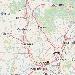
The route from Dover, New Hampshire to Pelham, New Hampshire takes approximately 59 minutes and covers a distance of 54.9 miles. The recommended route is via I-95 S and I-495 S due to traffic conditions. There are tolls along this route.
Directions
-
Get on NH-16 S/Spaulding Turnpike from Central Ave.
- Head east on NH-4 toward Main St.
- Turn left onto St John St.
- Turn left onto Central Ave.
- Turn left to stay on Central Ave.
- Turn right to stay on Central Ave.
- Pass by Subway (on the left in 0.3 mi).
- Turn right to merge onto NH-16 S/Spaulding Turnpike toward Portsmouth/Boston (toll road).
-
Continue on NH-16 S/Spaulding Turnpike. Take I-95 S and I-495 S to Pelham St in Methuen. Take exit 1A from MA-213 W.
- Merge onto NH-16 S/Spaulding Turnpike (toll road).
- Continue onto NH-16 S/US-4 E/Spaulding Turnpike.
- Use the right 2 lanes to merge onto I-95 S toward Hampton/Boston (toll road).
- Keep left at the fork to continue on I-95 (toll road).
- Enter Massachusetts.
- Use the right 2 lanes to take exit 89 for I-495 S toward Worcester.
- Take exit 105 for Massachusetts 213 Loop Connector toward Methuen/Salem New Hampshire/I-93 N.
- Take exit 1A on the left toward Boston.
- Keep right to continue on Exit 45, follow signs for Pelham St.
- Follow Pelham St, Old Gage Hill Rd, and NH-38 S/Bridge St to Nashua Rd in Pelham.
-
Final destination: Pelham, New Hampshire 03076.
Tips & Suggestions
- 🚗 Make sure to have sufficient cash or electronic payment methods to cover the tolls along the route.
- ⏱️ Consider checking traffic conditions before starting your journey to plan for possible delays or alternative routes.
- 🗺️ Use a navigation app or GPS device to help you stay on the designated route and provide real-time directions.
- ⛽ It's a good idea to fill up your vehicle's fuel tank before embarking on the trip.
- 🚧 Stay alert for any road signs or detours that may affect the recommended route.
- 📞 Have emergency contact numbers handy in case of any unforeseen incidents.
- 📍 Keep track of your surroundings and follow the road signs to ensure you're on the right path.
Distance by Flight
Shortest distance between Dover and Pelham is 39.3 miles (63.25 km).
Flight distance from Dover, NH to Pelham, NH is 39.3 miles. Estimated flight time is 00 hours 06 minutes.


Driving distance
The driving distance from Dover, New Hampshire to Pelham, New Hampshire is: 54.22 miles (87.25 km) by car.
Driving from Dover to Pelham will take approximately 01 hours 03 minutes.

#1 Dover
County seat city in Strafford County, New Hampshire, United States
| Population | 32443 |
|---|---|
| GPS Coordinates | 43°11'52"N 70°52'25"W |
| Latitude | 43.1978600 |
| Longitude | -70.8736700 |
| Altitude | 19 |
| Country | United States |

#2 Pelham
City in Hillsborough County, New Hampshire, United States of America
| Population | 14306 |
|---|---|
| GPS Coordinates | 42°44'4"N 71°19'28"W |
| Latitude | 42.7345300 |
| Longitude | -71.3245100 |
| Altitude | 47 |
| Country | United States |
Ending point in Pelham: Nashua Road (-71.324395,42.73464)
Estimated Travel Time Between Dover and Pelham
The distance between Dover and Pelham is 87 km if you choose to drive by road. You can go 00 hours 58 minutes if you drive your car at an average speed of 90 kilometers / hour. For different choices, please review the avg. speed travel time table on the below.
There is no time difference between Dover and Pelham. The current time is 14:20:42.
| Average Speed | Travel Time |
|---|---|
| 30 mph (48.3 km/h) | 01 hours 48 minutes |
| 40 mph (64.37 km/h) | 01 hours 21 minutes |
| 50 mph (80.47 km/h) | 01 hours 05 minutes |
| 60 mph (96.56 km/h) | 00 hours 54 minutes |
| 70 mph (112.65 km/h) | 00 hours 46 minutes |
| 75 mph (120.7 km/h) | 00 hours 43 minutes |
| 80 mph (128.75 km/h) | 00 hours 40 minutes |
Gas Consumption
A car with a fuel efficiency of 8.3 l/100 km will need 7.24 liters (1.91 gallon) of gas to cover the route between Dover and Pelham.
The estimated cost of gas to go from Dover to Pelham is $6.69 (diesel $8.39).
New Hampshire gas prices.
| Gasoline | Mid Grade | Premium | Diesel | |
|---|---|---|---|---|
| Gallon | $3.5 | $3.96 | $4.38 | $4.38 |
| Total | $6.69 | $7.58 | $8.39 | $8.39 |
Take a look at our Gas Cost Calculator feature. It will figure out how much it will cost to drive this particular distance.
The average gas price (in New Hampshire ) per gallon of daily gas for calculations is $3.496 (Diesel $4.384) /gallon. Last changed prices on March 26, 2025.
How did we calculate the distance?
The place names are translated into coordinates to approximate the distance between Dover and Pelham (latitude and longitude). Cities, states, and countries each have their own regional center. The Haversine formula is used to measure the radius.
Distance to Other Cities
Driving distance from Derry Village, NH to Dover 36.08 miles (58 km)
Driving distance from East Concord, NH to Dover 38.35 miles (62 km)


