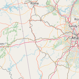
How far is Cusseta, GA from Johns Creek, GA?
Distance by Flight
Shortest distance between Cusseta and Johns Creek is 123.62 miles (198.95 km).
Flight distance from Cusseta, GA to Johns Creek, GA is 123.62 miles. Estimated flight time is 00 hours 18 minutes.
It takes 00 hours 16 minutes to travel from Cusseta to Johns Creek with an airplane (average speed of 550 miles).


Driving distance
The driving distance from Cusseta, Georgia to Johns Creek, Georgia is: 152.3 miles (245.11 km) by car.
Driving from Cusseta to Johns Creek will take approximately 02 hours 28 minutes.

#1 Cusseta
Consolidated city-county in and county seat of Chattahoochee County, Georgia, United States
| Population | 11267 |
|---|---|
| GPS Coordinates | 32°18'20"N 84°46'22"W |
| Latitude | 32.3054300 |
| Longitude | -84.7727000 |
| Altitude | 162 |
| Country | United States |

#2 Johns Creek
The most populous city in Fulton County, Georgia. It is located in the Atlanta metropolitan area. Johns Creek is known for its many parks and green spaces, its many historical sites, and its many attractions, such as the Chattahoochee Nature Center and the Johns Creek Arts Center.
| Population | 85192 |
|---|---|
| GPS Coordinates | 34°1'44"N 84°11'55"W |
| Latitude | 34.0289300 |
| Longitude | -84.1985800 |
| Altitude | 286 |
| Country | United States |
Ending point in Johns Creek: Morgan Hill Court (-84.198301,34.028453)
Estimated Travel Time Between Cusseta and Johns Creek
The distance between Cusseta and Johns Creek is 245 km if you choose to drive by road. You can go 02 hours 43 minutes if you drive your car at an average speed of 90 kilometers / hour. For different choices, please review the avg. speed travel time table on the below.
There is no time difference between Cusseta and Johns Creek. The current time is 07:30:17.
| Average Speed | Travel Time |
|---|---|
| 30 mph (48.3 km/h) | 05 hours 04 minutes |
| 40 mph (64.37 km/h) | 03 hours 48 minutes |
| 50 mph (80.47 km/h) | 03 hours 02 minutes |
| 60 mph (96.56 km/h) | 02 hours 32 minutes |
| 70 mph (112.65 km/h) | 02 hours 10 minutes |
| 75 mph (120.7 km/h) | 02 hours 01 minutes |
| 80 mph (128.75 km/h) | 01 hours 54 minutes |
Gas Consumption
A car with a fuel efficiency of 8.3 l/100 km will need 20.34 liters (5.37 gallon) of gas to cover the route between Cusseta and Johns Creek.
The estimated cost of gas to go from Cusseta to Johns Creek is $16.1 (diesel $21.92).
Georgia gas prices.
| Gasoline | Mid Grade | Premium | Diesel | |
|---|---|---|---|---|
| Gallon | $3 | $3.43 | $3.82 | $4.08 |
| Total | $16.1 | $18.46 | $20.54 | $21.92 |
Take a look at our Gas Cost Calculator feature. It will figure out how much it will cost to drive this particular distance.
The average gas price (in Georgia ) per gallon of daily gas for calculations is $2.995 (Diesel $4.079) /gallon. Last changed prices on September 05, 2025.
How did we calculate the distance?
The place names are translated into coordinates to approximate the distance between Cusseta and Johns Creek (latitude and longitude). Cities, states, and countries each have their own regional center. The Haversine formula is used to measure the radius.
Distance to Other Cities


Driving distance from California, GA to Cusseta 141.66 miles (228 km)


Driving distance from Minnesota, GA to Cusseta 94.55 miles (152 km)