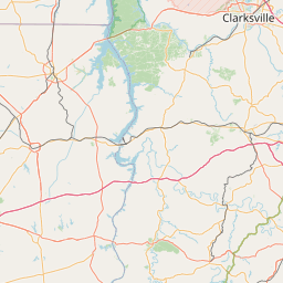
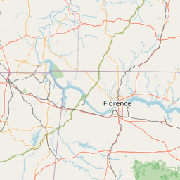
How far is Blaine, TN from New South Memphis, TN?
Fastest route
To travel from Blaine, Tennessee, to New South Memphis, Memphis, TN 38109, you will cover approximately 412 miles (663 kilometers) via I-40 W. The estimated travel time is 6 hours and 18 minutes. The route includes driving on I-40 W and I-55 N. Please be aware that your destination is in a different time zone.
Directions
-
Head Southwest on Bates Dr toward Rutledge Pike
- 🚗 Tip: Check your vehicle's fuel and ensure it is in good condition before starting the journey.
-
Turn left onto US-11W S/Rutledge Pike
- 🛣️ Tip: Plan for rest stops along the way to stretch and relax during the long drive.
-
Use the right lane to take the ramp onto I-40 W
- 🚦 Tip: Stay alert and follow traffic rules while merging onto the highway.
-
Continue on I-40 W. Drive to US-61 N/S 3rd St in Memphis. Take exit 7 from I-55 N
- 🗺️ Tip: Use a GPS or navigation app to stay on the correct route and avoid getting lost.
-
Use the right 2 lanes to take exit 376 for I-140 E toward Maryville
- 🌇 Tip: If possible, begin your journey early in the day to avoid rush hour traffic.
-
Keep left at the fork and merge onto I-40 W/I-75 S
- ⛽ Tip: Refuel at appropriate gas stations along the way to avoid running out of fuel.
-
Use the left 3 lanes to take exit 213A for I-440 W toward Memphis
- 📅 Tip: Plan your trip considering possible weather conditions and potential delays.
Tips & Suggestions
- 🕒 Tip: Adjust your watch or clock when you reach your destination to match the new time zone.
- 📍 Tip: Familiarize yourself with the route and have a map handy in case of any navigation issues.
Distance by Flight
Shortest distance between Blaine and New South Memphis is 364.27 miles (586.24 km).
Flight distance from Blaine, TN to New South Memphis, TN is 364.27 miles. Estimated flight time is 00 hours 49 minutes.
It takes 00 hours 44 minutes to travel from Blaine to New South Memphis with an airplane (average speed of 550 miles).


Driving distance
The driving distance from Blaine, Tennessee to New South Memphis, Tennessee is: 411.8 miles (662.73 km) by car.
Driving from Blaine to New South Memphis will take approximately 06 hours 18 minutes.

#1 Blaine
City in Grainger County, Tennessee, United States
| Population | 1869 |
|---|---|
| GPS Coordinates | 36°9'15"N 83°42'15"W |
| Latitude | 36.1542500 |
| Longitude | -83.7040700 |
| Altitude | 293 |
| Country | United States |
#2 New South Memphis
A neighborhood located in Memphis, Tennessee. It is known for its history and its culture.
| Population | 641608 |
|---|---|
| GPS Coordinates | 35°5'12"N 90°3'24"W |
| Latitude | 35.0867600 |
| Longitude | -90.0567600 |
| Altitude | 79 |
| Country | United States |
Ending point in New South Memphis: South Third Street (-90.05674,35.086758)
Estimated Travel Time Between Blaine and New South Memphis
The distance between Blaine and New South Memphis is 663 km if you choose to drive by road. You can go 07 hours 21 minutes if you drive your car at an average speed of 90 kilometers / hour. For different choices, please review the avg. speed travel time table on the below.
Please keep in mind that there is a 1 hour time gap between Blaine, TN and New South Memphis, TN. The current time in Blaine is 11:52:52, although it is 10:52:52 in New South Memphis.
| Average Speed | Travel Time |
|---|---|
| 30 mph (48.3 km/h) | 13 hours 43 minutes |
| 40 mph (64.37 km/h) | 10 hours 17 minutes |
| 50 mph (80.47 km/h) | 08 hours 14 minutes |
| 60 mph (96.56 km/h) | 06 hours 51 minutes |
| 70 mph (112.65 km/h) | 05 hours 52 minutes |
| 75 mph (120.7 km/h) | 05 hours 29 minutes |
| 80 mph (128.75 km/h) | 05 hours 08 minutes |
Gas Consumption
A car with a fuel efficiency of 8.3 l/100 km will need 55.01 liters (14.53 gallon) of gas to cover the route between Blaine and New South Memphis.
The estimated cost of gas to go from Blaine to New South Memphis is $45.63 (diesel $60.78).
Tennessee gas prices.
| Gasoline | Mid Grade | Premium | Diesel | |
|---|---|---|---|---|
| Gallon | $3.14 | $3.56 | $3.93 | $4.18 |
| Total | $45.63 | $51.7 | $57.15 | $60.78 |
Take a look at our Gas Cost Calculator feature. It will figure out how much it will cost to drive this particular distance.
The average gas price (in Tennessee ) per gallon of daily gas for calculations is $3.140 (Diesel $4.183) /gallon. Last changed prices on August 11, 2025.
How did we calculate the distance?
The place names are translated into coordinates to approximate the distance between Blaine and New South Memphis (latitude and longitude). Cities, states, and countries each have their own regional center. The Haversine formula is used to measure the radius.
Distance to Other Cities
Driving distance from East Chattanooga, TN to Blaine 126.59 miles (204 km)

Driving distance from City of Murfreesboro, TN to Blaine 199.19 miles (321 km)


