How far is Altadena, CA from Fresno, CA?
Distance by Flight
Shortest distance between Altadena and Fresno is 199.41 miles (320.91 km).
Flight distance from Altadena, CA to Fresno, CA is 199.41 miles. Estimated flight time is 00 hours 26 minutes.
It takes 00 hours 23 minutes to travel from Altadena to Fresno with an airplane (average speed of 550 miles).


Driving distance
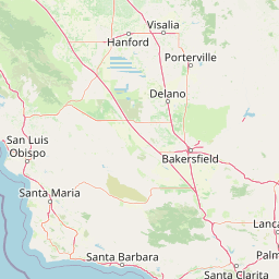
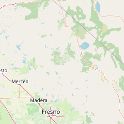
The driving distance from Altadena, California to Fresno, California is: 219.74 miles (353.64 km) by car.
Driving from Altadena to Fresno will take approximately 03 hours 42 minutes.

#1 Altadena
Census-designated place in Los Angeles County, California, United States
| Population | 42777 |
|---|---|
| GPS Coordinates | 34°11'23"N 118°7'52"W |
| Latitude | 34.1897300 |
| Longitude | -118.1311800 |
| Altitude | 414 |
| Country | United States |

#2 Fresno
The fifth most populous city in California and the center of the Fresno metropolitan area. It is located in the San Joaquin Valley in central California. Fresno is known for its agricultural industry, its hot climate, and its many attractions, such as the Fresno Chaffee Zoo and the Fresno Grizzlies baseball team.
| Population | 530267 |
|---|---|
| GPS Coordinates | 36°44'52"N 119°46'21"W |
| Latitude | 36.7477300 |
| Longitude | -119.7723700 |
| Altitude | 94 |
| Country | United States |
Ending point in Fresno: East Washington Avenue (-119.77237,36.747738)
Estimated Travel Time Between Altadena and Fresno
The distance between Altadena and Fresno is 354 km if you choose to drive by road. You can go 03 hours 55 minutes if you drive your car at an average speed of 90 kilometers / hour. For different choices, please review the avg. speed travel time table on the below.
There is no time difference between Altadena and Fresno. The current time is 23:24:59.
| Average Speed | Travel Time |
|---|---|
| 30 mph (48.3 km/h) | 07 hours 19 minutes |
| 40 mph (64.37 km/h) | 05 hours 29 minutes |
| 50 mph (80.47 km/h) | 04 hours 23 minutes |
| 60 mph (96.56 km/h) | 03 hours 39 minutes |
| 70 mph (112.65 km/h) | 03 hours 08 minutes |
| 75 mph (120.7 km/h) | 02 hours 55 minutes |
| 80 mph (128.75 km/h) | 02 hours 44 minutes |
Gas Consumption
A car with a fuel efficiency of 8.3 l/100 km will need 29.35 liters (7.75 gallon) of gas to cover the route between Altadena and Fresno.
The estimated cost of gas to go from Altadena to Fresno is $41.52 (diesel $48.04).
California gas prices.
| Gasoline | Mid Grade | Premium | Diesel | |
|---|---|---|---|---|
| Gallon | $5.36 | $5.59 | $5.74 | $6.2 |
| Total | $41.52 | $43.36 | $44.53 | $48.04 |
Take a look at our Gas Cost Calculator feature. It will figure out how much it will cost to drive this particular distance.
The average gas price (in California ) per gallon of daily gas for calculations is $5.355 (Diesel $6.196) /gallon. Last changed prices on July 11, 2025.
How did we calculate the distance?
The place names are translated into coordinates to approximate the distance between Altadena and Fresno (latitude and longitude). Cities, states, and countries each have their own regional center. The Haversine formula is used to measure the radius.


