Bhutan (Kingdom of Bhutan), BT
Bhutan: Independent country in South Asia
About

Quick Facts about Kingdom of Bhutan
| Population : | 807,610 |
| Country : | Bhutan |
| Different from : | Bataan |
| Head of government : | Prime Minister of Bhutan |
| Area : | 38394 km2 |
| Official name : | le Royaume du Bhoutan |
| Continent : | Asia |
| Easternmost point : | Point(92.12523 27.28178) |
| Northernmost point : | Point(90.0 28.32) |
| Legislative body : | Parliament of Bhutan |
| Official language : | Dzongkha |
| Capital : | Thimphu |
| Establishment : | January 01, 1970 (117 years ago) |
| Time Zone : | UTC+06:00 |
| Local time : | 04:11:48 (29th January 2025) |

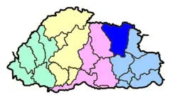
Geography
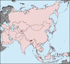
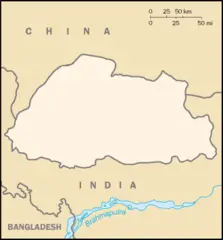
Kingdom of Bhutan is located at 27°30'0"N 90°30'0"E (27.5000000, 90.5000000). It has 2 neighbors: India and China.
Bhutan map
Click "full screen"  icon to open full mode. View satellite images
The largest city of Kingdom of Bhutan is Thimphu with a population of 98,676. Other cities include, Phuntsholing population 17,043 and Paro population 2,169. See all Kingdom of Bhutan cities & populated places.
- Official Website
Official website of Kingdom of Bhutan
Lotay Tshering ,
Kingdom of Bhutan has 2 neighbours.
- Republic of India Independent country in South Asia
- People’s Republic of China Independent country in East Asia
- Gasa District
- Trashiyangtse District
- Samtse District
- Bumthang District
- Trashigang District
- Punakha District
- Zhemgang District
- Chukha District
- Pemagatshel District
- Paro District
- Samdrup Jongkhar District
- Lhuntse District
- Tsirang District
- Wangdue Phodrang District
- Sarpang District
- Mongar District
- Dagana District
- Trongsa District
- Haa District
- Thimphu District
Demographics
| Year | Population | % Change | Method |
| 1960 | 224,155 | - | census |
| 1961 | 229,348 | 2.26% | census |
| 1962 | 234,758 | 2.3% | census |
| 1963 | 240,424 | 2.36% | census |
| 1964 | 246,388 | 2.42% | census |
| 1965 | 252,698 | 2.5% | census |
| 1966 | 259,344 | 2.56% | census |
| 1967 | 266,373 | 2.64% | census |
| 1968 | 273,954 | 2.77% | census |
| 1969 | 282,302 | 2.96% | census |
| 1970 | 291,555 | 3.17% | census |
| 1971 | 301,758 | 3.38% | census |
| 1972 | 312,823 | 3.54% | census |
| 1973 | 324,583 | 3.62% | census |
| 1974 | 336,802 | 3.63% | census |
| 1975 | 349,280 | 3.57% | census |
| 1976 | 362,006 | 3.52% | census |
| 1977 | 374,953 | 3.45% | census |
| 1978 | 387,893 | 3.34% | census |
| 1979 | 400,551 | 3.16% | census |
| 1980 | 412,745 | 2.95% | census |
| 1981 | 424,082 | 2.67% | census |
| 1982 | 434,592 | 2.42% | census |
| 1983 | 445,008 | 2.34% | census |
| 1984 | 456,362 | 2.49% | census |
| 1985 | 469,244 | 2.75% | census |
| 1986 | 484,390 | 3.13% | census |
| 1987 | 501,192 | 3.35% | census |
| 1988 | 517,306 | 3.11% | census |
| 1989 | 529,519 | 2.31% | census |
| 1990 | 535,738 | 1.16% | census |
| 1991 | 534,905 | -0.16% | census |
| 1992 | 528,304 | -1.25% | census |
| 1993 | 519,056 | -1.78% | census |
| 1994 | 511,588 | -1.46% | census |
| 1995 | 509,105 | -0.49% | census |
| 1996 | 512,594 | 0.68% | census |
| 1997 | 521,146 | 1.64% | census |
| 1998 | 533,737 | 2.36% | census |
| 1999 | 548,599 | 2.71% | census |
| 2000 | 564,350 | 2.79% | census |
| 2001 | 580,888 | 2.85% | census |
| 2002 | 598,455 | 2.94% | census |
| 2003 | 616,383 | 2.91% | census |
| 2004 | 633,893 | 2.76% | census |
| 2005 | 650,417 | 2.54% | census |
| 2006 | 665,568 | 2.28% | census |
| 2007 | 679,365 | 2.03% | census |
| 2008 | 692,159 | 1.85% | census |
| 2009 | 704,542 | 1.76% | census |
| 2010 | 716,939 | 1.73% | census |
| 2011 | 729,429 | 1.71% | census |
| 2012 | 741,822 | 1.67% | census |
| 2013 | 753,947 | 1.61% | census |
| 2014 | 719,056 | -4.85% | (Worldbank) |
| 2015 | 727,876 | 1.21% | (Worldbank) |
| 2016 | 736,709 | 1.2% | (Worldbank) |
| 2017 | 807,610 | 8.78% | census |
| 2018 | 754,394 | -7.05% | (Worldbank) |
| 2019 | 763,092 | 1.14% | (Worldbank) |
An Bhutain, An Bhútain, An Bhútáin, Bh2utan, Bhoetaan, Bhoetan, Bhotana, Bhoutan, Bhutaan, Bhutan, Bhutan nutome, Bhutani, Bhután, Bhwtan, Bhùtán, Bhútán, Botan, Boutan, Bu-tan (Bhutan), Butaan, Butaani, Butaean, Butaen, Butan, Butan Patshalygy, Butana, Butanas, Butani, Butania, Butanmudin Nutg, Butano, Butao, Butaŋ, Butàn, Bután, Bután - འབྲུག་ཡུལ, Butáni, Butão, Butäan, Butän, Butāna, Buuten, Bútan, Bûtan, Druk-yul, IBhuthani, Iiʼniʼ Tłʼiishtsoh Bikéyah, Kingdom of Bhutan, Kraljevina Butan, Mpoutan, Orileede Butani, Orílẹ́ède Bútánì, Putani, Pūtani, Regne de Bhutan, Shoҳigarii Butan, batan, bhutan, bhutana, bhwtn, bu dan, butan, butan wang guo, bwtan, bwwtan, bwټan, i-Bhutan, phutan, phuthan, prathes phutan, putan, puttan, Μπουτάν, Бутан, Бутан Патшалығы, Бутанмудин Нутг, Шоҳигарии Бутан, Բութան, Բուտան, בהוטאן, בהוטן, باتان, بوتان, بووتان, بوټان, بھوٹان, بۇتان, ބޫޓާން, भुटान, भूटान, भूतान, ভুটান, ভূটান, ભૂટાન, ભૂતાન, ଭୁଟାନ, ଭୁଟାନ୍, பூடான், பூட்டான், భూటాన్, ಭುತಾನ, ಭೂತಾನ್, ഭൂട്ടാന്, ഭൂട്ടാൻ, භූතානය, ประเทศภูฏาน, ภูฏาน, ภูฐาน, ພູຖານ, འབྲུག, འབྲུག་ཡུལ་, འབྲུག་ཡུལ།, ဘတနနငင, ဘူတန်နိုင်ငံ, ბუტანი, ბჰუტანი, ቡህታን, ប៊ូតាន, ブータン, ブータン王国, 不丹, 부탄
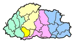
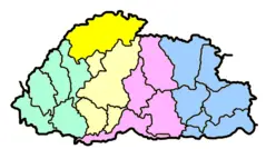
Map & Images (more maps)
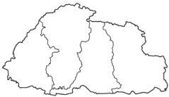
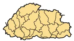
Bhutan Blank Map
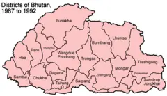
Bhutan Districts 1987 1992
Bhutan Districts Blank
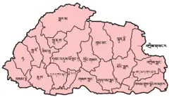
Bhutan Districts Dzongkha
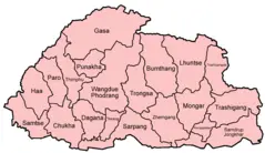
Bhutan Districts English
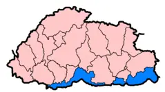
Bhutan Subdivisions Flood Hit Between July 3 And August 15 2007
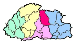
Bhutan Zones Blank
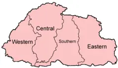
Bhutan Zones English
Bhutan Pos
Bhutan Distretti Numerato
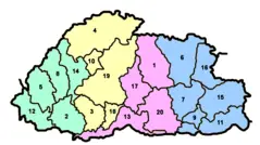
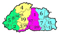
Bhutan Divisions Numbered
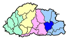
Bhutan Divisions
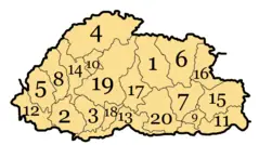
Bhutan Dzongdey Numbered
Bhutan Map Blank
Bhutanbhumthang
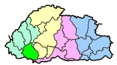
Bhutanchukha
Bhutandagana
Bhutangasa
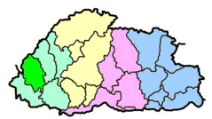
Bhutanhaa
Bhutanlhuntse