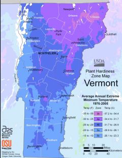
Vermont, US
Vermont: Located in the New England region of the northeastern United States, this state is known for its natural landscapes, including the Green Mountains.
Vermont is a state located in the New England region of the northeastern United States. It is bordered by Massachusetts to the south, New Hampshire to the east, New York to the west, and the Canadian province of Quebec to the north. Vermont is the only state in New England that does not border the Atlantic Ocean.
Some key facts about Vermont:
- Capital: Montpelier
- Population: Around 624,000 (2nd least populous state)
- Area: 9,616 square miles (45th largest state)
- Nickname: The Green Mountain State
Vermont has a long history. The first European explorers arrived in the early 1600s. Vermont was an independent republic from 1777 to 1791 before becoming the 14th state admitted to the Union.
Vermont is known for its natural beauty and rural character. Much of the state is forested and mountainous, including the Green Mountains which run north-south through the center of the state. Outdoor recreation like skiing, hiking, and camping are popular activities.
Vermont also has a distinctive culture and way of life. Small towns, dairy farms, maple syrup production, and covered bridges are iconic parts of the Vermont landscape. Politically, Vermont is considered a very liberal state.
Some of Vermont's main industries include dairy farming, maple syrup, tourism, and manufacturing. IBM is one of the state's largest private employers. The largest city is Burlington, home to the University of Vermont.
In summary, Vermont is a unique U.S. state with a small population, rural character, progressive values, and stunning natural scenery. The Green Mountains, independent spirit, and iconic small towns make Vermont a distinctive place to live and visit.

State Snapshot
Vermont at a glance
Vermont currently has 135 quality-checked populated place pages and 14 county pages linked on MapSof.
Mapped cities & towns
135
These counts use a stricter populated-place filter so the main lists stay focused on real city and town pages.
County pages
14
Open related pagesLargest city
BurlingtonPopulation 42,899
Top linked places
Quick Facts about Vermont
| Population | 623,347 |
| Country | United States of America |
| Area | 24923 km2 |
| Water as percent of area | 4.16% |
| Land as percent of area | 95.84% |
| Latitude & Longitude | 44.0003,-72.7498 |
| Legislative body | Vermont General Assembly |
| Named for | Green Mountains |
| Altitude | 1,001 feet / 305 meters |
| Capital | Montpelier |
| Establishment | March 04, 1791 (235 years ago) |
| Time Zone | America/New_York, Eastern Time Zone |
| Local time | 09:12:07 (22nd September 2026) |
| Weather | 60℉ Slight Chance Rain Showers 7-days weather |

Geography
Vermont is located at 44°0'1"N 72°44'59"W (44.0003400, -72.7498300). It has 4 neighbors: New Hampshire, New York, Quebec and Massachusetts.
Vermont map
 icon to open full mode. View satellite images
The largest city of Vermont is Burlington with a population of 42,899. Other cities include, South Burlington population 19,578, Colchester population 17,102, Bennington population 14,897 and Brattleboro population 11,257. See all Vermont cities & populated places.
Largest Cities in Vermont (more)
Cities, Towns, Villages, Neighborhoods & Other Populated Places in Vermont.
| City Name | County | Population |
|---|---|---|
| Burlington | Chittenden | 42,899 |
| South Burlington | Chittenden | 19,578 |
| Colchester | Chittenden | 17,102 |
| Bennington | Bennington | 14,897 |
| Brattleboro | Windham | 11,257 |
| Milton | Chittenden | 10,907 |
| Essex Junction | Chittenden | 10,793 |
| Williston | Chittenden | 10,263 |
| Hartford | Windsor | 9,566 |
| Springfield | Windsor | 8,875 |
| Barre | Washington | 7,741 |
| Shelburne | Chittenden | 7,649 |
| Winooski | Chittenden | 7,527 |
| Montpelier | Washington | 7,328 |
| Saint Johnsbury | Caledonia | 7,070 |
| Middlebury (village) | Addison | 6,588 |
Show more Vermont cities and populated places
Weather
A slight chance of rain showers. Partly sunny, with a high near 60. East wind around 3 mph.
7-Day ForecastOfficial website of Vermont
Official Website- Orange County
- Orleans County
- Windsor County
- Lamoille County
- Addison County
- Essex County
- Bennington County
- Caledonia County
- Grand Isle County
- Washington County
- Windham County
- Chittenden County
- Franklin County
- Rutland County
Demographics
| Year | Population | % Change | Method |
|---|---|---|---|
| 1910 | 355,956 | - | census |
| 1920 | 352,428 | -0.99% | census |
| 1930 | 359,611 | 2.04% | census |
| 1940 | 359,231 | -0.11% | census |
| 1950 | 377,747 | 5.15% | census |
| 1960 | 389,881 | 3.21% | census |
| 1970 | 444,330 | 13.97% | census |
| 1980 | 511,456 | 15.11% | census |
| 1990 | 562,758 | 10.03% | census |
| 2000 | 608,827 | 8.19% | census |
| 2010 | 625,741 | 2.78% | census |
| 2011 | 627,049 | 0.21% | estimation process |
| 2012 | 626,090 | -0.15% | estimation process |
| 2013 | 626,210 | 0.02% | estimation process |
| 2014 | 625,214 | -0.16% | estimation process |
| 2015 | 625,216 | 0% | estimation process |
| 2016 | 623,657 | -0.25% | estimation process |
| 2017 | 624,344 | 0.11% | estimation process |
| 2018 | 624,358 | 0% | estimation process |
| 2019 | 623,989 | -0.06% | estimation process |
| 2020 | 623,347 | -0.1% | estimation process |
People born in Vermont (80)
People born in Vermont, including physician Caroline Burghardt, United States explorer and author Thomas J. Farnham, artist Margaret Foley, .
More notable people
- David Klass (American writer) he was born in 08/03/1960
- William "Bill" Rice (American actor, director, painter (1931-2006)) he was born in 17/10/1931
- David Franzoni (American screenwriter) he was born in 04/03/1947
- Elisabeth von Trapp (American female singer) she was born in 01/01/1955
- Hal Fowler (American poker player) he was born in 12/01/1927
- Lawrence C. Washington (American mathematician) he was born in 01/01/1951
- Scot Eaton (Comic book artist) he was born in 01/01/2000
- William Church (American inventor) he was born in 01/01/1778
- Alvinza Hayward (American businessman) he was born in 01/01/1822
- Hyrum Smith (American Mormon leader) he was born in 09/02/1800
- Stephen R. Bissette (American comics artist) he was born in 14/03/1955
- Leonard Knight (American artist) he was born in 01/11/1931
- John Lawrence Grattan (US Cavalry officer) he was born in 01/06/1830
- A. B. Colton (Minnesota state legislator) he was born in 01/01/1831
- Alexander O. Smith (American translator and author) he was born in 08/02/1973
- Ammi R. Butler (American mayor) he was born in 04/09/1821
- Andrew Neel (American filmmaker) he was born in 01/01/1978
- Bob Spear (Naturalist and woodcarver) he was born in 21/02/1920
Vermont Counties
Chittenden County

county in Vermont, United States.
Washington County

county in Vermont, United States.
Rutland County

county in Vermont, United States.
| County Name | Population |
|---|---|
| Chittenden County | 164,306 |
| Washington County | 58,328 |
| Rutland County | 57,764 |
| Windsor County | 54,988 |
| Franklin County | 49,685 |
| Windham County | 42,015 |
| Addison County | 36,851 |
| Bennington County | 35,338 |
| Caledonia County | 29,705 |
| Orange County | 28,837 |
| Orleans County | 26,897 |
| Lamoille County | 25,341 |
| Grand Isle County | 7,169 |
| Essex County | 6,123 |
Show more Vermont counties
Map & Images (more maps)
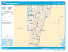
Map of Vermont Na 1
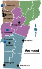
Map of Vermont Regions
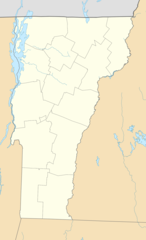
Usa Vermont Location Map
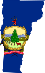
Vermont Flag Map
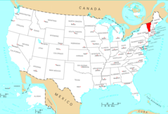
Where Is Vermont Located
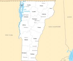
Vermont Cities And Towns
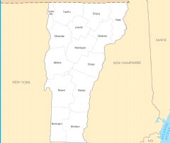
Vermont County Map
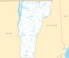
Vermont Rivers And Lakes
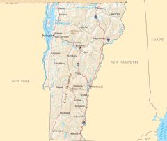
Vermont Reference Map