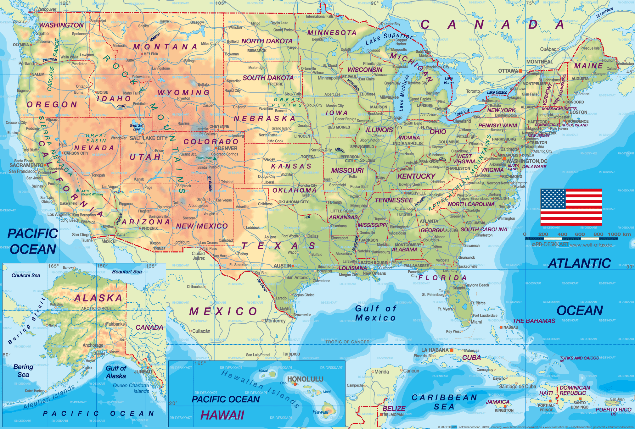
United States Cities Map
The United States has many major cities spread across its 50 states. Here are some of the most populous and important cities in the US:
New York City
New York City is the largest city in the US with a population of over 8 million. It is located in the state of New York and is comprised of 5 boroughs: Manhattan, Brooklyn, Queens, The Bronx, and Staten Island. New York City is a global hub of finance, culture, and commerce.
Los Angeles
Los Angeles, located in California, is the second largest city in the US with close to 4 million residents. LA is known for Hollywood, the center of the world's film industry, as well as its beautiful beaches and Mediterranean climate.
Chicago
Chicago is the third largest city in the country with 2.7 million residents. Located in Illinois along Lake Michigan, Chicago is a major transportation and business hub, and is renowned for its amazing architecture. The city is also known for its unique style of pizza and hot dogs.
Houston
Houston is the largest city in Texas and fourth largest in the US with over 2 million people. Houston's economy centers around the energy, manufacturing, aeronautics, and healthcare industries. The city is also home to NASA's Johnson Space Center.
Phoenix
Phoenix is the capital and most populous city in Arizona with 1.6 million residents. Located in the Sonoran Desert, Phoenix gets very hot in the summer but enjoys mild winters. Phoenix has a thriving tourism industry and is known for its luxurious resorts and golf courses.
More United States Static Maps
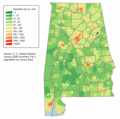
Alabama Population Map
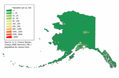
Alaska Population Map
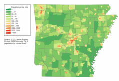
Arkansas Population Map
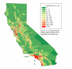
California Population Map
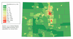
Colorado Population Map
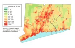
Connecticut Population Map
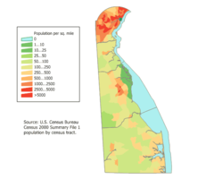
Delaware Population Map
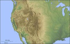
Der Westen Der Vereinigten Staaten
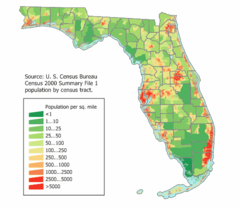
Florida Population Map
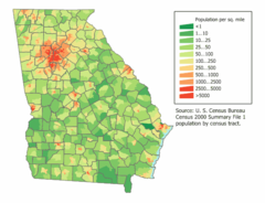
Georgia Population Map
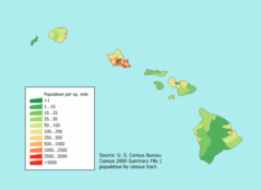
Hawaii Population Map
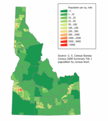
Idaho Population Map
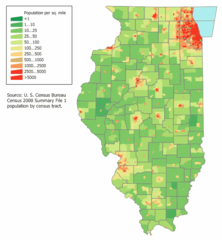
Illinois Population Map
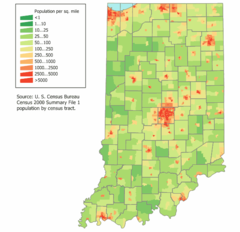
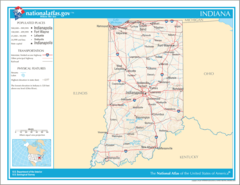
Indiana Population Map
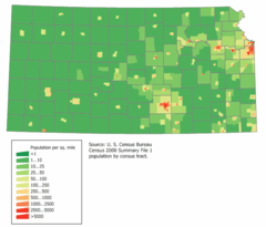
Kansas Population Map
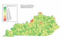
Kentucky Population Map
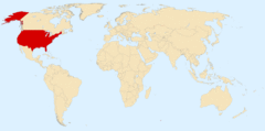
Location Uf Us
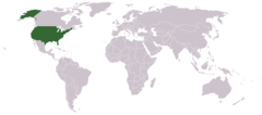
Location Usa
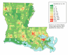
Louisiana Population Map
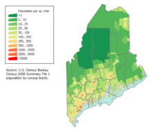
Maine Population Map
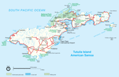
Mapoftutuila American Samoa
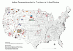
Map Indian Reservations Usa
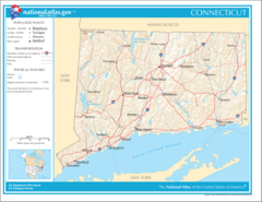
Map of Connecticut Na
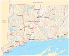
Map of Connecticut Na Cropp
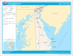
Map of Delaware Na
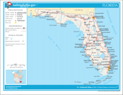
Map of Florida Na
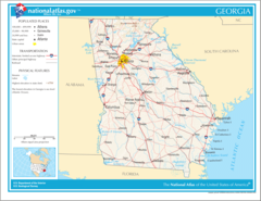
Map of Georgia Na
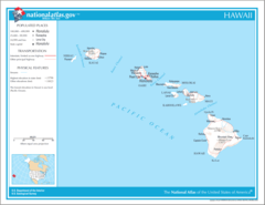
Map of Hawaii Na
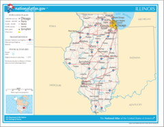
Map of Illinois Na