Tehran, Tehrān
Tehran: This sprawling metropolis is situated at the foot of the Alborz Mountains in north-central Iran.
About

Quick Facts about Tehran
| Population | 8,846,782 |
| Country | Iran |
| State | Tehrān (Iran) |
| Postal code | 13ххх-15ххх |
| Phone Area Codes | 021 |
| Area | 686 km2 |
| Official name | تهران |
| Latitude & Longitude | 35.6944,51.4215 |
| Legislative body | Tehran City Council |
| Official language | Persian |
| Altitude | 3,937 feet / 1200 meters |
| Capital city | Tehran is capital of Qajar dynasty, Imperial State of Iran, Iran |
| Establishment | March 20, 1794 (232 years ago) |
| Time Zone | UTC+03:30, Iran Standard Time Zone, UTC+04:30 |
| Local time | 00:59:33 (10th June 2026) |

North of tehran image
Geography
Tehran is located at 35°41'40"N 51°25'17"E (35.6943900, 51.4215100).
Tehran map
Click "full screen"  icon to open full mode. View satellite images
Official website of Tehran
Official Website- Baghdad
- Bangkok (2012 )
- Beijing
- Berlin
- Brasília
- Budapest (2015 )
- Caracas
- Dubai
- Dushanbe
- Erbil
- Havana
- Khartoum
- Kinshasa
- Kuwait City
- London
- Los Angeles (1972 )
- Manila
- Minsk
- Moscow
- Pavlodar
- Pretoria
- Saint Petersburg
- Sana'a
- Seoul
- Tbilisi
Demographics
| Year | Population | % Change | Method |
|---|---|---|---|
| 2006 | 7,711,230 | - | census |
| 2012 | 8,846,782 | 12.84% | census |
| 2016 | 8,846,782 | 0% | census |
THR, Taekhran, Tahran, Techerane, Teera, Teerao, Teerã, Teerão, Tegeran, Teheran, Teherana, Teheranas, Teherano, Teherán, Teherāna, Tehrano, Tekheran, Téhéran, de hei lan, teharan, teharana, tehelan, teirani, thran, thrn, thrwn, tihiran, tihran, Τεχεράνη, Тæхран, Тегеран, Техеран, Теҳрон, Թեհրան, טהראן, טהרן, تهران, تهرون, تِهران, تِهِرَن, تہران, طهران, ܛܗܪܐܢ, तेहरान, তেহরান, தெஹ்ரான், เตหะราน, ཏེ་ཧི་རན།, თეირანი, ቴህራን, テヘラン, 德黑兰, 테헤란
Map & Images (more maps)
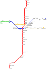
Tehran Metro Map
996 x 1451
- 13,480k -
png