South Korea (Republic of Korea), KR
South Korea: Located on the southern portion of the Korean Peninsula in East Asia, it is a country known for its vibrant culture, advanced technology, and significant economic influence.
About

Country Snapshot
Republic of Korea at a glance
Republic of Korea currently has 75 quality-checked populated place pages and 16 state or regional pages linked on MapSof.
Mapped cities & towns
75
These counts use a stricter populated-place filter so the main lists stay focused on real city and town pages.
States & regions
16
Open related pagesLargest city
SeoulPopulation 9,806,538
Top linked places
Quick Facts about Republic of Korea
| Population | 51,159,889 |
| Country | South Korea |
| Instagram username | koreanet_official |
| Plate code | ROK |
| Area | 100295 km2 |
| Official name | la République de Corée, Corée du Sud, 大韓民國, Republic of Korea, 대한민국 |
| Continent | Asia |
| Easternmost point | Point(130.938055555 37.528888888) |
| Northernmost point | Point(128.37 38.62) |
| Latitude & Longitude | 36.5000,127.7500 |
| Legislative body | National Assembly |
| Official language | Korean |
| Capital | Seoul |
| Establishment | August 15, 1948 (77 years ago) |
| Time Zone | Asia/Seoul, Korea Standard Time, UTC+08:00, UTC+08:30, UTC+09:00 |
| Local time | 09:58:32 (23rd July 2026) |

Geography
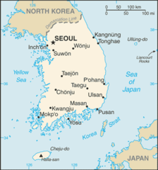
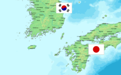
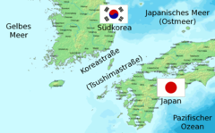
Republic of Korea is located at 36°30'0"N 127°45'0"E (36.5000000, 127.7500000). It has 3 neighbors: China, Japan and North Korea.
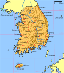
South Korea map
The largest city of Republic of Korea is Seoul with a population of 9,806,538. Other cities include, Daegu population 2,518,467, Changwon population 1,046,054, Bucheon-si population 850,731 and Ansan-si population 652,800. See all Republic of Korea cities & populated places.
Compare Republic of Korea with
- North Chungcheong Province
- Seoul
- South Gyeongsang Province
- Jeju Province
- Gyeonggi Province
- South Jeolla Province
- North Gyeongsang Province
- Gangwon Province
- Gwangju
- North Jeolla Province
- Busan
- Sejong City
- Ulsan
- Incheon
- South Chungcheong Province
- Daejeon
- Daegu
Demographics
| Year | Population | % Change | Method |
|---|---|---|---|
| 1960 | 25,012,374 | - | census |
| 1961 | 25,765,673 | 2.92% | census |
| 1962 | 26,513,030 | 2.82% | census |
| 1963 | 27,261,747 | 2.75% | census |
| 1964 | 27,984,155 | 2.58% | census |
| 1965 | 28,704,674 | 2.51% | census |
| 1966 | 29,435,571 | 2.48% | census |
| 1967 | 30,130,983 | 2.31% | census |
| 1968 | 30,838,302 | 2.29% | census |
| 1969 | 31,544,266 | 2.24% | census |
| 1970 | 32,240,827 | 2.16% | census |
| 1971 | 32,882,704 | 1.95% | census |
| 1972 | 33,505,406 | 1.86% | census |
| 1973 | 34,103,149 | 1.75% | census |
| 1974 | 34,692,266 | 1.7% | census |
| 1975 | 35,280,725 | 1.67% | census |
| 1976 | 35,848,523 | 1.58% | census |
| 1977 | 36,411,795 | 1.55% | census |
| 1978 | 36,969,185 | 1.51% | census |
| 1979 | 37,534,236 | 1.51% | census |
| 1980 | 38,123,775 | 1.55% | census |
| 1981 | 38,723,248 | 1.55% | census |
| 1982 | 39,326,352 | 1.53% | census |
| 1983 | 39,910,403 | 1.46% | census |
| 1984 | 40,405,956 | 1.23% | census |
| 1985 | 40,805,744 | 0.98% | census |
| 1986 | 41,213,674 | 0.99% | census |
| 1987 | 41,621,690 | 0.98% | census |
| 1988 | 42,031,247 | 0.97% | census |
| 1989 | 42,449,038 | 0.98% | census |
| 1990 | 42,869,283 | 0.98% | census |
| 1991 | 43,295,704 | 0.98% | census |
| 1992 | 43,747,962 | 1.03% | census |
| 1993 | 44,194,628 | 1.01% | census |
| 1994 | 44,641,540 | 1% | census |
| 1995 | 45,092,991 | 1% | census |
| 1996 | 45,524,681 | 0.95% | census |
| 1997 | 45,953,580 | 0.93% | census |
| 1998 | 46,286,503 | 0.72% | census |
| 1999 | 46,616,677 | 0.71% | census |
| 2000 | 47,008,111 | 0.83% | census |
| 2001 | 47,357,362 | 0.74% | census |
| 2002 | 47,622,179 | 0.56% | census |
| 2003 | 47,859,311 | 0.5% | census |
| 2004 | 48,039,415 | 0.37% | census |
| 2005 | 48,138,077 | 0.2% | census |
| 2006 | 48,371,946 | 0.48% | census |
| 2007 | 48,597,652 | 0.46% | census |
| 2008 | 48,948,698 | 0.72% | census |
| 2009 | 49,182,038 | 0.47% | census |
| 2010 | 49,410,366 | 0.46% | census |
| 2011 | 49,779,440 | 0.74% | census |
| 2012 | 50,004,441 | 0.45% | census |
| 2013 | 50,219,669 | 0.43% | census |
| 2014 | 25,057,752 | -100.42% | (Worldbank) |
| 2015 | 51,069,375 | 50.93% | census |
| 2016 | 25,307,744 | -101.79% | (Worldbank) |
| 2017 | 51,466,201 | 50.83% | census |
| 2018 | 25,549,819 | -101.43% | (Worldbank) |
| 2019 | 25,666,161 | 0.45% | (Worldbank) |
| 2026 | 51,159,889 | 49.83% |
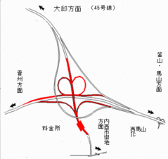
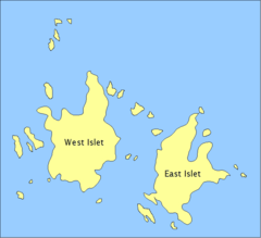
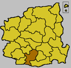
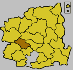
Map & Images (more maps)
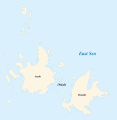
Dokdo Map 1
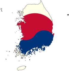
Flag Map of South Korea
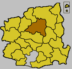
Gyeongbuk Andong Map
Gyeongbuk Daegu Map
Gyeongbuk Gumi Map
Gyeongbuk Ulleung Map
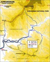
Juwangsan
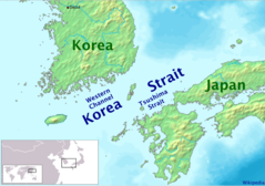
Korea Strait 1
Korea, South Cia Wfb Map
Koreastrasse Without Labels 1
Koreastrasse 2
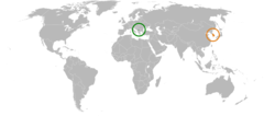
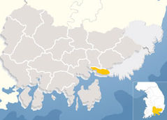
Kosovo South Korea Locator 1
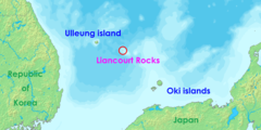
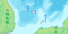
Location of Liancourt Rocks En
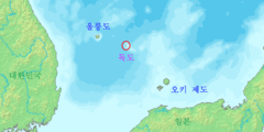
Location of Liancourt Rocks Ja 1
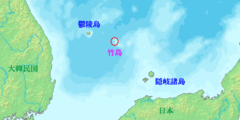
Location of Liancourt Rocks Ko 1
Location of Liancourt Rocks Zh Classical 1
Map Jinhae Si
Map South Korea Blank
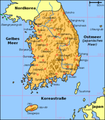
Map South Korea De
Map of Dokdo