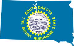
South Dakota, US
South Dakota: Located in the Upper Midwest region of the United States, this state is known for its prairies, badlands, and the Black Hills, home to Mount Rushmore.
About
South Dakota became the 40th state admitted to the Union on November 2, 1889. Its neighbors are North Dakota, Minnesota, Iowa, Nebraska, Wyoming and Montana.
Geography and Climate
South Dakota covers 77,121 square miles featuring fertile prairie lands, the Black Hills, Badlands and rivers like the Missouri. The Black Hills contain Mount Rushmore and other peaks over 7,000 feet high. The diverse landscape provides stunning scenery.
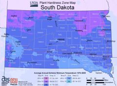
The continental climate means hot summers and bitterly cold winters. Rapid weather shifts are common.
Economy and Industries
Key industries are agriculture, tourism and manufacturing. Cattle ranching and farming drive the agricultural sector. Major crops are wheat, corn, and soybeans. Tourism draws visitors to attractions like the Badlands National Park, Mount Rushmore and the Black Hills.
Large manufacturing operations produce cars, airplanes, and medical devices in Sioux Falls. The financial services industry is also growing rapidly in South Dakota.
Culture and Demographics
South Dakota has under 1 million residents with 85% white and 9% Native American or Alaskan Native. Native American tribes based in the state include Lakota, Nakota and Dakota Sioux. The culture blends western ranch life with Native American heritage.
Government and Politics
The capital is Pierre while the largest city is Sioux Falls. The current governor is Kristi Noem, Republican. South Dakota is solidly Republican, last voting Democratic for president in 1964.
Conclusion
In summary, South Dakota offers majestic natural beauty through landmarks like Mount Rushmore and Badlands National Park. Agriculture, manufacturing and tourism contribute to the economy. Native American history infuses South Dakotan culture and lifestyle.

State Snapshot
South Dakota at a glance
South Dakota currently has 420 quality-checked populated place pages and 66 county pages linked on MapSof.
Mapped cities & towns
420
These counts use a stricter populated-place filter so the main lists stay focused on real city and town pages.
County pages
66
Open related pagesLargest city
Sioux FallsPopulation 157,584
Top linked places
Quick Facts about South Dakota
| Population | 892,717 |
| Country | United States of America |
| Area | 199729 km2 |
| Water as percent of area | 1.69% |
| Land as percent of area | 98.31% |
| Latitude & Longitude | 44.5003,-100.2507 |
| Legislative body | South Dakota Legislature |
| Named for | Dakota people |
| Official language | English |
| Altitude | 2,198 feet / 670 meters |
| Capital | Pierre |
| Establishment | November 02, 1889 (136 years ago) |
| Time Zone | UTC−06:00, Central Time Zone, America/Chicago, Mountain Time Zone |
| Local time | 09:59:57 (10th June 2026) |

Geography
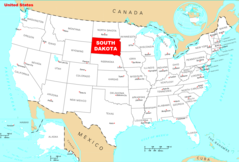
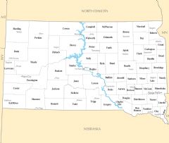
South Dakota is located at 44°30'1"N 100°15'2"W (44.5002600, -100.2506900). It has 6 neighbors: Iowa, Minnesota, Nebraska, Montana, North Dakota and Wyoming.
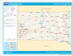
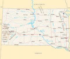
South Dakota map
The largest city of South Dakota is Sioux Falls with a population of 157,584. Other cities include, Rapid City population 77,503, Watertown population 22,303, Mitchell population 15,697 and Yankton population 14,651. See all South Dakota cities & populated places.
Largest Cities in South Dakota (more)
Cities, Towns, Villages, Neighborhoods & Other Populated Places in South Dakota.
| City Name | County | Population |
|---|---|---|
| Sioux Falls | Minnehaha | 157,584 |
| Rapid City | Pennington | 77,503 |
| Watertown | Codington | 22,303 |
| Mitchell | Davison | 15,697 |
| Yankton | Yankton | 14,651 |
| Pierre | Hughes | 13,708 |
| Spearfish | Lawrence | 11,900 |
| Brandon | Minnehaha | 10,168 |
| Rapid Valley | Pennington | 8,260 |
| Box Elder | Pennington | 7,165 |
| Harrisburg | Lincoln | 7,126 |
| Madison | Lake | 7,064 |
| Sturgis | Meade | 6,978 |
| Tea | Lincoln | 6,405 |
| Belle Fourche | Butte | 5,742 |
| Hot Springs | Fall River | 3,502 |
Show more South Dakota cities and populated places
Official website of South Dakota
Official Website- Walworth County
- Brookings County
- Roberts County
- Lake County
- Fall River County
- Jerauld County
- Hand County
- Pennington County
- Beadle County
- Dewey County
- Sanborn County
- Moody County
- Oglala Lakota County
- Butte County
- Spink County
- Custer County
- Brown County
- Brule County
- Sully County
- Kingsbury County
- Aurora County
- Grant County
- Tripp County
- Day County
- Faulk County
- Turner County
- Meade County
- Jackson County
- Codington County
- Todd County
- Charles Mix County
- Bennett County
- Douglas County
- Hamlin County
- Perkins County
- Davison County
- Clark County
- Jones County
- Hanson County
- Bon Homme County
- Lyman County
- Gregory County
- Lawrence County
- Ziebach County
- Edmunds County
- Campbell County
- Minnehaha County
- Mellette County
- Harding County
- Hughes County
- McPherson County
- Union County
- Miner County
- Yankton County
- Clay County
- Hutchinson County
- Haakon County
- McCook County
- Corson County
- Lincoln County
- Deuel County
- Hyde County
- Marshall County
- Buffalo County
- Potter County
- Stanley County
Demographics
| Year | Population | % Change | Method |
|---|---|---|---|
| 1860 | 4,837 | - | census |
| 1870 | 11,776 | 58.92% | census |
| 1880 | 98,268 | 88.02% | census |
| 1890 | 348,600 | 71.81% | census |
| 1900 | 403,000 | 13.5% | census |
| 1910 | 583,888 | 30.98% | census |
| 1919 | 606,000 | 3.65% | census |
| 1920 | 636,547 | 4.8% | census |
| 1930 | 692,849 | 8.13% | census |
| 1940 | 642,961 | -7.76% | census |
| 1950 | 652,740 | 1.5% | census |
| 1960 | 680,514 | 4.08% | census |
| 1970 | 665,507 | -2.25% | census |
| 1980 | 690,768 | 3.66% | census |
| 1990 | 696,004 | 0.75% | census |
| 2000 | 754,844 | 7.79% | census |
| 2010 | 814,180 | 7.29% | census |
| 2011 | 823,579 | 1.14% | estimation process |
| 2012 | 833,566 | 1.2% | estimation process |
| 2013 | 842,316 | 1.04% | estimation process |
| 2014 | 849,129 | 0.8% | estimation process |
| 2015 | 853,988 | 0.57% | estimation process |
| 2016 | 862,996 | 1.04% | estimation process |
| 2017 | 872,868 | 1.13% | estimation process |
| 2018 | 878,698 | 0.66% | estimation process |
| 2019 | 884,659 | 0.67% | estimation process |
| 2020 | 892,717 | 0.9% | estimation process |
People born in South Dakota (88)
People born in South Dakota, including Brulé Sioux chief, Native leader Spotted Tail, opera singer Jess Thomas, Hollywood stuntman and Lakota Siouxmedicine man Archie Fire Lame Deer, .
More notable people
- Boyd Raeburn (American musician) he was born in 27/10/1913
- Norm Van Brocklin (American football player, coach, executive (1926-1983)) he was born in 15/03/1926
- Spotted Elk (Native American leader) he was born in 01/01/1826
- Gall (19th century Lakota chief) he was born in 01/01/1840
- John O'Neil (American rugby union player) he was born in 04/10/1898
- Bill Johnson (science fiction writer (20th century)) he was born in 01/01/1956
- Nicky Katt (American actor) he was born in 11/05/1970
- Pug Manders (American football player (1913-1985)) he was born in 05/05/1913
- Gary Stormo (American geneticist) he was born in 01/01/1950
- Gene Roth (actor (1903-1976)) he was born in 08/01/1903
- Phil Graham (American newspaper publisher) he was born in 18/07/1915
- Nathan Lee Chasing His Horse (American actor) he was born in 28/04/1976
- Luther Standing Bear (Oglala Lakota writer and actor (1868-1939)) he was born in 01/12/1868
- Lynn Job (American composer) she was born in 01/01/1959
- Linda Avey (American biotech analyst, biologist, and co-founder of 23andMe) she was born in 01/01/1960
- Siegfried Schoenbohm he was born in 01/01/1938
- Crow Foot (Son of Sitting Bull) he was born in 01/01/1876
- Nightwolf (character from Mortal Kombat)
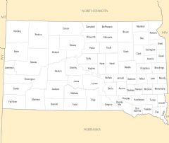
South Dakota Counties (more)
Minnehaha County

county in South Dakota, United States of America
Pennington County

county in South Dakota, United States of America
Lincoln County

county in South Dakota, United States
| County Name | Population |
|---|---|
| Minnehaha County | 196,659 |
| Pennington County | 115,926 |
| Lincoln County | 63,019 |
| Brown County | 38,738 |
| Brookings County | 35,603 |
| Meade County | 28,588 |
| Codington County | 28,186 |
| Lawrence County | 26,221 |
| Yankton County | 22,742 |
| Davison County | 19,812 |
| Beadle County | 18,513 |
| Hughes County | 17,336 |
| Union County | 16,192 |
| Clay County | 14,246 |
| Oglala Lakota County | 14,070 |
| Lake County | 12,488 |
Show more South Dakota counties
Map & Images (more maps)
Map of South Dakota Na 1
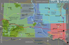
South Dakota Regions Map
Usa South Dakota Location Map
South Dakota Flag Map
Where Is South Dakota Located
South Dakota Cities And Towns
South Dakota County Map
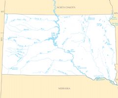
South Dakota Rivers And Lakes
South Dakota Reference Map