Siena, Tuscany
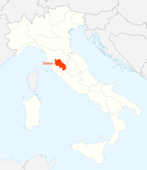
Siena: city in Tuscany, Italy and capital of the province of Siena
About
Quick Facts about Siena
| Population | 53,901 |
| Country | Italy |
| State | Tuscany (Italy) |
| County | Provincia di Siena |
| Different from | sienna |
| Postal code | 53100 |
| Plate code | SI |
| Phone Area Codes | 0577 |
| Area | 118.53 km2 |
| Official name | Siena, Saena Iulia |
| Has part | Historic Centre of Siena |
| Easternmost point | Point(11.4285563 43.3393583) |
| Northernmost point | Point(11.3327902 43.3663312) |
| Latitude & Longitude | 43.3182,11.3306 |
| Altitude | 1,056 feet / 322 meters |
| Capital city | Siena is capital of Republic of Siena, Province of Siena, Ombrone |
| Time Zone | UTC+01:00, UTC+02:00 |
| Local time | 00:22:31 (10th June 2026) |
Geography
Siena is located at 43°19'6"N 11°19'50"E (43.3182200, 11.3306400). It has 5 neighbors: Sovicille, Monteroni d Arbia, Monteriggioni, Castelnuovo Berardenga and Asciano.
Siena map
Click "full screen"  icon to open full mode. View satellite images
Official website of Siena
Official Website- Avignon (1961 )
- Bernalda
- Buffalo
- L’Aquila
- Weimar (1994 )
- Wetzlar
Demographics
| Year | Population | % Change | Method |
|---|---|---|---|
| 2016 | 53,853 | - | Istat |
| 2017 | 53,772 | -0.15% | demographic balance |
| 2018 | 53,901 | 0.24% | demographic balance |
SAY, Saena Iulia, Saena Julia, Sena, Sien-a, Sienna, Sienne, Sieno, Séna, shiena, siyena, syynh, Σιένα, Сиена, Сіена, סיינה, सियेना, シエーナ
Map & Images (more maps)
Location Map of Siena
1338 x 1548
- 97,943k -
png
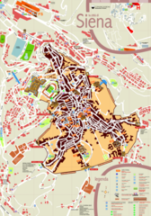
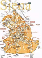
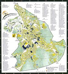
Tourist Map of Siena
1259 x 1800
- 686,006k -
png
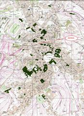
City Map of Siena
1800 x 1508
- 652,386k -
jpg
City Map Siena
1558 x 1800
- 688,638k -
jpg
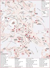
Hotel Map of Siena
760 x 1051
- 194,847k -
jpg
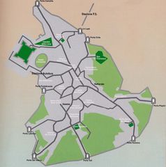
Map of Siena
1100 x 884
- 267,294k -
jpg
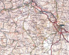
Physical Map of Siena
1308 x 1800
- 565,367k -
jpg
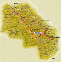
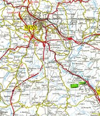
Province Map of Siena
1150 x 1176
- 229,623k -
jpg
Siena City Map
1448 x 1581
- 403,309k -
jpg
Siena Map
883 x 1204
- 211,101k -
jpg
Siena Map 1
898 x 907
- 91,092k -
jpg